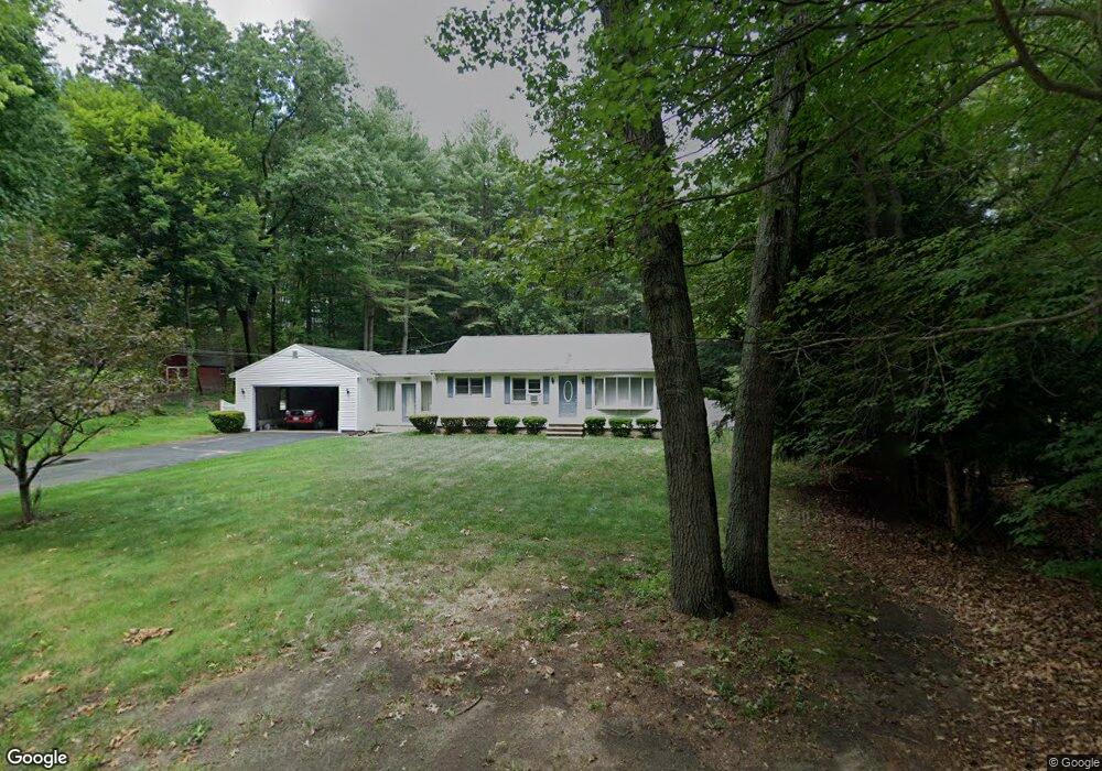
69 Patten Rd Westford, MA 01886
Estimated Value: $595,000 - $689,000
3
Beds
1
Bath
1,332
Sq Ft
$487/Sq Ft
Est. Value
About This Home
This home is located at 69 Patten Rd, Westford, MA 01886 and is currently estimated at $649,253, approximately $487 per square foot. 69 Patten Rd is a home located in Middlesex County with nearby schools including Col John Robinson, John A. Crisafulli Elementary School, and Blanchard Middle School.
Create a Home Valuation Report for This Property
The Home Valuation Report is an in-depth analysis detailing your home's value as well as a comparison with similar homes in the area
Home Values in the Area
Average Home Value in this Area
Tax History Compared to Growth
Tax History
| Year | Tax Paid | Tax Assessment Tax Assessment Total Assessment is a certain percentage of the fair market value that is determined by local assessors to be the total taxable value of land and additions on the property. | Land | Improvement |
|---|---|---|---|---|
| 2025 | $6,893 | $500,600 | $309,000 | $191,600 |
| 2024 | $6,893 | $500,600 | $309,000 | $191,600 |
| 2023 | $6,897 | $467,300 | $294,600 | $172,700 |
| 2022 | $6,832 | $423,800 | $259,100 | $164,700 |
| 2021 | $6,447 | $397,100 | $259,100 | $138,000 |
| 2020 | $6,485 | $397,100 | $259,100 | $138,000 |
| 2019 | $6,440 | $388,900 | $259,100 | $129,800 |
| 2018 | $5,858 | $372,700 | $248,000 | $124,700 |
| 2017 | $5,585 | $355,500 | $248,000 | $107,500 |
| 2016 | $5,545 | $340,200 | $234,100 | $106,100 |
| 2015 | $5,436 | $334,700 | $234,100 | $100,600 |
| 2014 | $5,367 | $323,300 | $224,600 | $98,700 |
Source: Public Records
Map
Nearby Homes
- 66 Patten Rd
- 8 Sandy Beach Rd
- 16 Abbot St
- 12 Patten Rd
- 5 Colonel Rolls Dr
- 66 N Main St Unit 66
- 64 N Main St Unit 64
- 3 Hillside Ave
- 19-21 Broadway St
- 28 Graniteville Rd
- 34 West St
- 12 Brookfield Dr Unit A
- 11 River St
- 7 Mill Park Place
- 1 Thistle Ln
- 1 Woodridge Ln
- 1 Courtney Ln
- 222 Forge Village Rd
- 92 Jimney Dr
- 125 Concord Rd