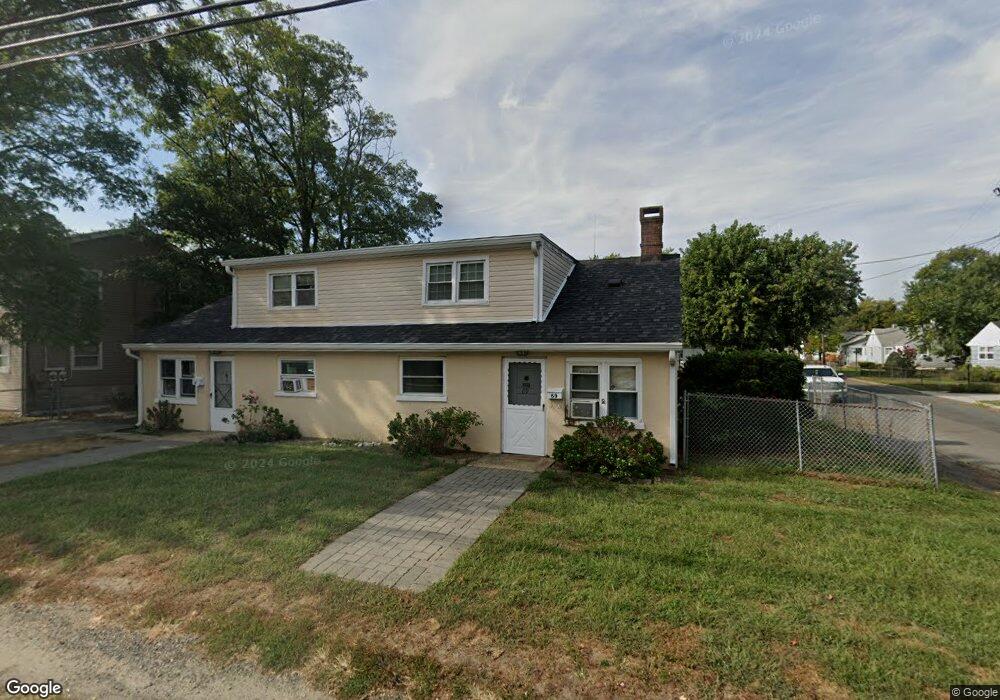
69 Port Monmouth Rd Keansburg, NJ 07734
Estimated Value: $458,000 - $544,000
5
Beds
2
Baths
2,160
Sq Ft
$230/Sq Ft
Est. Value
About This Home
This home is located at 69 Port Monmouth Rd, Keansburg, NJ 07734 and is currently estimated at $497,875, approximately $230 per square foot. 69 Port Monmouth Rd is a home located in Monmouth County with nearby schools including Joseph C. Caruso School, Joseph R. Bolger Middle School, and Keansburg High School.
Ownership History
Date
Name
Owned For
Owner Type
Purchase Details
Closed on
Jan 4, 1999
Sold by
Froehlich Robert
Bought by
Protentis Paul
Current Estimated Value
Home Financials for this Owner
Home Financials are based on the most recent Mortgage that was taken out on this home.
Original Mortgage
$83,700
Interest Rate
6.76%
Mortgage Type
Commercial
Purchase Details
Closed on
Apr 17, 1995
Sold by
Bird Dogs Inc
Bought by
Froelich Robert and Froelich Iris
Home Financials for this Owner
Home Financials are based on the most recent Mortgage that was taken out on this home.
Original Mortgage
$76,000
Interest Rate
8.55%
Mortgage Type
Commercial
Create a Home Valuation Report for This Property
The Home Valuation Report is an in-depth analysis detailing your home's value as well as a comparison with similar homes in the area
Home Values in the Area
Average Home Value in this Area
Purchase History
| Date | Buyer | Sale Price | Title Company |
|---|---|---|---|
| Protentis Paul | $93,000 | -- | |
| Froelich Robert | $95,450 | -- |
Source: Public Records
Mortgage History
| Date | Status | Borrower | Loan Amount |
|---|---|---|---|
| Previous Owner | Protentis Paul | $83,700 | |
| Previous Owner | Froelich Robert | $76,000 |
Source: Public Records
Tax History Compared to Growth
Tax History
| Year | Tax Paid | Tax Assessment Tax Assessment Total Assessment is a certain percentage of the fair market value that is determined by local assessors to be the total taxable value of land and additions on the property. | Land | Improvement |
|---|---|---|---|---|
| 2025 | $7,227 | $389,400 | $214,000 | $175,400 |
| 2024 | $7,483 | $328,500 | $173,300 | $155,200 |
| 2023 | $7,483 | $288,900 | $140,500 | $148,400 |
| 2022 | $6,475 | $254,100 | $109,700 | $144,400 |
| 2021 | $6,475 | $210,500 | $93,800 | $116,700 |
| 2020 | $6,776 | $169,100 | $54,900 | $114,200 |
| 2019 | $6,584 | $166,300 | $52,900 | $113,400 |
| 2018 | $6,407 | $163,900 | $52,900 | $111,000 |
| 2017 | $6,212 | $163,700 | $51,900 | $111,800 |
| 2016 | $6,224 | $170,700 | $46,900 | $123,800 |
| 2015 | $6,043 | $172,500 | $51,900 | $120,600 |
| 2014 | $5,918 | $173,900 | $66,900 | $107,000 |
Source: Public Records
Map
Nearby Homes
- 173 Forest Ave
- 11 Snyder Ave
- 250 Forest Ave
- 19 Randall Place
- 123 Forest Ave
- 358 Carr Ave
- 210 Main St
- 256 Twilight Ave
- 18 Neptune Place
- 224 Walling Place
- 93 Lawrence Ave
- 3 Carlo Dr
- 32 Moran Place
- 49 Lincoln Ct
- 282 Carr Ave
- 170 Park Ave
- 101 Manning Place
- 32 Lakewood Ave
- 64 Waackaack Ave
- 18 Saint Johns Place
- 55 Snyder Ave
- 59 Port Monmouth Rd
- 74 Port Monmouth Rd
- 51 Snyder Ave
- 75 Port Monmouth Rd
- 56 Harding Ave
- 60 Harding Ave
- 56 Port Monmouth Rd
- 52 Snyder Ave
- 50 Harding Ave
- 76 Port Monmouth Rd
- 67 Port Monmouth Rd
- 0 Van Brunt Place Unit 22238198
- 52 Port Monmouth Rd
- 47 Snyder Ave
- 80 Port Monmouth Rd
- 11 Van Brunt Place
- 83 Port Monmouth Rd
- 48 Port Monmouth Rd Unit 2
- 48 Port Monmouth Rd Unit 1