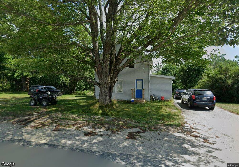
69 Ridge Rd Cherryfield, ME 04622
Estimated Value: $135,295 - $166,000
2
Beds
2
Baths
960
Sq Ft
$159/Sq Ft
Est. Value
About This Home
This home is located at 69 Ridge Rd, Cherryfield, ME 04622 and is currently estimated at $153,098, approximately $159 per square foot. 69 Ridge Rd is a home located in Washington County.
Ownership History
Date
Name
Owned For
Owner Type
Purchase Details
Closed on
Jul 9, 2020
Sold by
Cherryfield Town Of
Bought by
Schoppee Erika
Current Estimated Value
Purchase Details
Closed on
Sep 28, 2018
Sold by
Coastal Builders & Sons
Bought by
Hall Adam W and Hall Sarah
Home Financials for this Owner
Home Financials are based on the most recent Mortgage that was taken out on this home.
Original Mortgage
$204,211
Interest Rate
4.5%
Mortgage Type
New Conventional
Purchase Details
Closed on
Nov 30, 2005
Sold by
Whitmore Dennise R
Bought by
Johnston Alan and Johnston Danyel
Home Financials for this Owner
Home Financials are based on the most recent Mortgage that was taken out on this home.
Original Mortgage
$98,800
Interest Rate
10%
Mortgage Type
Commercial
Create a Home Valuation Report for This Property
The Home Valuation Report is an in-depth analysis detailing your home's value as well as a comparison with similar homes in the area
Purchase History
| Date | Buyer | Sale Price | Title Company |
|---|---|---|---|
| Schoppee Erika | -- | None Available | |
| Hall Adam W | -- | -- | |
| Johnston Alan | -- | -- |
Source: Public Records
Mortgage History
| Date | Status | Borrower | Loan Amount |
|---|---|---|---|
| Previous Owner | Hall Adam W | $204,211 | |
| Previous Owner | Johnston Alan | $98,800 |
Source: Public Records
Tax History
| Year | Tax Paid | Tax Assessment Tax Assessment Total Assessment is a certain percentage of the fair market value that is determined by local assessors to be the total taxable value of land and additions on the property. | Land | Improvement |
|---|---|---|---|---|
| 2024 | $1,517 | $72,600 | $22,800 | $49,800 |
| 2023 | $1,467 | $72,600 | $22,800 | $49,800 |
| 2022 | $1,546 | $80,500 | $22,800 | $57,700 |
| 2021 | $1,691 | $80,500 | $22,800 | $57,700 |
| 2020 | $1,886 | $79,900 | $19,100 | $60,800 |
| 2019 | $1,702 | $79,900 | $19,100 | $60,800 |
| 2018 | $1,558 | $79,900 | $19,100 | $60,800 |
| 2017 | $1,558 | $79,900 | $19,100 | $60,800 |
| 2016 | $1,558 | $79,900 | $19,100 | $60,800 |
| 2015 | $1,564 | $79,900 | $19,100 | $60,800 |
| 2014 | $1,558 | $79,900 | $19,100 | $60,800 |
| 2013 | -- | $79,900 | $19,100 | $60,800 |
Source: Public Records
Map
Nearby Homes
- 266 Willey District Rd
- 272 Willey District Rd
- 19 High St
- 30 River Rd
- 163 Blacks Woods Rd
- 18 Blacks Woods Rd
- 9 Big Rock Ln
- 249 Blacks Woods Rd
- 24 Lynch Hill Rd
- 472 Kansas Rd
- 462 Kansas Rd
- 94 Heath Rd
- Lot #118 Kansas Rd
- 1491 Main St
- M2, L4 Sacarap Rd
- 7 Sharon Ln
- 307 Oak Point Rd
- 69 Mill St
- 1730 Main St
- 6 Forest Hill St
Your Personal Tour Guide
Ask me questions while you tour the home.