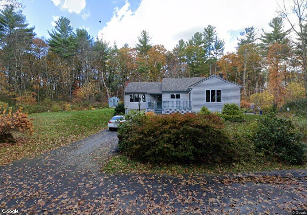
69 River Rd Rutland, MA 01543
Estimated Value: $473,000 - $567,000
3
Beds
3
Baths
1,741
Sq Ft
$298/Sq Ft
Est. Value
About This Home
This home is located at 69 River Rd, Rutland, MA 01543 and is currently estimated at $518,918, approximately $298 per square foot. 69 River Rd is a home located in Worcester County with nearby schools including Wachusett Regional High School.
Create a Home Valuation Report for This Property
The Home Valuation Report is an in-depth analysis detailing your home's value as well as a comparison with similar homes in the area
Home Values in the Area
Average Home Value in this Area
Tax History
| Year | Tax Paid | Tax Assessment Tax Assessment Total Assessment is a certain percentage of the fair market value that is determined by local assessors to be the total taxable value of land and additions on the property. | Land | Improvement |
|---|---|---|---|---|
| 2025 | $5,873 | $412,400 | $108,300 | $304,100 |
| 2024 | $5,621 | $379,000 | $103,700 | $275,300 |
| 2023 | $5,163 | $376,300 | $98,400 | $277,900 |
| 2022 | $5,189 | $328,600 | $84,700 | $243,900 |
| 2021 | $5,057 | $302,800 | $84,700 | $218,100 |
| 2020 | $4,100 | $232,800 | $80,900 | $151,900 |
| 2019 | $4,016 | $224,500 | $77,500 | $147,000 |
| 2018 | $6,362 | $198,400 | $77,500 | $120,900 |
| 2017 | $3,635 | $198,400 | $77,500 | $120,900 |
| 2016 | $3,682 | $212,000 | $74,200 | $137,800 |
| 2015 | $3,465 | $196,300 | $74,200 | $122,100 |
| 2014 | $3,359 | $196,300 | $74,200 | $122,100 |
Source: Public Records
Map
Nearby Homes
- 4 Intervale Rd
- 34 Simonds Hill Rd
- 45 Old Colony Rd
- 569 E County Rd
- 9 Old Princeton Road Cut-Off
- 75 Barre Rd
- 56 Hubbardston Rd
- 36 Healdville Rd
- 35 Brintnal Dr
- 14 Grizzly Dr
- 1 Barre Road Cut Off
- 16 Richards Ave
- 7 Williamsville Rd
- 147 E County Rd Unit 149
- 139 E County Rd Unit 139
- 100 Brooks Station Rd
- 5 Miles Rd
- 13 Goodnow Rd
- 90 Woodside Ave
- 30 Woodside Ave
Your Personal Tour Guide
Ask me questions while you tour the home.