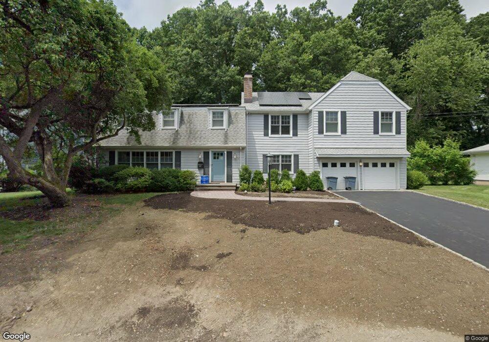
69 Rock Ridge Dr Port Chester, NY 10573
Estimated Value: $1,179,000 - $1,464,000
5
Beds
4
Baths
2,908
Sq Ft
$458/Sq Ft
Est. Value
About This Home
This home is located at 69 Rock Ridge Dr, Port Chester, NY 10573 and is currently estimated at $1,333,280, approximately $458 per square foot. 69 Rock Ridge Dr is a home located in Westchester County with nearby schools including Bruno M. Ponterio Ridge Street School, Blind Brook Rye Middle School, and Blind Brook High School.
Ownership History
Date
Name
Owned For
Owner Type
Purchase Details
Closed on
Oct 5, 2023
Sold by
Echtman Elyse D
Bought by
Daniel Berger Of Revocable Trust and Echtman
Current Estimated Value
Purchase Details
Closed on
Jun 25, 1997
Sold by
Staffaroni Paul J and Staffaroni Lisa C
Bought by
Berger Daniel M and Echtman Elyse D
Create a Home Valuation Report for This Property
The Home Valuation Report is an in-depth analysis detailing your home's value as well as a comparison with similar homes in the area
Home Values in the Area
Average Home Value in this Area
Purchase History
| Date | Buyer | Sale Price | Title Company |
|---|---|---|---|
| Daniel Berger Of Revocable Trust | -- | None Listed On Document | |
| Berger Daniel M | $435,000 | Commonwealth Land Title Ins |
Source: Public Records
Tax History Compared to Growth
Tax History
| Year | Tax Paid | Tax Assessment Tax Assessment Total Assessment is a certain percentage of the fair market value that is determined by local assessors to be the total taxable value of land and additions on the property. | Land | Improvement |
|---|---|---|---|---|
| 2024 | $34,022 | $1,233,000 | $490,300 | $742,700 |
| 2023 | $30,658 | $1,185,600 | $467,000 | $718,600 |
| 2022 | $30,579 | $1,118,500 | $467,000 | $651,500 |
| 2021 | $30,254 | $1,045,345 | $467,000 | $578,345 |
| 2020 | $26,450 | $1,045,345 | $467,000 | $578,345 |
| 2019 | $49,405 | $1,050,600 | $432,900 | $617,700 |
| 2018 | $18,423 | $1,020,000 | $423,800 | $596,200 |
| 2017 | $4,127 | $1,100,655 | $418,800 | $681,855 |
| 2016 | $36,674 | $990,455 | $386,900 | $603,555 |
| 2015 | -- | $977,500 | $389,300 | $588,200 |
| 2014 | -- | $893,900 | $342,200 | $551,700 |
| 2013 | -- | $685,000 | $314,100 | $370,900 |
Source: Public Records
Map
Nearby Homes
- 20 Woodland Dr
- 139 Betsy Brown Rd
- 90 Windsor Rd
- 23 Sylvan Rd
- 80 Valley Terrace
- 345 Betsy Brown Rd
- 23 W Glen Ave
- 79 Robert Ave
- 82 Shelley Ave
- 12 Paddock Rd
- 22 Ridge Blvd
- 60 Lafayette Dr
- 213 Treetop Crescent
- 4 Mark Dr
- 15 Rockinghorse Trail
- 106 Puritan Dr
- 565 King St
- 563 King St
- 561 King St
- 9 Wilton Rd
- 71 Rock Ridge Dr
- 67 Rock Ridge Dr
- 3 Rock Ridge Dr
- 68 Rock Ridge Dr
- 70 Rock Ridge Dr
- 65 Rock Ridge Dr
- 66 Rock Ridge Dr
- 11 Rock Ridge Dr
- 1 Rock Ridge Dr
- 1 Acker Dr
- 3 Acker Dr
- 64 Rock Ridge Dr
- 2 Jacqueline Ln
- 62 Rock Ridge Dr
- 4 Rock Ridge Dr
- 2 Rock Ridge Dr
- 17 Knollwood Dr
- 2 Concord Place
- 3 Concord Place
- 10 Rock Ridge Dr