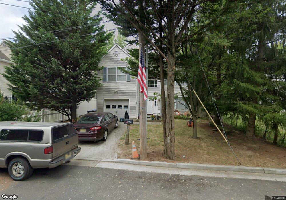
69 S End Ave North Middletown, NJ 07748
Estimated Value: $530,000 - $671,000
4
Beds
3
Baths
1,878
Sq Ft
$324/Sq Ft
Est. Value
About This Home
This home is located at 69 S End Ave, North Middletown, NJ 07748 and is currently estimated at $607,546, approximately $323 per square foot. 69 S End Ave is a home located in Monmouth County with nearby schools including Ocean Avenue Elementary School, Thorne Middle School, and Middletown High School North.
Ownership History
Date
Name
Owned For
Owner Type
Purchase Details
Closed on
Mar 1, 2001
Sold by
Logan Gerard
Bought by
Szczesna Iowan Borkowska
Current Estimated Value
Home Financials for this Owner
Home Financials are based on the most recent Mortgage that was taken out on this home.
Original Mortgage
$163,600
Interest Rate
7.04%
Purchase Details
Closed on
Jan 5, 2001
Sold by
Logan Gerard
Bought by
Gomez William and Gomez Mayerlen
Home Financials for this Owner
Home Financials are based on the most recent Mortgage that was taken out on this home.
Original Mortgage
$163,600
Interest Rate
7.04%
Create a Home Valuation Report for This Property
The Home Valuation Report is an in-depth analysis detailing your home's value as well as a comparison with similar homes in the area
Home Values in the Area
Average Home Value in this Area
Purchase History
| Date | Buyer | Sale Price | Title Company |
|---|---|---|---|
| Szczesna Iowan Borkowska | $204,500 | -- | |
| Gomez William | $208,800 | -- |
Source: Public Records
Mortgage History
| Date | Status | Borrower | Loan Amount |
|---|---|---|---|
| Previous Owner | Szczesna Iowan Borkowska | $163,600 | |
| Previous Owner | Gomez William | $187,900 |
Source: Public Records
Tax History Compared to Growth
Tax History
| Year | Tax Paid | Tax Assessment Tax Assessment Total Assessment is a certain percentage of the fair market value that is determined by local assessors to be the total taxable value of land and additions on the property. | Land | Improvement |
|---|---|---|---|---|
| 2025 | $7,820 | $553,200 | $275,000 | $278,200 |
| 2024 | $7,727 | $475,400 | $199,000 | $276,400 |
| 2023 | $7,727 | $444,600 | $174,600 | $270,000 |
| 2022 | $7,159 | $427,700 | $167,500 | $260,200 |
| 2021 | $7,159 | $344,200 | $108,800 | $235,400 |
| 2020 | $6,919 | $323,600 | $105,000 | $218,600 |
| 2019 | $6,862 | $324,900 | $105,000 | $219,900 |
| 2018 | $6,820 | $314,700 | $105,000 | $209,700 |
| 2017 | $6,690 | $305,600 | $100,000 | $205,600 |
| 2016 | $5,871 | $275,500 | $75,000 | $200,500 |
| 2015 | $5,857 | $265,400 | $75,000 | $190,400 |
| 2014 | $6,343 | $280,300 | $100,000 | $180,300 |
Source: Public Records
Map
Nearby Homes
- 0 Clinton St Unit 22238196
- 0 Bray Ave Unit 22420777
- 0 S End Ave Unit 22420779
- 280 Linden Ave
- 29 Carter Ave
- 32 Dakota Ave
- 136 Sycamore Ave
- 210 Ocean Ave
- 118 Jersey Ave
- 0 Oregon Ave
- 443 Port Monmouth Rd E
- 723 Monmouth Pkwy
- 37 Ohio Ave
- 93 Monmouth Ave
- 91 Monmouth Ave
- 71 Bay Ave
- 75 Ohio Ave
- 28 Duchess Ave
- 19 Walada Ave
- 35 Montana Ave
- 0 S Southend Ave Unit 22041901
- 0 S Southend Ave Unit 21908491
- 67 S End Ave
- 71 S End Ave
- 65 S End Ave
- 472 Center Ave
- 470 Center Ave
- 478 Center Ave
- 464 Center Ave
- 68 S End Ave
- 61 S End Ave
- 480 Center Ave
- 458 Center Ave
- 0 Clinton St
- 81 Clinton St
- 80 Clinton St
- 488 Center Ave
- 469 Center Ave
- 473 Center Ave
- 77 Clinton St