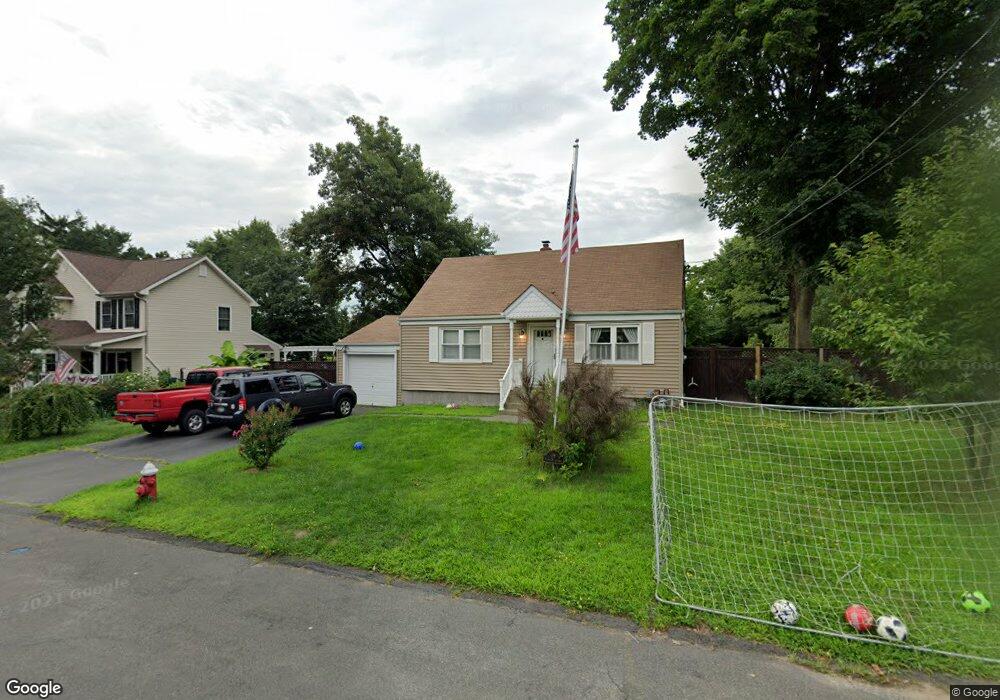
69 Secor Blvd Pearl River, NY 10965
Estimated Value: $595,000 - $647,993
4
Beds
1
Bath
1,272
Sq Ft
$488/Sq Ft
Est. Value
About This Home
This home is located at 69 Secor Blvd, Pearl River, NY 10965 and is currently estimated at $620,498, approximately $487 per square foot. 69 Secor Blvd is a home located in Rockland County with nearby schools including Pearl River High School and St Margaret School.
Ownership History
Date
Name
Owned For
Owner Type
Purchase Details
Closed on
Feb 16, 2006
Sold by
Sparrow Sean M and Sparrow Patricia Cantos
Bought by
Donadio Mark and Donadio Nicole S
Current Estimated Value
Home Financials for this Owner
Home Financials are based on the most recent Mortgage that was taken out on this home.
Original Mortgage
$314,400
Outstanding Balance
$176,575
Interest Rate
6.16%
Mortgage Type
Fannie Mae Freddie Mac
Estimated Equity
$443,923
Purchase Details
Closed on
Aug 26, 1998
Sold by
Salierno Providence
Bought by
Sparrow Sean M and Sparrow Patricia Cantos
Create a Home Valuation Report for This Property
The Home Valuation Report is an in-depth analysis detailing your home's value as well as a comparison with similar homes in the area
Home Values in the Area
Average Home Value in this Area
Purchase History
| Date | Buyer | Sale Price | Title Company |
|---|---|---|---|
| Donadio Mark | $393,500 | The Judicial Title Insurance | |
| Sparrow Sean M | $203,000 | Commonwealth Land Title Ins |
Source: Public Records
Mortgage History
| Date | Status | Borrower | Loan Amount |
|---|---|---|---|
| Open | Donadio Mark | $314,400 |
Source: Public Records
Tax History
| Year | Tax Paid | Tax Assessment Tax Assessment Total Assessment is a certain percentage of the fair market value that is determined by local assessors to be the total taxable value of land and additions on the property. | Land | Improvement |
|---|---|---|---|---|
| 2022 | $3,498 | $135,800 | $39,200 | $96,600 |
| 2021 | $9,095 | $135,800 | $39,200 | $96,600 |
| 2020 | $8,424 | $135,800 | $39,200 | $96,600 |
| 2019 | $3,231 | $135,800 | $39,200 | $96,600 |
| 2018 | $7,920 | $135,800 | $39,200 | $96,600 |
| 2017 | $7,628 | $135,800 | $39,200 | $96,600 |
| 2016 | $7,390 | $135,800 | $39,200 | $96,600 |
| 2015 | -- | $135,800 | $39,200 | $96,600 |
| 2014 | -- | $135,800 | $39,200 | $96,600 |
Source: Public Records
Map
Nearby Homes
- 166 E Crooked Hill Rd Unit 166
- 452 Somerset Dr Unit F
- 422 Somerset Dr Unit B
- 135 Standish Dr
- 760 E Crooked Hill Rd Unit 760
- 225 N Middletown Rd Unit J
- 33 Marion Place
- 510 Highview Ave
- 54 Douglas Ct
- 22 Hovenkamp Ave
- 7 Staubitz Ave
- 352 Holt Dr
- 258 Holt Dr
- 124 Braunsdorf Rd
- 148 E Washington Ave
- 84 Townline Rd
- 34 Mountainview Ave
- 6 Pelham Ct
- 109 Gatto Ln
- 123 Gatto Ln
Your Personal Tour Guide
Ask me questions while you tour the home.