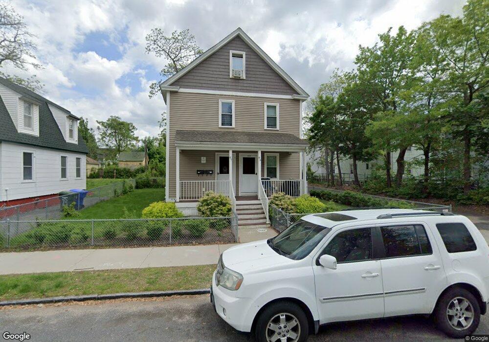
69 Shattuck St Springfield, MA 01109
Bay NeighborhoodEstimated Value: $271,000 - $344,000
7
Beds
2
Baths
2,189
Sq Ft
$135/Sq Ft
Est. Value
About This Home
This home is located at 69 Shattuck St, Springfield, MA 01109 and is currently estimated at $295,189, approximately $134 per square foot. 69 Shattuck St is a home located in Hampden County with nearby schools including Homer Street Elementary School, John F. Kennedy Academy, and Springfield High School of Science and Technology.
Ownership History
Date
Name
Owned For
Owner Type
Purchase Details
Closed on
Dec 15, 2016
Sold by
Neighborhood Homes Lp
Bought by
Bh Eht 1 Llc
Current Estimated Value
Home Financials for this Owner
Home Financials are based on the most recent Mortgage that was taken out on this home.
Original Mortgage
$5,349,480
Outstanding Balance
$4,276,509
Interest Rate
3.54%
Mortgage Type
Purchase Money Mortgage
Estimated Equity
-$3,981,320
Create a Home Valuation Report for This Property
The Home Valuation Report is an in-depth analysis detailing your home's value as well as a comparison with similar homes in the area
Home Values in the Area
Average Home Value in this Area
Purchase History
| Date | Buyer | Sale Price | Title Company |
|---|---|---|---|
| Bh Eht 1 Llc | $1,940,000 | -- | |
| Bh Eht 1 Llc | $1,940,000 | -- |
Source: Public Records
Mortgage History
| Date | Status | Borrower | Loan Amount |
|---|---|---|---|
| Open | Bh Eht 1 Llc | $5,349,480 | |
| Closed | Bh Eht 1 Llc | $5,349,480 |
Source: Public Records
Tax History
| Year | Tax Paid | Tax Assessment Tax Assessment Total Assessment is a certain percentage of the fair market value that is determined by local assessors to be the total taxable value of land and additions on the property. | Land | Improvement |
|---|---|---|---|---|
| 2025 | $1,853 | $118,200 | $22,500 | $95,700 |
| 2024 | $1,898 | $118,200 | $22,500 | $95,700 |
| 2023 | $2,015 | $118,200 | $22,500 | $95,700 |
| 2022 | $2,225 | $118,200 | $22,500 | $95,700 |
| 2021 | $2,234 | $118,200 | $22,500 | $95,700 |
| 2020 | $2,308 | $118,200 | $22,500 | $95,700 |
| 2019 | $3,037 | $154,300 | $22,500 | $131,800 |
| 2018 | $3,025 | $153,700 | $22,500 | $131,200 |
| 2017 | $1,473 | $74,900 | $18,300 | $56,600 |
| 2016 | $1,473 | $74,900 | $18,300 | $56,600 |
| 2015 | $1,473 | $74,900 | $18,300 | $56,600 |
Source: Public Records
Map
Nearby Homes
- 15 Kenyon St
- 46 Mapledell St
- 65 Montrose St
- 145 Cambridge St
- 25 Dresden St
- 48-50 Dresden St
- 283 Wilbraham Rd
- 52-56 Andrew St
- 19 Westford Ave
- 31-33 Suffolk St
- 16 Cambridge St
- 15-17 Sycamore St
- 163 Marion St
- 62-64 Bristol St
- 21 Clifford St
- 158 Bowles St
- 89 Bristol St
- 52-54 Aster St
- 111 Marlborough St
- 124-126 Westford Cir
- 73 Shattuck St
- 69 State Street Terrace
- 71 Maynard St Unit 73
- 69 Maynard St
- 65 Maynard St
- 74 Willard Ave Unit 76
- 68 Willard Ave
- 74-76 Willard Ave
- 66 Shattuck St Unit 68
- 85 Maynard St
- 64 Willard Ave
- 72 Shattuck St Unit 74
- 59 Maynard St Unit 2R
- 59 Maynard St
- 59 State Street Terrace
- 89 Maynard St
- 55 Maynard St
- 95 Maynard St
- 52 Willard Ave
- 49 Maynard St
Your Personal Tour Guide
Ask me questions while you tour the home.