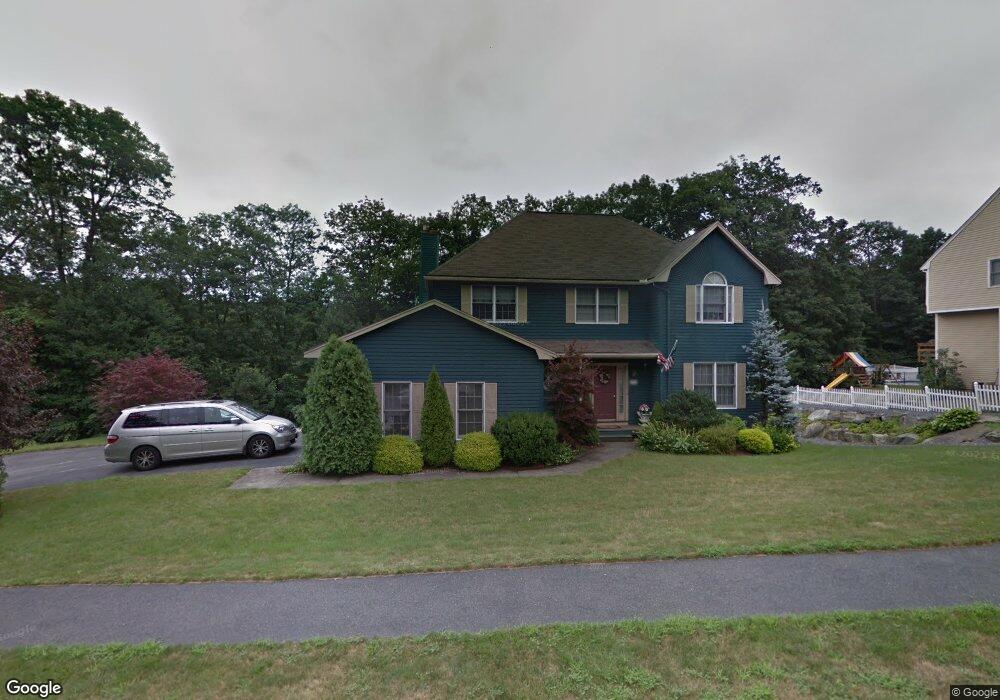
69 Stoney Hill Rd Shrewsbury, MA 01545
Estimated Value: $1,015,000 - $1,323,000
4
Beds
4
Baths
2,823
Sq Ft
$399/Sq Ft
Est. Value
About This Home
This home is located at 69 Stoney Hill Rd, Shrewsbury, MA 01545 and is currently estimated at $1,126,904, approximately $399 per square foot. 69 Stoney Hill Rd is a home located in Worcester County with nearby schools including Floral Street School, Sherwood Middle School, and Oak Middle School.
Ownership History
Date
Name
Owned For
Owner Type
Purchase Details
Closed on
Nov 30, 1995
Sold by
Jj Farrell Inc
Bought by
Bracken Michael and Bracken Teresa
Current Estimated Value
Create a Home Valuation Report for This Property
The Home Valuation Report is an in-depth analysis detailing your home's value as well as a comparison with similar homes in the area
Home Values in the Area
Average Home Value in this Area
Purchase History
| Date | Buyer | Sale Price | Title Company |
|---|---|---|---|
| Bracken Michael | $240,000 | -- | |
| Bracken Michael | $240,000 | -- |
Source: Public Records
Mortgage History
| Date | Status | Borrower | Loan Amount |
|---|---|---|---|
| Open | Bracken Michael | $417,000 | |
| Closed | Bracken Michael | $50,000 |
Source: Public Records
Tax History Compared to Growth
Tax History
| Year | Tax Paid | Tax Assessment Tax Assessment Total Assessment is a certain percentage of the fair market value that is determined by local assessors to be the total taxable value of land and additions on the property. | Land | Improvement |
|---|---|---|---|---|
| 2025 | $113 | $941,200 | $278,000 | $663,200 |
| 2024 | $11,396 | $920,500 | $264,800 | $655,700 |
| 2023 | $10,083 | $768,500 | $264,800 | $503,700 |
| 2022 | $9,324 | $660,800 | $235,300 | $425,500 |
| 2021 | $8,349 | $633,000 | $235,300 | $397,700 |
| 2020 | $7,894 | $633,000 | $235,300 | $397,700 |
| 2019 | $7,607 | $605,200 | $224,400 | $380,800 |
| 2018 | $7,831 | $618,600 | $205,600 | $413,000 |
| 2017 | $7,515 | $585,700 | $186,200 | $399,500 |
| 2016 | $7,530 | $579,200 | $174,200 | $405,000 |
| 2015 | $7,146 | $541,400 | $145,000 | $396,400 |
Source: Public Records
Map
Nearby Homes
- 45 Stoney Hill Rd
- 127 Stoney Hill Rd
- 34 Clews St
- Ivywood Plan at Winslow Point - The Building 1 Series
- Hayden Plan at Winslow Point - The Building 1 Series
- 15 Windle Ave
- 1 Purinton St
- 2 Winslow Ln Unit 2302
- 2 Winslow Ln Unit 406
- 51 Cortland Grove Dr Unit 51
- 69 Cortland Grove Dr Unit 69
- 495 Grafton St
- 4 Westboro Rd
- 165 Green St
- 468 Grafton St
- 4 Winslow Ln Unit 1410
- 40 Adams Farm Rd
- 22 Adams Rd
- 0 East St
- 7 Thoreau Cir
- 73 Stoney Hill Rd
- 6 Quail Hollow Dr Unit 6
- 70 Stoney Hill Rd
- 68 Stoney Hill Rd
- 75 Stoney Hill Rd
- 72 Stoney Hill Rd
- 66 Stoney Hill Rd
- 8 Quail Hollow Dr
- 74 Stoney Hill Rd
- 10 Quail Hollow Dr
- 76 Stoney Hill Rd
- 7 Quail Hollow Dr
- 79 Stoney Hill Rd
- 62 Stoney Hill Rd
- 61 Stoney Hill Rd
- 9 Quail Hollow Dr
- 78 Stoney Hill Rd
- 14 Quail Hollow Dr
- 11 Quail Hollow Dr
- 15 Quail Hollow Dr