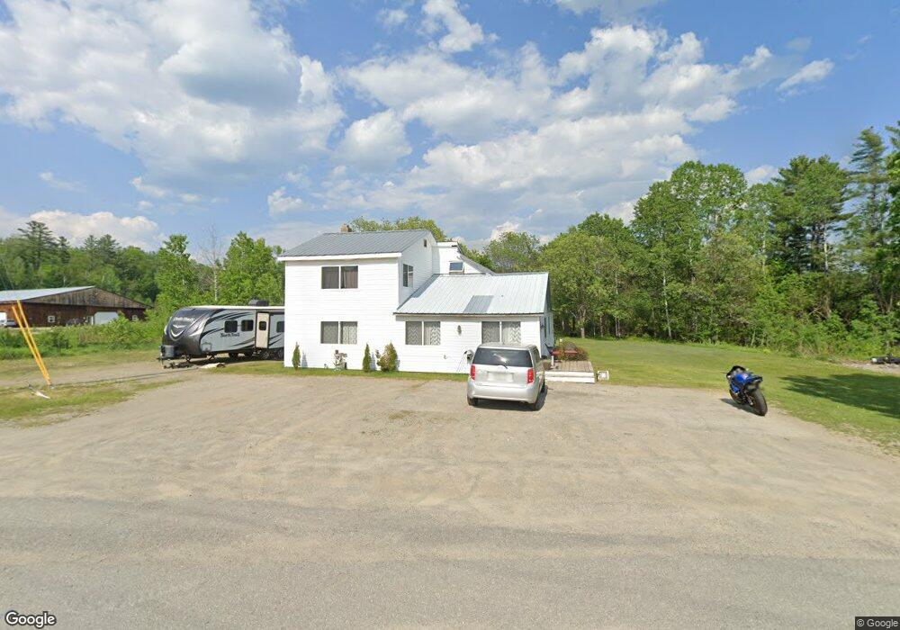
69 W Freeman Rd Unit 1C Strong, ME 04983
Estimated Value: $123,000 - $358,000
--
Bed
--
Bath
729
Sq Ft
$328/Sq Ft
Est. Value
About This Home
This home is located at 69 W Freeman Rd Unit 1C, Strong, ME 04983 and is currently estimated at $239,292, approximately $328 per square foot. 69 W Freeman Rd Unit 1C is a home located in Franklin County with nearby schools including Mt. Abram Regional High School.
Ownership History
Date
Name
Owned For
Owner Type
Purchase Details
Closed on
Nov 3, 2015
Sold by
Wells Fargo Bank Na
Bought by
Abbott John H
Current Estimated Value
Purchase Details
Closed on
May 13, 2015
Sold by
Wells Fargo Bank Na
Bought by
Wells Fargo Bank Na
Purchase Details
Closed on
Feb 6, 2015
Sold by
Wells Fargo Bank Na
Bought by
Wells Fargo Bank Na
Purchase Details
Closed on
Aug 10, 2005
Sold by
Cousineau Lumber Inc
Bought by
House Vincent M and Proctor Sarah K
Home Financials for this Owner
Home Financials are based on the most recent Mortgage that was taken out on this home.
Original Mortgage
$91,800
Interest Rate
5.54%
Mortgage Type
Purchase Money Mortgage
Create a Home Valuation Report for This Property
The Home Valuation Report is an in-depth analysis detailing your home's value as well as a comparison with similar homes in the area
Home Values in the Area
Average Home Value in this Area
Purchase History
| Date | Buyer | Sale Price | Title Company |
|---|---|---|---|
| Abbott John H | $32,500 | -- | |
| Wells Fargo Bank Na | -- | -- | |
| Wells Fargo Bank Na | -- | -- | |
| House Vincent M | -- | -- |
Source: Public Records
Mortgage History
| Date | Status | Borrower | Loan Amount |
|---|---|---|---|
| Previous Owner | House Vincent M | $91,800 |
Source: Public Records
Tax History Compared to Growth
Tax History
| Year | Tax Paid | Tax Assessment Tax Assessment Total Assessment is a certain percentage of the fair market value that is determined by local assessors to be the total taxable value of land and additions on the property. | Land | Improvement |
|---|---|---|---|---|
| 2024 | $1,974 | $112,170 | $25,880 | $86,290 |
| 2023 | $1,795 | $112,170 | $25,880 | $86,290 |
| 2022 | $1,772 | $112,170 | $25,880 | $86,290 |
| 2021 | $1,851 | $112,170 | $25,880 | $86,290 |
| 2020 | $1,918 | $112,170 | $25,880 | $86,290 |
| 2019 | $1,997 | $112,170 | $25,880 | $86,290 |
| 2018 | $1,739 | $112,170 | $25,880 | $86,290 |
| 2017 | $1,615 | $112,170 | $25,880 | $86,290 |
| 2016 | $1,593 | $112,170 | $25,880 | $86,290 |
| 2015 | $1,649 | $112,170 | $25,880 | $86,290 |
| 2013 | $1,436 | $112,170 | $25,880 | $86,290 |
Source: Public Records
Map
Nearby Homes
- 22 W Freeman Rd
- 16 Whitetail Dr
- 162.7 Collins Dr
- 83 Lambert Hill Rd
- U03-68-C Tbd
- 18 N Main St
- 44 Norton Hill Rd
- 29 River St
- 43 Brookside Ln
- MR11 L35 Burbank Hill Rd
- R-5 13-A Norton Hill Rd
- 9 Beechnut Ridge
- Lot 4 Taylor Hill Rd
- 4 Cousineaus Tory Hill Heights
- 68 S Strong Rd
- 152 Johnson Rd
- MR7 L31&37 Taylor Hill Rd
- 402 Baker Hill Rd
- 97 Lake St
- 722 Farmington Rd
- 69 W Freeman Rd Unit 1
- 69 W Freeman Rd
- Lots 78 & Freeman Ridge
- 72 W Freeman Rd
- M U-1, L 1 W Freeman Rd
- 86 W Freeman Rd
- 71 W Freeman Rd
- LOT 11 Woodland Heights True Hill
- LOT 9 Woodland Heights True Hill
- LOT 7 Woodland Heights True Hill
- Lot 1 True Hill Rd East View Ridge
- LOT 1 True Hill
- Lot 5 True Hill Road East View Ridg
- LOT 5 Woodland Heights True Hill
- Lot 3 True Hill Rd East View Ridge
- 19 Woodland Heights True Hill Rd
- LOT 10 Woodland Heights True Hill
- LOT 8 Woodland Heights True Hill
- LOT 6 Woodland Heights True Hill
- Lot 6 Woodland Heights True Hill Rd