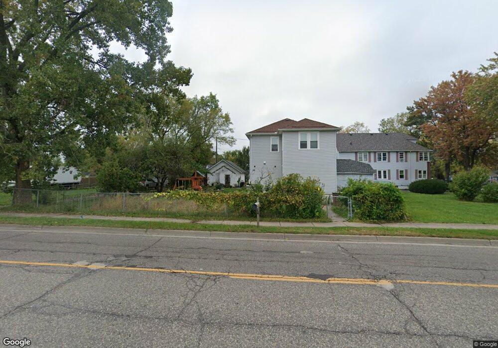
69 W Kennett Rd Pontiac, MI 48340
Estimated Value: $164,000 - $222,000
4
Beds
2
Baths
1,864
Sq Ft
$104/Sq Ft
Est. Value
About This Home
This home is located at 69 W Kennett Rd, Pontiac, MI 48340 and is currently estimated at $193,843, approximately $103 per square foot. 69 W Kennett Rd is a home located in Oakland County with nearby schools including Alcott School, Pontiac Middle School, and Pontiac High School.
Ownership History
Date
Name
Owned For
Owner Type
Purchase Details
Closed on
Jul 20, 2016
Sold by
Yang Palece and Yang Pai
Bought by
Arnold Christopher John and Yang Nancy
Current Estimated Value
Purchase Details
Closed on
Mar 24, 2003
Sold by
Yang Palue and Yang Pai
Bought by
Yang Palue and Yang Pai
Purchase Details
Closed on
Oct 15, 2002
Sold by
Yang Pao
Bought by
Yang Palee
Purchase Details
Closed on
Aug 9, 1999
Sold by
Yang Pao
Bought by
Yang Pao
Purchase Details
Closed on
Aug 10, 1995
Sold by
Richie Gordon L
Bought by
Yang Pao
Home Financials for this Owner
Home Financials are based on the most recent Mortgage that was taken out on this home.
Original Mortgage
$30,000
Interest Rate
7.64%
Mortgage Type
New Conventional
Create a Home Valuation Report for This Property
The Home Valuation Report is an in-depth analysis detailing your home's value as well as a comparison with similar homes in the area
Home Values in the Area
Average Home Value in this Area
Purchase History
| Date | Buyer | Sale Price | Title Company |
|---|---|---|---|
| Arnold Christopher John | -- | None Available | |
| Yang Palue | -- | -- | |
| Yang Palee | -- | -- | |
| Yang Pao | -- | -- | |
| Yang Pao | $44,000 | -- |
Source: Public Records
Mortgage History
| Date | Status | Borrower | Loan Amount |
|---|---|---|---|
| Previous Owner | Yang Pao | $30,000 |
Source: Public Records
Tax History Compared to Growth
Tax History
| Year | Tax Paid | Tax Assessment Tax Assessment Total Assessment is a certain percentage of the fair market value that is determined by local assessors to be the total taxable value of land and additions on the property. | Land | Improvement |
|---|---|---|---|---|
| 2024 | $1,578 | $61,490 | $0 | $0 |
| 2023 | $1,504 | $54,000 | $0 | $0 |
| 2022 | $1,514 | $47,620 | $0 | $0 |
| 2021 | $1,470 | $40,700 | $0 | $0 |
| 2020 | $1,367 | $35,490 | $0 | $0 |
| 2019 | $1,428 | $30,390 | $0 | $0 |
| 2018 | $1,381 | $24,880 | $0 | $0 |
| 2017 | $1,522 | $23,380 | $0 | $0 |
| 2016 | $717 | $19,920 | $0 | $0 |
| 2015 | -- | $19,130 | $0 | $0 |
| 2014 | -- | $18,340 | $0 | $0 |
| 2011 | -- | $23,340 | $0 | $0 |
Source: Public Records
Map
Nearby Homes
- 109 W Kennett Rd
- 119 W Kennett Rd
- 137 Dresden Ave
- 141 Parkdale Ave
- 0 S Merrimac St Unit 20250035082
- 110 W Tennyson Ave
- 33 W Beverly Ave
- 201 Parkdale Ave
- 998 Dewey St
- 18 E 18 E Rutgers Ave
- 236 W Cornell Ave
- 134 W Fairmount Ave
- 117 W Strathmore Ave
- 255 W Rutgers Ave
- 112 W Strathmore Ave
- 207 W Strathmore Ave
- 54 Hudson Ave
- 709 Kinney Rd
- 240 W Fairmount Ave
- 686 Lounsbury Ave
- 888 Hollywood Ave
- 63 W Kennett Rd
- 878 Hollywood Ave
- 874 Hollywood Ave
- 91 W Kennett Rd
- 72 Parkdale Ave Unit Bldg-Unit
- 72 Parkdale Ave
- 93 W Kennett Rd
- 875 Hollywood Ave
- 866 Hollywood Ave
- 64 Parkdale Ave
- 97 Dresden Ave
- 104 W Kennett Rd
- 94 Parkdale Ave
- 97 W Kennett Rd
- 48 Parkdale Ave
- 48 Parkdale Ave
- 105 Dresden Ave
- 98 Parkdale Ave
- 101 W Kennett Rd