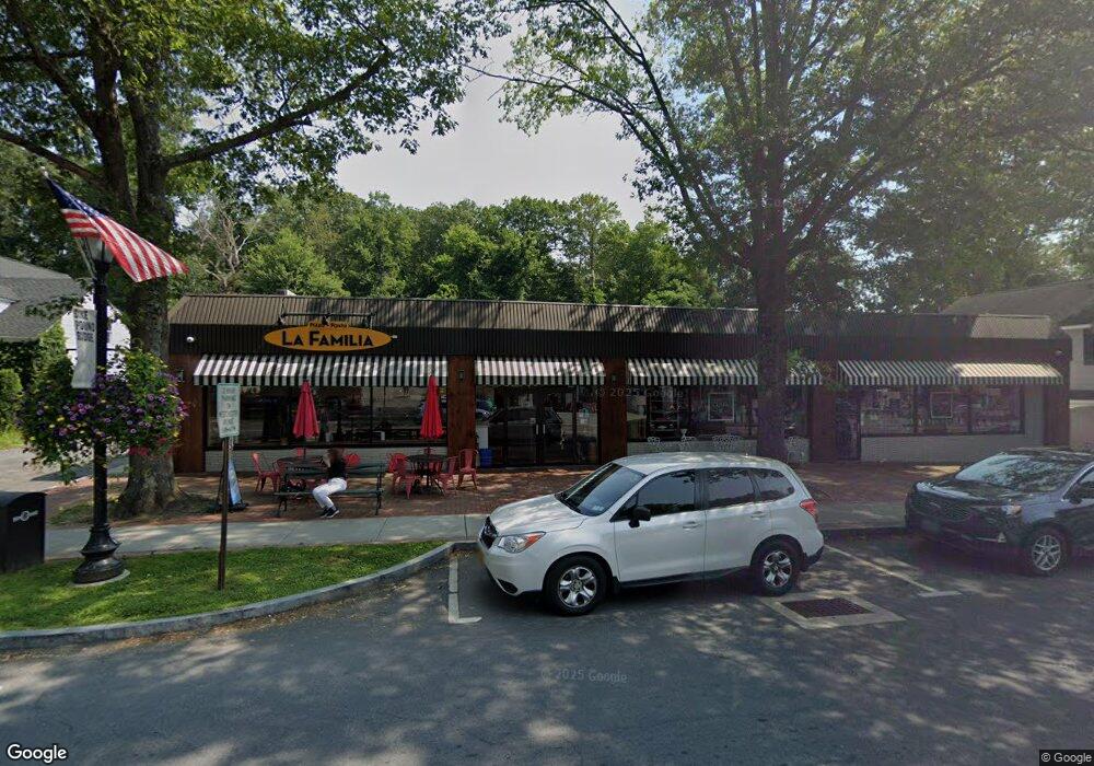
69 Westchester Ave Unit 2 Pound Ridge, NY 10576
Estimated Value: $3,312,851
--
Bed
--
Bath
800
Sq Ft
$4,141/Sq Ft
Est. Value
About This Home
This home is located at 69 Westchester Ave Unit 2, Pound Ridge, NY 10576 and is currently estimated at $3,312,851, approximately $4,141 per square foot. 69 Westchester Ave Unit 2 is a home located in Westchester County with nearby schools including Pound Ridge Elementary School, Fox Lane Middle School, and Fox Lane High School.
Ownership History
Date
Name
Owned For
Owner Type
Purchase Details
Closed on
Sep 6, 2019
Sold by
Pound Ridge Plaza Llc
Bought by
69 71 Westchester Avenue Llc
Current Estimated Value
Purchase Details
Closed on
Oct 28, 2010
Sold by
Vazzana Nicholas S
Bought by
Pound Ridge Plaza Llc
Home Financials for this Owner
Home Financials are based on the most recent Mortgage that was taken out on this home.
Original Mortgage
$1,500,000
Interest Rate
5.5%
Mortgage Type
Commercial
Purchase Details
Closed on
Aug 3, 2004
Sold by
Goldstein Jonathan and Moffatt Christine
Bought by
Fenenbock Lorna Marie and Lorna Marie Fenenbock Living Trust
Create a Home Valuation Report for This Property
The Home Valuation Report is an in-depth analysis detailing your home's value as well as a comparison with similar homes in the area
Home Values in the Area
Average Home Value in this Area
Purchase History
| Date | Buyer | Sale Price | Title Company |
|---|---|---|---|
| 69 71 Westchester Avenue Llc | $2,500,000 | Statewide Abstract Copr | |
| Pound Ridge Plaza Llc | $2,179,000 | All Ny Title Agency Inc | |
| Fenenbock Lorna Marie | $930,000 | Multiple |
Source: Public Records
Mortgage History
| Date | Status | Borrower | Loan Amount |
|---|---|---|---|
| Previous Owner | Pound Ridge Plaza Llc | $1,500,000 |
Source: Public Records
Tax History Compared to Growth
Tax History
| Year | Tax Paid | Tax Assessment Tax Assessment Total Assessment is a certain percentage of the fair market value that is determined by local assessors to be the total taxable value of land and additions on the property. | Land | Improvement |
|---|---|---|---|---|
| 2024 | $40,238 | $255,000 | $65,000 | $190,000 |
| 2023 | $38,609 | $255,000 | $65,000 | $190,000 |
| 2022 | $36,450 | $254,000 | $65,000 | $189,000 |
| 2021 | $35,834 | $254,000 | $65,000 | $189,000 |
| 2020 | $35,199 | $254,000 | $65,000 | $189,000 |
| 2019 | $35,478 | $250,000 | $65,000 | $185,000 |
| 2018 | $24,091 | $250,000 | $65,000 | $185,000 |
| 2017 | $0 | $250,000 | $65,000 | $185,000 |
| 2016 | $33,646 | $250,000 | $65,000 | $185,000 |
| 2015 | -- | $250,000 | $65,000 | $185,000 |
| 2014 | -- | $250,000 | $65,000 | $185,000 |
| 2013 | -- | $250,000 | $65,000 | $185,000 |
Source: Public Records
Map
Nearby Homes
- 0 Rolling Meadow Ln Unit ONEH6302491
- 26 Pequot Ln
- 17 Eastwoods Rd
- 119 Proprietors Crossing
- 171 Proprietors Crossing
- 33 Peters Ln
- 176 Logan Rd
- 928 West Rd
- 331 Dans Hwy
- 98 Eastwoods Rd
- 1421 Oenoke Ridge
- 78 Trinity Pass
- 27 West Ln
- 1247 Oenoke Ridge
- 2993 High Ridge Rd
- 104 Dans Hwy
- 49 Indian Hill Rd
- 32 Joshua Hobby Ln
- 22 Joshua Hobby Ln
- 259 Westchester Ave
- 69 Westchester Ave Unit 3
- 69 Westchester Ave Unit 1
- 69 Westchester Ave
- 147-3 Trinity Pass Rd
- 147-2 Trinity Pass Rd
- 147-1 Trinity Pass Rd
- 71 Westchester Ave
- 4 Trinity Pass Rd
- 65 Westchester Ave
- 65 Westchester Ave Unit Retail
- 65 Westchester Ave Unit A
- 68 Westchester Ave Unit A
- 70 Westchester Ave Unit 1a
- 70 Westchester Ave
- 72 Westchester Ave
- 77 Westchester Ave
- 76 Westchester Ave Unit C
- 76 Westchester Ave Unit B
- 76 Westchester Ave Unit D
- 76 Westchester Ave