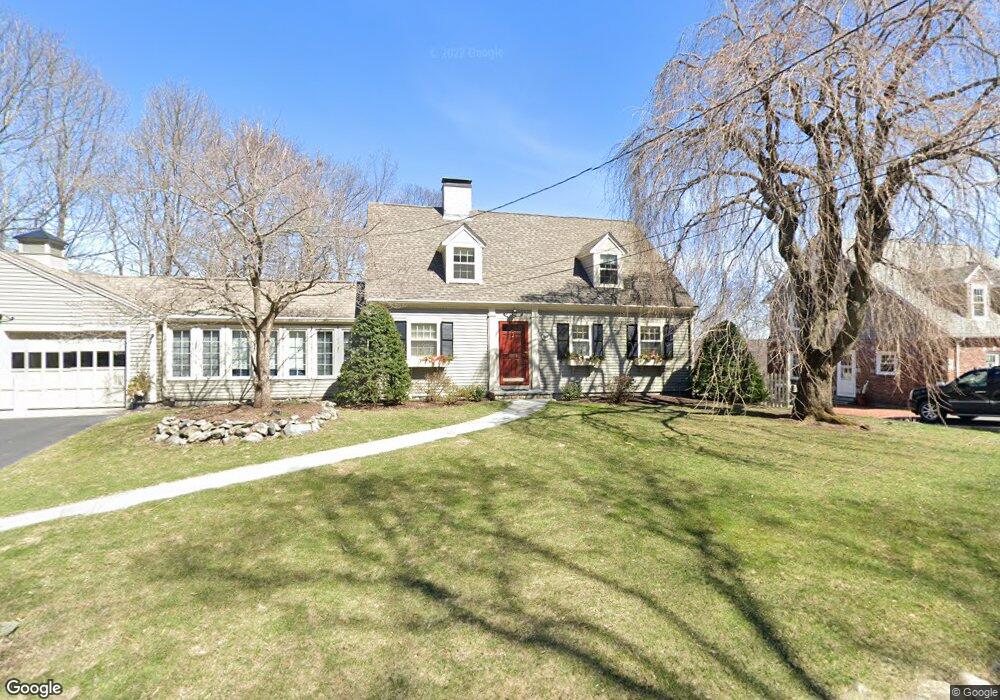
69 Westland Ave Winchester, MA 01890
West Side NeighborhoodEstimated Value: $1,363,000 - $1,491,899
3
Beds
3
Baths
1,764
Sq Ft
$816/Sq Ft
Est. Value
About This Home
This home is located at 69 Westland Ave, Winchester, MA 01890 and is currently estimated at $1,438,975, approximately $815 per square foot. 69 Westland Ave is a home located in Middlesex County with nearby schools including Vinson-Owen Elementary School, McCall Middle School, and Winchester High School.
Ownership History
Date
Name
Owned For
Owner Type
Purchase Details
Closed on
Sep 15, 2021
Sold by
Murphy Karen D
Bought by
Karen D Murphy T
Current Estimated Value
Create a Home Valuation Report for This Property
The Home Valuation Report is an in-depth analysis detailing your home's value as well as a comparison with similar homes in the area
Home Values in the Area
Average Home Value in this Area
Purchase History
| Date | Buyer | Sale Price | Title Company |
|---|---|---|---|
| Karen D Murphy T | -- | None Available |
Source: Public Records
Tax History Compared to Growth
Tax History
| Year | Tax Paid | Tax Assessment Tax Assessment Total Assessment is a certain percentage of the fair market value that is determined by local assessors to be the total taxable value of land and additions on the property. | Land | Improvement |
|---|---|---|---|---|
| 2025 | $163 | $1,472,900 | $1,048,900 | $424,000 |
| 2024 | $15,789 | $1,393,600 | $974,000 | $419,600 |
| 2023 | $14,448 | $1,224,400 | $824,200 | $400,200 |
| 2022 | $14,848 | $1,186,900 | $786,700 | $400,200 |
| 2021 | $13,306 | $1,037,100 | $636,900 | $400,200 |
| 2020 | $12,385 | $999,600 | $599,400 | $400,200 |
| 2019 | $11,651 | $962,100 | $561,900 | $400,200 |
| 2018 | $11,344 | $930,600 | $541,300 | $389,300 |
| 2017 | $10,434 | $849,700 | $482,300 | $367,400 |
| 2016 | $9,797 | $838,800 | $482,300 | $356,500 |
| 2015 | $9,029 | $743,700 | $402,700 | $341,000 |
| 2014 | $9,291 | $733,900 | $402,700 | $331,200 |
Source: Public Records
Map
Nearby Homes
- 89 Wildwood St
- 54 Johnson Rd
- 139 High St
- 44 Cabot St
- 26 Swan Rd
- 80 Arlington St
- 7 Wainwright Rd Unit 118
- 104 Church St
- 5 Azalea Rd
- 20 Amberwood Dr
- 1 Copley St
- 189 High St
- 10 Sheffield Rd
- 32 Woodside Rd
- 6 Ivy Cir
- 269 Cambridge Rd Unit 203
- 273 Cambridge Rd Unit 202
- 9 Norfolk Rd
- 15 Wildwood St
- 4 Wyman Ct Unit 4
- 73 Westland Ave
- 44 Robinhood Rd
- 65 Westland Ave
- 70 Westland Ave
- 48 Robinhood Rd
- 42 Robinhood Rd
- 63 Westland Ave
- 63 Westland Ave Unit single
- 75 Westland Ave
- 38 Robinhood Rd
- 50 Robinhood Rd
- 74 Westland Ave
- 45 Robinhood Rd
- 126 Wildwood St
- 120 Wildwood St
- 36 Robinhood Rd
- 57 Westland Ave
- 43 Robinhood Rd
- 5 Worthen Rd
- 58 Westland Ave