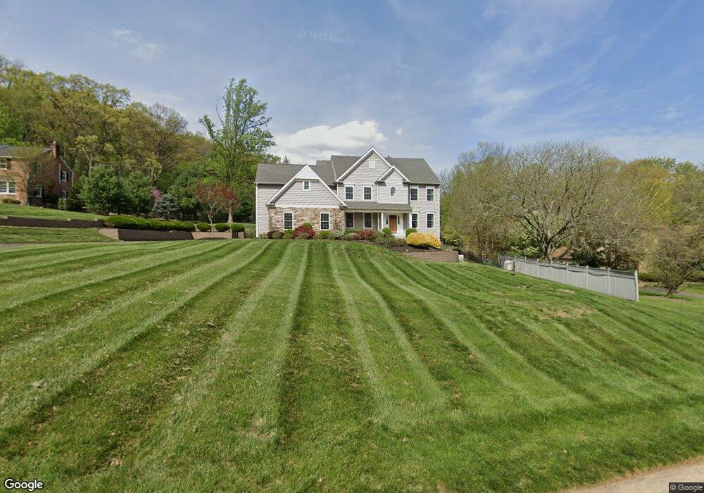
69 Windover Ln Doylestown, PA 18901
Estimated Value: $609,000 - $1,324,000
5
Beds
5
Baths
3,608
Sq Ft
$304/Sq Ft
Est. Value
About This Home
This home is located at 69 Windover Ln, Doylestown, PA 18901 and is currently estimated at $1,095,284, approximately $303 per square foot. 69 Windover Ln is a home with nearby schools including Kutz Elementary School, Lenape Middle School, and Central Bucks High School-West.
Ownership History
Date
Name
Owned For
Owner Type
Purchase Details
Closed on
Sep 16, 2014
Sold by
Terry Franklin A and Terry Mary L
Bought by
Lee Kook Sung and Lee Sue Y
Current Estimated Value
Home Financials for this Owner
Home Financials are based on the most recent Mortgage that was taken out on this home.
Original Mortgage
$600,000
Outstanding Balance
$458,830
Interest Rate
4.11%
Mortgage Type
Construction
Estimated Equity
$636,454
Purchase Details
Closed on
Jun 2, 1989
Bought by
Terry Franklin A
Create a Home Valuation Report for This Property
The Home Valuation Report is an in-depth analysis detailing your home's value as well as a comparison with similar homes in the area
Home Values in the Area
Average Home Value in this Area
Purchase History
| Date | Buyer | Sale Price | Title Company |
|---|---|---|---|
| Lee Kook Sung | $225,000 | None Available | |
| Terry Franklin A | $405,000 | -- |
Source: Public Records
Mortgage History
| Date | Status | Borrower | Loan Amount |
|---|---|---|---|
| Open | Lee Kook Sung | $600,000 |
Source: Public Records
Tax History Compared to Growth
Tax History
| Year | Tax Paid | Tax Assessment Tax Assessment Total Assessment is a certain percentage of the fair market value that is determined by local assessors to be the total taxable value of land and additions on the property. | Land | Improvement |
|---|---|---|---|---|
| 2025 | $13,210 | $74,650 | $10,230 | $64,420 |
| 2024 | $13,210 | $74,650 | $10,230 | $64,420 |
| 2023 | $12,596 | $74,650 | $10,230 | $64,420 |
| 2022 | $12,456 | $74,650 | $10,230 | $64,420 |
| 2021 | $12,200 | $74,650 | $10,230 | $64,420 |
| 2020 | $12,144 | $74,650 | $10,230 | $64,420 |
| 2019 | $12,013 | $74,650 | $10,230 | $64,420 |
| 2018 | $11,976 | $74,650 | $10,230 | $64,420 |
| 2017 | $11,882 | $74,650 | $10,230 | $64,420 |
| 2016 | $11,808 | $74,650 | $10,230 | $64,420 |
| 2015 | -- | $8,240 | $8,240 | $0 |
| 2014 | -- | $8,240 | $8,240 | $0 |
Source: Public Records
Map
Nearby Homes
- 126 Short Rd
- 249 East Rd
- 3015 Yorkshire Rd
- 000 Cherry Ln
- 150 Watercrest Dr
- 152 Watercrest Dr
- 3775 Buckingham Dr
- 223 Cherry Ln
- 3889 Robin Rd
- 106 Saddle Dr
- lot #3 next to 3739 York Rd
- 21 Shady Springs Dr
- 505 E State St
- 2320 Turk Rd
- 2479 Wheatfield Ln
- 339 E Ashland St
- 466 Linden Ave
- 420 Edison Furlong Rd
- 0 000 Rd E
- 3772 Powder Horn Dr