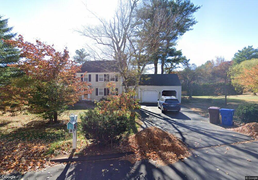
69 Wolf Pit Rd Farmington, CT 06032
Estimated Value: $489,718 - $597,000
4
Beds
2
Baths
1,775
Sq Ft
$304/Sq Ft
Est. Value
About This Home
This home is located at 69 Wolf Pit Rd, Farmington, CT 06032 and is currently estimated at $539,180, approximately $303 per square foot. 69 Wolf Pit Rd is a home located in Hartford County with nearby schools including East Farms School, West Woods Upper Elementary School, and Irving A. Robbins Middle School.
Ownership History
Date
Name
Owned For
Owner Type
Purchase Details
Closed on
Feb 4, 2022
Sold by
Stanfield Edward
Bought by
Stanfield Susan
Current Estimated Value
Purchase Details
Closed on
Sep 29, 1992
Sold by
C B Dev Corp
Bought by
Setzko Steven
Create a Home Valuation Report for This Property
The Home Valuation Report is an in-depth analysis detailing your home's value as well as a comparison with similar homes in the area
Home Values in the Area
Average Home Value in this Area
Purchase History
| Date | Buyer | Sale Price | Title Company |
|---|---|---|---|
| Stanfield Susan | -- | None Available | |
| Setzko Steven | $155,000 | -- |
Source: Public Records
Mortgage History
| Date | Status | Borrower | Loan Amount |
|---|---|---|---|
| Previous Owner | Setzko Steven | $66,000 | |
| Previous Owner | Setzko Steven | $210,000 | |
| Previous Owner | Setzko Steven | $228,000 | |
| Previous Owner | Setzko Steven | $228,000 |
Source: Public Records
Tax History
| Year | Tax Paid | Tax Assessment Tax Assessment Total Assessment is a certain percentage of the fair market value that is determined by local assessors to be the total taxable value of land and additions on the property. | Land | Improvement |
|---|---|---|---|---|
| 2025 | $6,917 | $259,840 | $89,460 | $170,380 |
| 2024 | $6,613 | $259,840 | $89,460 | $170,380 |
| 2023 | $6,291 | $259,840 | $89,460 | $170,380 |
| 2022 | $5,933 | $202,360 | $74,840 | $127,520 |
| 2021 | $5,830 | $202,360 | $74,840 | $127,520 |
| 2020 | $5,660 | $202,360 | $74,840 | $127,520 |
| 2019 | $5,660 | $202,360 | $74,840 | $127,520 |
| 2018 | $5,500 | $202,360 | $74,840 | $127,520 |
| 2017 | $5,403 | $202,510 | $84,970 | $117,540 |
| 2016 | $5,221 | $202,510 | $84,970 | $117,540 |
| 2015 | $5,065 | $202,510 | $84,970 | $117,540 |
| 2014 | $4,950 | $202,520 | $84,980 | $117,540 |
Source: Public Records
Map
Nearby Homes
- 78 Birdseye Rd
- 11 Mountain Spring Rd
- 1 Magnolia Cir
- 9 Dunham Ln
- 48 Great Meadow Ln
- 50 Poplar Hill Dr
- 8128 Colt Hwy
- 5 Talcott Ridge Rd Unit F
- 5 Yorkshire Ct Unit 5
- 13 Byrne Ct Unit A
- 169 Country Club Rd
- 138 Bradford Walk Unit 138
- 23 Lewis Rd
- 178 Alexander Rd
- 215 Old Mountain Rd
- 57 Merigold Dr
- 43 Crescent Ave
- 260 Brittany Farms Rd Unit B
- 235 Brittany Farms Rd Unit G
- 300 Brittany Farms Rd Unit C
- 67 Wolf Pit Rd
- 65 Wolf Pit Rd
- 20 Elizabeth Rd
- 18 Elizabeth Rd
- 63 Wolf Pit Rd
- 21 Elizabeth Rd
- 19 Elizabeth Rd
- 16 Elizabeth Rd
- 61 Wolf Pit Rd
- 17 Elizabeth Rd
- 12 Elizabeth Rd
- 521 Farmington Ave
- 529 Farmington Ave
- 54 Birdseye Rd
- 15 Elizabeth Rd
- 10 Elizabeth Rd
- 58 Birdseye Rd
- 11 Elizabeth Rd
- 60 Birdseye Rd
- 8 Elizabeth Rd
Your Personal Tour Guide
Ask me questions while you tour the home.