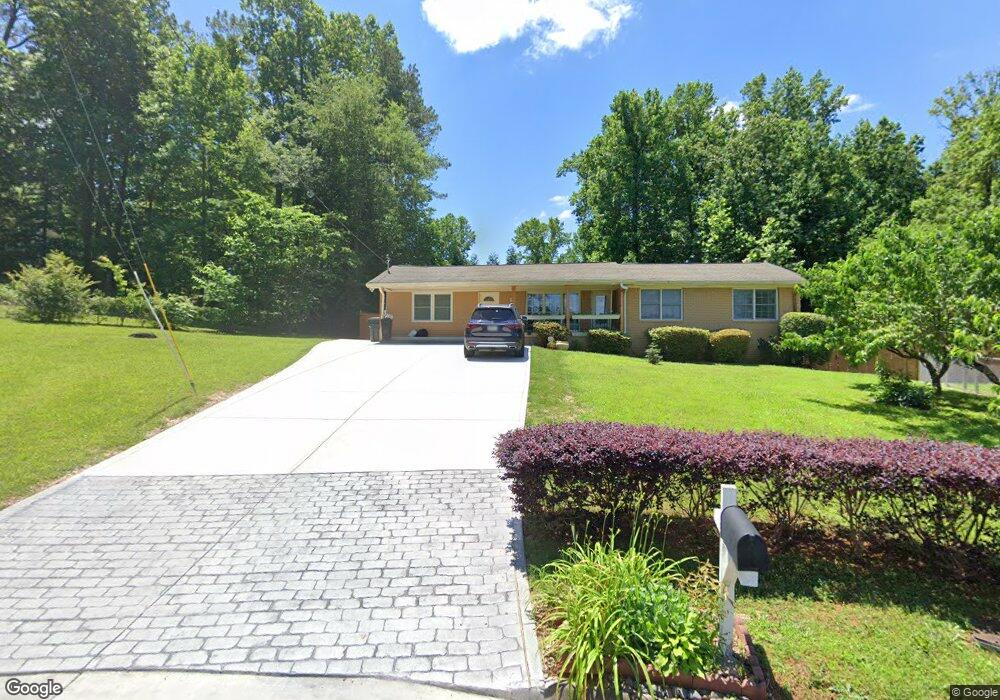
690 Abe Cir NE Kennesaw, GA 30144
Sandy Plains NeighborhoodEstimated Value: $339,379 - $409,000
3
Beds
2
Baths
1,836
Sq Ft
$207/Sq Ft
Est. Value
About This Home
This home is located at 690 Abe Cir NE, Kennesaw, GA 30144 and is currently estimated at $380,845, approximately $207 per square foot. 690 Abe Cir NE is a home located in Cobb County with nearby schools including Nicholson Elementary School, McCleskey Middle School, and Kell High School.
Ownership History
Date
Name
Owned For
Owner Type
Purchase Details
Closed on
May 5, 2003
Sold by
Bank One Na
Bought by
Tzvetkov Vasil
Current Estimated Value
Home Financials for this Owner
Home Financials are based on the most recent Mortgage that was taken out on this home.
Original Mortgage
$93,460
Outstanding Balance
$40,679
Interest Rate
5.81%
Mortgage Type
New Conventional
Estimated Equity
$340,166
Create a Home Valuation Report for This Property
The Home Valuation Report is an in-depth analysis detailing your home's value as well as a comparison with similar homes in the area
Home Values in the Area
Average Home Value in this Area
Purchase History
| Date | Buyer | Sale Price | Title Company |
|---|---|---|---|
| Tzvetkov Vasil | $93,500 | -- |
Source: Public Records
Mortgage History
| Date | Status | Borrower | Loan Amount |
|---|---|---|---|
| Open | Tzvetkov Vasil | $93,460 |
Source: Public Records
Tax History Compared to Growth
Tax History
| Year | Tax Paid | Tax Assessment Tax Assessment Total Assessment is a certain percentage of the fair market value that is determined by local assessors to be the total taxable value of land and additions on the property. | Land | Improvement |
|---|---|---|---|---|
| 2024 | $3,065 | $137,288 | $26,000 | $111,288 |
| 2023 | $1,962 | $111,428 | $22,000 | $89,428 |
| 2022 | $2,211 | $97,112 | $18,000 | $79,112 |
| 2021 | $1,728 | $75,048 | $14,000 | $61,048 |
| 2020 | $1,441 | $61,912 | $8,000 | $53,912 |
| 2019 | $1,441 | $61,912 | $8,000 | $53,912 |
| 2018 | $1,123 | $47,400 | $8,000 | $39,400 |
| 2017 | $1,073 | $47,400 | $8,000 | $39,400 |
| 2016 | $1,128 | $49,824 | $6,000 | $43,824 |
| 2015 | $1,251 | $42,452 | $6,000 | $36,452 |
| 2014 | $1,261 | $42,452 | $0 | $0 |
Source: Public Records
Map
Nearby Homes
- 4704 Lincoln Dr NE
- 4669 Blue Topaz Trail
- 707 Smokey Quartz Way
- 710 Smokey Quartz Way
- 694 Smokey Quartz Way
- 4785 Moonstone NE
- 703 Smokey Quartz Way
- 706 Smokey Quartz Way
- 702 Smokey Quartz Way
- The Gavin E Plan at The Village at Shallowford - Signature Series
- The Marion A Plan at The Village at Shallowford - Classic Series
- The Cary A Plan at The Village at Shallowford - Classic Series
- 4778 Moonstone NE
- 639 Tigers Eye Terrace
- 4785 Moonstone Trace
- 680 Abe Cir NE
- 4662 Rambling Rd NE
- 700 Abe Cir NE Unit 2
- 4727 Lincoln Dr NE
- 4674 Rambling Rd NE
- 0 Abe Cir Unit 7108435
- 691 Abe Cir NE
- 4650 Rambling Rd NE
- 0 Lincoln Dr NE
- 4733 Lincoln Dr NE
- 4686 Rambling Rd NE
- 4713 Lincoln Dr NE
- 4720 Lincoln Dr NE
- 4714 Lincoln Dr NE
- 709 Gettysburg Trail NE
- 729 Gettysburg Trail NE
- 4726 Lincoln Dr NE
- 4677 Rambling Rd NE Unit 1
- 4770 Lincoln Dr NE
- 4741 Lincoln Dr NE