Estimated Value: $233,000 - $293,000
3
Beds
2
Baths
1,550
Sq Ft
$173/Sq Ft
Est. Value
About This Home
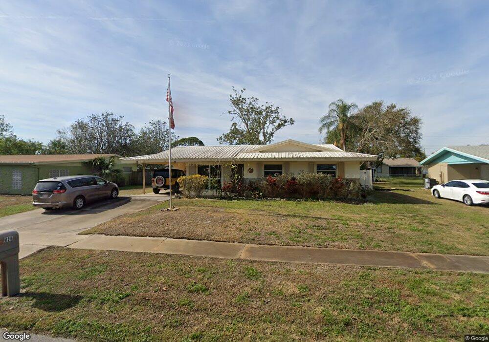
This home is located at 690 Aloha Ave, Cocoa, FL 32927 and is currently estimated at $267,579, approximately $172 per square foot. 690 Aloha Ave is a home located in Brevard County with nearby schools including Atlantis Elementary School, Space Coast Junior/Senior High School, and East Atlantic Prep of Brevard County.
Ownership History
Date
Name
Owned For
Owner Type
Purchase Details
Closed on
Sep 19, 2023
Sold by
Mcdaniel Edward G
Bought by
Gruber Kris Diane
Current Estimated Value
Purchase Details
Closed on
Sep 4, 2013
Sold by
Mcdaniel Edward G
Bought by
Mcdaniel Edward G and Mcdaniel Diane K
Purchase Details
Closed on
Oct 25, 1991
Sold by
Rose Sylvia Ann and Mcdaniel Sylvia A
Bought by
Mcdaniel Edward G
Create a Home Valuation Report for This Property
The Home Valuation Report is an in-depth analysis detailing your home's value as well as a comparison with similar homes in the area
Home Values in the Area
Average Home Value in this Area
Purchase History
| Date | Buyer | Sale Price | Title Company |
|---|---|---|---|
| Gruber Kris Diane | $100 | None Listed On Document | |
| Gruber Kris Diane | $100 | None Listed On Document | |
| Mcdaniel Edward G | -- | None Available | |
| Mcdaniel Edward G | -- | None Available |
Source: Public Records
Tax History
| Year | Tax Paid | Tax Assessment Tax Assessment Total Assessment is a certain percentage of the fair market value that is determined by local assessors to be the total taxable value of land and additions on the property. | Land | Improvement |
|---|---|---|---|---|
| 2025 | $2,834 | $171,410 | -- | -- |
| 2024 | $553 | $180,950 | -- | -- |
| 2023 | $553 | $62,960 | $0 | $0 |
| 2022 | $536 | $61,130 | $0 | $0 |
| 2021 | $842 | $59,350 | $0 | $0 |
| 2020 | $795 | $58,540 | $0 | $0 |
| 2019 | $740 | $57,230 | $0 | $0 |
| 2018 | $738 | $56,170 | $0 | $0 |
| 2017 | $734 | $55,020 | $0 | $0 |
| 2016 | $736 | $53,890 | $18,000 | $35,890 |
| 2015 | $737 | $53,520 | $15,000 | $38,520 |
| 2014 | $740 | $53,100 | $11,000 | $42,100 |
Source: Public Records
Map
Nearby Homes
- 780 Alcazar Ave
- 645 Altura Dr
- 1131 Covina St
- 1164 Aron St
- 0 Fay Blvd Unit 1011912
- 1165 Aron St
- 701 Amor Dr
- 6455 Orchid Ave
- 1231 Vineland St
- 520 Arabella Ln
- 1050 Barclay Dr
- 3875 Fay Blvd
- 961 Kaufman St
- 6900 N Highway 1 Unit 6307
- 6900 N Highway 1 Unit 6303
- 6760 N Highway 1 Unit 3204
- 3925 Newport St
- 1040 Jersey St
- 6800 N Highway 1 Unit 4202
- 1029 Illinois Rd
- 680 Aloha Ave
- 698 Aloha Ave
- 691 Alcazar Ave
- 699 Alcazar Ave
- 681 Alcazar Ave
- 671 Aloha Ave Unit 1
- 700 Aloha Ave
- 681 Aloha Ave
- 671 Alcazar Ave
- 701 Alcazar Ave
- 699 Aloha Ave
- 660 Aloha Ave
- 661 Aloha Ave
- 710 Aloha Ave
- 711 Alcazar Ave
- 701 Aloha Ave
- 690 Lindsay Ave
- 680 Lindsay Ave
- 651 Aloha Ave
- 670 Lindsay Ave
Your Personal Tour Guide
Ask me questions while you tour the home.