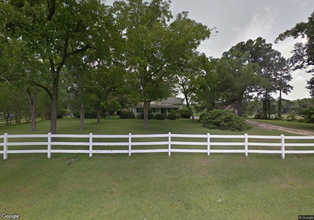
690 Byrd Rd Bunnlevel, NC 28323
Estimated Value: $162,000 - $295,000
4
Beds
2
Baths
1,847
Sq Ft
$119/Sq Ft
Est. Value
About This Home
This home is located at 690 Byrd Rd, Bunnlevel, NC 28323 and is currently estimated at $219,032, approximately $118 per square foot. 690 Byrd Rd is a home located in Harnett County with nearby schools including Lillington-Shawtown Elementary School, Harnett Central Middle School, and Harnett Central High School.
Ownership History
Date
Name
Owned For
Owner Type
Purchase Details
Closed on
May 3, 2018
Sold by
Byrd Ernest and Byrd Laura Beth
Bought by
Neighbors Jimmy Scott and Neighbors Tracy Leigh
Current Estimated Value
Home Financials for this Owner
Home Financials are based on the most recent Mortgage that was taken out on this home.
Original Mortgage
$70,000
Outstanding Balance
$41,474
Interest Rate
4.4%
Mortgage Type
New Conventional
Estimated Equity
$177,558
Purchase Details
Closed on
Nov 22, 2016
Sold by
Byrd Judy Poe
Bought by
Byrd Ernest Stanley and Byrd Laura Beth Mccullen
Create a Home Valuation Report for This Property
The Home Valuation Report is an in-depth analysis detailing your home's value as well as a comparison with similar homes in the area
Home Values in the Area
Average Home Value in this Area
Purchase History
| Date | Buyer | Sale Price | Title Company |
|---|---|---|---|
| Neighbors Jimmy Scott | $70,000 | None Available | |
| Byrd Ernest Stanley | $50,000 | -- |
Source: Public Records
Mortgage History
| Date | Status | Borrower | Loan Amount |
|---|---|---|---|
| Open | Neighbors Jimmy Scott | $70,000 |
Source: Public Records
Tax History
| Year | Tax Paid | Tax Assessment Tax Assessment Total Assessment is a certain percentage of the fair market value that is determined by local assessors to be the total taxable value of land and additions on the property. | Land | Improvement |
|---|---|---|---|---|
| 2025 | $904 | $115,239 | $0 | $0 |
| 2024 | $904 | $115,239 | $0 | $0 |
| 2023 | $904 | $115,239 | $0 | $0 |
| 2022 | $1,021 | $115,239 | $0 | $0 |
| 2021 | $1,021 | $107,610 | $0 | $0 |
| 2020 | $1,021 | $107,610 | $0 | $0 |
| 2019 | $1,006 | $107,610 | $0 | $0 |
| 2018 | $1,006 | $107,610 | $0 | $0 |
| 2017 | $1,006 | $107,610 | $0 | $0 |
| 2016 | $1,101 | $118,510 | $0 | $0 |
| 2015 | $1,101 | $118,510 | $0 | $0 |
| 2014 | $1,101 | $118,510 | $0 | $0 |
Source: Public Records
Map
Nearby Homes
- 3792 McNeill Hobbs Rd
- 6200 U S 401
- 444 Sanderfer Rd
- 0 Sanderfer Rd Unit 10126922
- 7111 U S 401
- 1333 Bunnlevel Erwin Rd
- 1925 Bunnlevel Erwin Rd
- 1655 Bunnlevel Erwin Rd
- 2044 Wire Rd
- 2527 Joel Johnson Rd
- 2657 Joel Johnson Rd
- 0 Wire Rd
- 2727 Wire Rd
- 2915 McLean Chapel Church Rd
- 1271 Nutgrass Rd
- 155 Nectar Ln
- 175 Nectar Ln
- 191 Nectar Ln
- 209 Nectar Ln
- 2470 Wire Rd
- 637 Byrd Rd
- 798 Byrd Rd
- 585 Byrd Rd
- 546 Byrd Rd
- 496 Byrd Rd
- 3791 McNeill Hobbs Rd
- 824 Byrd Rd
- 462 Byrd Rd
- 3910 McNeill Hobbs Rd
- 102 Sanderfer Rd
- 0 H and L Dr Unit 1972713
- 0 H and L Dr Unit 1827158
- 0 H and L Dr Unit TR1996415
- 0 H and L Dr Unit TR2045979
- 0 H and L Dr Unit 6 1827158
- 0 H and L Dr Unit 6 1972713
- 0 H and L Dr
- 0 H&l Dr Unit 381671
- 0 H&l Dr Unit 549284
- 4381 McNeill Hobbs Rd
Your Personal Tour Guide
Ask me questions while you tour the home.