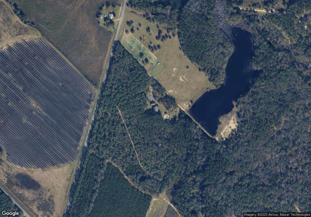
690 Gresston Baptist Rd Eastman, GA 31023
Estimated Value: $455,000 - $944,411
--
Bed
7
Baths
6,520
Sq Ft
$107/Sq Ft
Est. Value
About This Home
This home is located at 690 Gresston Baptist Rd, Eastman, GA 31023 and is currently estimated at $694,853, approximately $106 per square foot. 690 Gresston Baptist Rd is a home located in Dodge County with nearby schools including Dodge County High School.
Ownership History
Date
Name
Owned For
Owner Type
Purchase Details
Closed on
Apr 26, 2002
Sold by
Yawn Gary E
Bought by
Rahn James T and Rahn Tamela B
Current Estimated Value
Purchase Details
Closed on
Jan 31, 1995
Bought by
Tripp Joan W
Create a Home Valuation Report for This Property
The Home Valuation Report is an in-depth analysis detailing your home's value as well as a comparison with similar homes in the area
Home Values in the Area
Average Home Value in this Area
Purchase History
| Date | Buyer | Sale Price | Title Company |
|---|---|---|---|
| Rahn James T | $206,000 | -- | |
| Tripp Joan W | $16,500 | -- |
Source: Public Records
Tax History Compared to Growth
Tax History
| Year | Tax Paid | Tax Assessment Tax Assessment Total Assessment is a certain percentage of the fair market value that is determined by local assessors to be the total taxable value of land and additions on the property. | Land | Improvement |
|---|---|---|---|---|
| 2024 | $6,212 | $288,827 | $93,885 | $194,942 |
| 2023 | $7,458 | $288,827 | $93,885 | $194,942 |
| 2022 | $5,946 | $272,094 | $75,208 | $196,886 |
| 2021 | $5,970 | $273,310 | $75,208 | $198,102 |
| 2020 | $6,027 | $253,168 | $55,066 | $198,102 |
| 2019 | $4,972 | $211,627 | $55,066 | $156,561 |
| 2018 | $5,408 | $211,627 | $55,066 | $156,561 |
| 2017 | $5,408 | $211,627 | $55,066 | $156,561 |
| 2016 | $4,807 | $214,998 | $55,066 | $159,932 |
| 2015 | -- | $214,997 | $55,066 | $159,932 |
| 2014 | -- | $233,174 | $52,270 | $180,904 |
| 2013 | -- | $233,174 | $52,270 | $180,903 |
Source: Public Records
Map
Nearby Homes
- 238 Wilson Woodard Rd
- 0 Gooch Rd Unit LOT F 10320712
- 0 Gooch Rd - Lot C
- 3557 Antioch Church Rd
- 115 Log Cabin Rd
- 140 Antioch Church Rd
- 251 Bill Hambrick Rd
- 0 Log Cabin Rd Unit LOT WP001 10506501
- 0 Log Cabin Rd Unit LotWP001 23229925
- 00 Log Cabin Rd
- 0 Bethel Church Rd Unit 10601037
- 983 Cochran Hwy
- 415 Ga Highway 257
- 94 24th Ave
- 596 Ga Highway 257
- 407 Powers Rd
- 139 and 137 Ga Hwy 257
- 1227 Hawkinsville Hwy
- 0 Fish Rd
- 5611 Cottondale Ave
- 0 Gresston Baptist Rd
- 808 Gresston Baptist Rd
- 554 Gresston Baptist Rd
- 35 Hardy Rd
- 190 Hardy Rd
- 121 Hardy Rd
- 121 Hardy Rd
- 500 Gresston Baptist Rd
- 211 Hardy Rd
- 1002 Gresston Baptist Rd
- 386 Gresston Baptist Rd
- 331 Hardy Rd
- 1084 Gresston Baptist Rd
- 111 Garrett Oxley Rd
- 1166 Gresston Baptist Rd
- 0 Pecan Ln Unit 8350294
- 0 Pecan Ln
- 429 Hardy Rd
- 1141 Gresston Baptist Rd
- 1141 Gresston Baptist Rd
