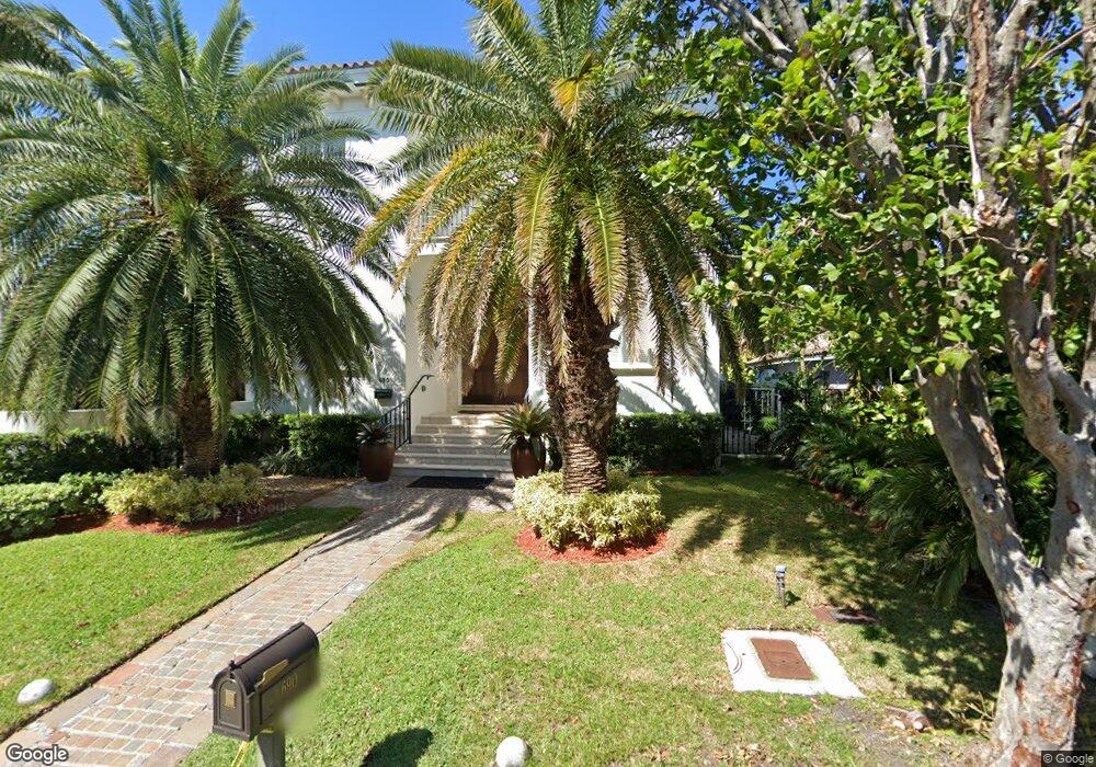
690 Hampton Ln Key Biscayne, FL 33149
Estimated Value: $3,706,000 - $5,015,000
6
Beds
5
Baths
3,416
Sq Ft
$1,254/Sq Ft
Est. Value
About This Home
This home is located at 690 Hampton Ln, Key Biscayne, FL 33149 and is currently estimated at $4,284,777, approximately $1,254 per square foot. 690 Hampton Ln is a home located in Miami-Dade County with nearby schools including Key Biscayne K-8 Center, Ponce de Leon Middle School, and Coral Gables Senior High School.
Ownership History
Date
Name
Owned For
Owner Type
Purchase Details
Closed on
Dec 1, 2004
Sold by
Bive Corp
Bought by
Gomez Xavier Antonio Marcos and Gomez Maria C
Current Estimated Value
Home Financials for this Owner
Home Financials are based on the most recent Mortgage that was taken out on this home.
Original Mortgage
$1,155,000
Interest Rate
5.25%
Mortgage Type
Unknown
Purchase Details
Closed on
May 28, 2002
Sold by
Marcela Apey I
Bought by
Bive Corp
Create a Home Valuation Report for This Property
The Home Valuation Report is an in-depth analysis detailing your home's value as well as a comparison with similar homes in the area
Home Values in the Area
Average Home Value in this Area
Purchase History
| Date | Buyer | Sale Price | Title Company |
|---|---|---|---|
| Gomez Xavier Antonio Marcos | $1,650,000 | -- | |
| Bive Corp | -- | -- |
Source: Public Records
Mortgage History
| Date | Status | Borrower | Loan Amount |
|---|---|---|---|
| Previous Owner | Gomez Xavier Antonio Marcos | $1,155,000 | |
| Closed | Gomez Xavier Antonio Marcos | $165,000 |
Source: Public Records
Tax History
| Year | Tax Paid | Tax Assessment Tax Assessment Total Assessment is a certain percentage of the fair market value that is determined by local assessors to be the total taxable value of land and additions on the property. | Land | Improvement |
|---|---|---|---|---|
| 2025 | $29,385 | $1,879,401 | -- | -- |
| 2024 | $28,996 | $1,826,435 | -- | -- |
| 2023 | $28,996 | $1,773,238 | $0 | $0 |
| 2022 | $27,866 | $1,721,591 | $0 | $0 |
| 2021 | $27,944 | $1,671,448 | $0 | $0 |
| 2020 | $26,596 | $1,648,371 | $892,576 | $755,795 |
| 2019 | $29,290 | $1,807,130 | $0 | $0 |
| 2018 | $27,798 | $1,773,435 | $0 | $0 |
| 2017 | $27,449 | $1,736,959 | $0 | $0 |
| 2016 | $27,538 | $1,701,234 | $0 | $0 |
| 2015 | $27,938 | $1,689,409 | $0 | $0 |
| 2014 | $28,369 | $1,676,001 | $0 | $0 |
Source: Public Records
Map
Nearby Homes
- 760 Allendale Rd
- 285 W Enid Dr
- 691 Ridgewood Rd
- 635 Curtiswood Dr
- 741 Harbor Dr
- 797 Ridgewood Rd
- 545 Sabal Palm Dr
- 420 Island Dr
- 738 Fernwood Rd
- 550 Harbor Dr
- 164 W Mashta Dr
- 465 Hampton Ln
- 315 Palmwood Ln
- 861 Harbor Dr
- 544 Fernwood Rd Unit 544
- 301 Redwood Ln
- 445 Ridgewood Rd
- 355 Redwood Ln
- 401 Warren Ln
- 960 Mariner Dr
Your Personal Tour Guide
Ask me questions while you tour the home.