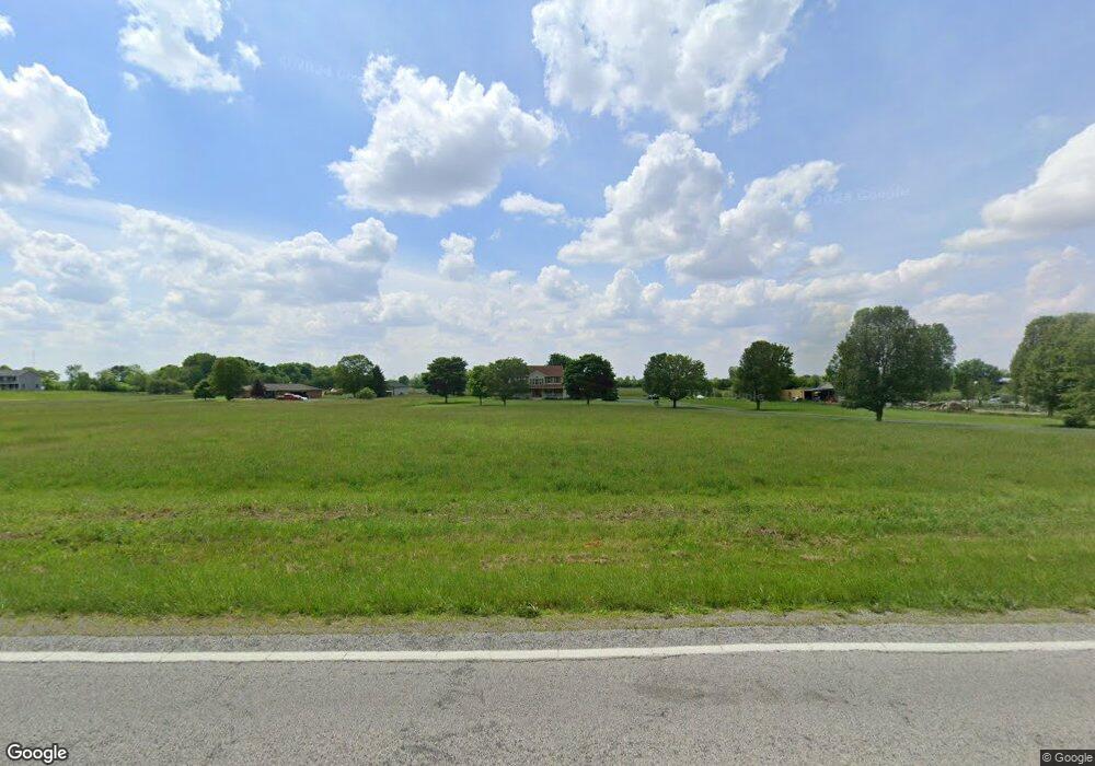
690 N State Route 201 Casstown, OH 45312
Estimated Value: $455,000 - $538,490
3
Beds
3
Baths
2,640
Sq Ft
$188/Sq Ft
Est. Value
About This Home
This home is located at 690 N State Route 201, Casstown, OH 45312 and is currently estimated at $496,745, approximately $188 per square foot. 690 N State Route 201 is a home located in Miami County with nearby schools including Miami East Elementary School, Miami East Junior High School, and Miami East High School.
Ownership History
Date
Name
Owned For
Owner Type
Purchase Details
Closed on
Aug 9, 2021
Sold by
Fisher Tara L and Fisher Mark A
Bought by
Fisher Tara L and Fisher Mark A
Current Estimated Value
Purchase Details
Closed on
Aug 5, 2008
Sold by
Fisher Tara L and Fisher Mark A
Bought by
Fisher Tara L and Fisher Mark A
Purchase Details
Closed on
Nov 15, 1999
Sold by
Fisher Mark A
Bought by
Fisher Tara L
Purchase Details
Closed on
Apr 28, 1999
Sold by
Fisher Tara L
Bought by
Fisher Mark A and Fisher Tara L
Create a Home Valuation Report for This Property
The Home Valuation Report is an in-depth analysis detailing your home's value as well as a comparison with similar homes in the area
Home Values in the Area
Average Home Value in this Area
Purchase History
| Date | Buyer | Sale Price | Title Company |
|---|---|---|---|
| Fisher Tara L | -- | None Available | |
| Fisher Tara L | -- | -- | |
| Fisher Tara L | -- | -- | |
| Fisher Mark A | -- | -- |
Source: Public Records
Tax History Compared to Growth
Tax History
| Year | Tax Paid | Tax Assessment Tax Assessment Total Assessment is a certain percentage of the fair market value that is determined by local assessors to be the total taxable value of land and additions on the property. | Land | Improvement |
|---|---|---|---|---|
| 2024 | $3,611 | $113,700 | $17,450 | $96,250 |
| 2023 | $3,611 | $113,700 | $17,450 | $96,250 |
| 2022 | $3,714 | $113,700 | $17,450 | $96,250 |
| 2021 | $3,058 | $88,560 | $14,530 | $74,030 |
| 2020 | $3,074 | $88,560 | $14,530 | $74,030 |
| 2019 | $3,127 | $88,560 | $14,530 | $74,030 |
| 2018 | $3,133 | $85,700 | $17,520 | $68,180 |
| 2017 | $3,100 | $85,700 | $17,520 | $68,180 |
| 2016 | $2,900 | $85,700 | $17,520 | $68,180 |
| 2015 | $2,911 | $81,220 | $15,660 | $65,560 |
| 2014 | $2,911 | $81,220 | $15,660 | $65,560 |
| 2013 | $2,927 | $81,220 | $15,660 | $65,560 |
Source: Public Records
Map
Nearby Homes
- 910 S Alcony Conover Rd
- 910 S Alcony-Conover Rd
- 5782 N Addison New Carlisle Rd
- 211 N Grant St
- 107 N Main St
- 12 N Main St
- 72 N Childrens Home Rd
- 6570 S Tipp Cowl Rd
- 10916 Ayres Pike
- 4845 E Troy Urbana Rd
- 12490 Stafford Rd
- 2386 Lefevre Rd
- 1947 Woodcliffe Dr
- 2656 Addison New Carlisle Rd
- 3430 Michael Dr
- 1760 Hunters Ridge Dr
- 3410 Michael Dr
- 1500 Paradise Trail
- 620 N State Route 201
- 700 N State Route 201
- 700 Ohio 201
- 520 N State Route 201
- 780 N State Route 201
- 505 N State Route 201
- 999999 State Rd 201
- 999999 Sr 201
- 420 N State Route 201
- 6730 E Casstown Clark Rd
- 6996 E Casstown Clark Rd
- 6985 E Casstown Clark Rd
- 6825 E Casstown Clark Rd
- 6933 E Casstown Clark Rd
- 6887 E Casstown Clark Rd
- 7125 E Casstown Clark Rd
- 1070 N State Route 201
- 1065 N State Route 201
- 6767 E Casstown Clark Rd
- 230 N State Route 201