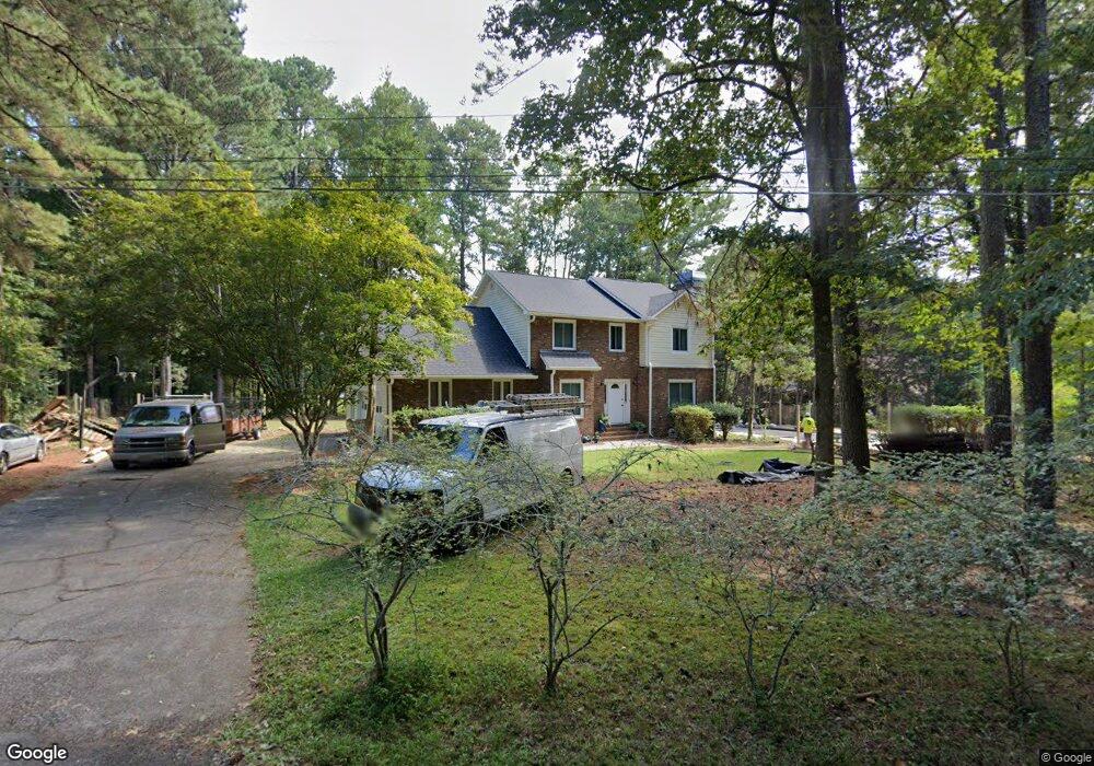
690 Redds Cir SW Lilburn, GA 30047
Estimated Value: $365,752 - $390,000
3
Beds
3
Baths
1,954
Sq Ft
$192/Sq Ft
Est. Value
About This Home
This home is located at 690 Redds Cir SW, Lilburn, GA 30047 and is currently estimated at $375,938, approximately $192 per square foot. 690 Redds Cir SW is a home located in Gwinnett County with nearby schools including Camp Creek Elementary School, Trickum Middle School, and Parkview High School.
Ownership History
Date
Name
Owned For
Owner Type
Purchase Details
Closed on
Jul 23, 2002
Sold by
Henowitz Mark R and Henowitz Janis W
Bought by
Lofton Laverne E
Current Estimated Value
Home Financials for this Owner
Home Financials are based on the most recent Mortgage that was taken out on this home.
Original Mortgage
$144,800
Outstanding Balance
$72,310
Interest Rate
9.43%
Mortgage Type
New Conventional
Estimated Equity
$303,628
Create a Home Valuation Report for This Property
The Home Valuation Report is an in-depth analysis detailing your home's value as well as a comparison with similar homes in the area
Home Values in the Area
Average Home Value in this Area
Purchase History
| Date | Buyer | Sale Price | Title Company |
|---|---|---|---|
| Lofton Laverne E | $181,000 | -- |
Source: Public Records
Mortgage History
| Date | Status | Borrower | Loan Amount |
|---|---|---|---|
| Open | Lofton Laverne E | $144,800 |
Source: Public Records
Tax History Compared to Growth
Tax History
| Year | Tax Paid | Tax Assessment Tax Assessment Total Assessment is a certain percentage of the fair market value that is determined by local assessors to be the total taxable value of land and additions on the property. | Land | Improvement |
|---|---|---|---|---|
| 2025 | $991 | $116,120 | $24,000 | $92,120 |
| 2024 | $988 | $116,120 | $24,000 | $92,120 |
| 2023 | $988 | $123,680 | $24,000 | $99,680 |
| 2022 | $2,459 | $75,080 | $12,000 | $63,080 |
| 2021 | $2,493 | $75,080 | $12,000 | $63,080 |
| 2020 | $2,509 | $75,080 | $12,000 | $63,080 |
| 2019 | $2,451 | $75,320 | $14,000 | $61,320 |
| 2018 | $2,451 | $75,320 | $14,000 | $61,320 |
| 2016 | $2,270 | $65,960 | $14,000 | $51,960 |
| 2015 | $2,293 | $65,960 | $14,000 | $51,960 |
| 2014 | $2,100 | $56,720 | $14,000 | $42,720 |
Source: Public Records
Map
Nearby Homes
- 851 Rockbridge Rd SW
- 771 Mountainbrooke Cir SW
- 717 Oxford Ct SW
- 746 Oxford Ct SW
- 881 Rockbridge Rd SW
- 923 Tall Pine Ct SW
- 5774 Vantage Ct
- 483 Rollingwood Dr
- 5632 Stillwater Ct
- 507 Castlearie Dr
- 507 Castleaire Dr Unit 1
- 1019 Crestwood Ln
- 358 W Wind Dr SW
- 5521 E Wind Dr SW
- 5798 Musket Ln
- 5633 Breezy Ct SW
- 574 Horseshoe Cir SW
- 228 Amour Way SW
- 262 Harmony Grove Rd
- 5575 Lilburn Stone Mountain Rd
- 5585 Lilburn Stone Mountain Rd
- 685 Redds Cir SW
- 5595 Lilburn Stone Mountain Rd
- 5565 Lilburn Stone Mtn Rd
- 5565 Lilburn Stone Mountain
- 5565 Lilburn Stone Mountain Rd
- 776 Lioness Ct
- 786 Lioness Ct
- 766 Lioness Ct
- 705 Redds Cir SW
- 679 Redds Cir SW
- 756 Lioness Ct
- 654 Redds Cir SW
- 5572 Lilburn Stone Mountain Rd
- 797 Lioness Ct
- 746 Lioness Ct
- 5555 Lilburn Stone Mountain Rd
- 5625 Lilburn Stone Mountain Rd
- 787 Lioness Ct