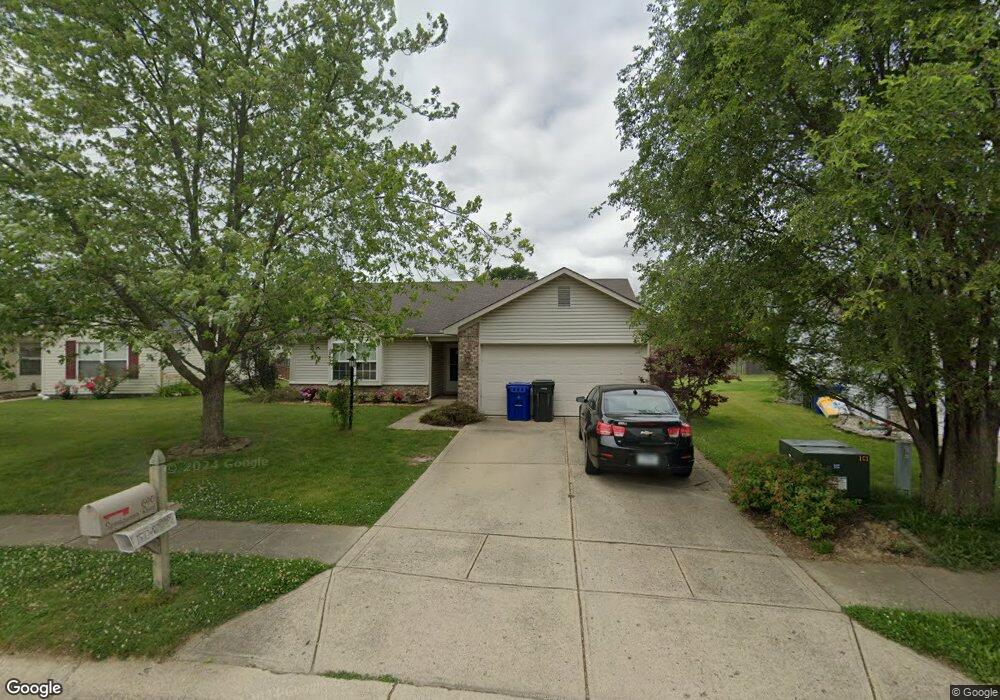
690 Springwater Rd Kokomo, IN 46902
Estimated Value: $196,000 - $221,000
3
Beds
2
Baths
1,200
Sq Ft
$173/Sq Ft
Est. Value
About This Home
This home is located at 690 Springwater Rd, Kokomo, IN 46902 and is currently estimated at $207,706, approximately $173 per square foot. 690 Springwater Rd is a home located in Howard County with nearby schools including Taylor Elementary School, Taylor Middle School, and Taylor High School.
Ownership History
Date
Name
Owned For
Owner Type
Purchase Details
Closed on
Aug 20, 2018
Sold by
Catt Megan L
Bought by
Catt Megan L and Catt Jacob
Current Estimated Value
Home Financials for this Owner
Home Financials are based on the most recent Mortgage that was taken out on this home.
Original Mortgage
$73,000
Outstanding Balance
$63,398
Interest Rate
4.5%
Mortgage Type
New Conventional
Estimated Equity
$144,308
Purchase Details
Closed on
Sep 30, 2008
Sold by
Stephen J Duffy
Bought by
Duncan Megan L and Duncan Lauma J
Create a Home Valuation Report for This Property
The Home Valuation Report is an in-depth analysis detailing your home's value as well as a comparison with similar homes in the area
Home Values in the Area
Average Home Value in this Area
Purchase History
| Date | Buyer | Sale Price | Title Company |
|---|---|---|---|
| Catt Megan L | $97,090 | Rosenberg Lpa | |
| Duncan Megan L | $90,000 | Metropolitan Title |
Source: Public Records
Mortgage History
| Date | Status | Borrower | Loan Amount |
|---|---|---|---|
| Open | Catt Megan L | $73,000 |
Source: Public Records
Tax History Compared to Growth
Tax History
| Year | Tax Paid | Tax Assessment Tax Assessment Total Assessment is a certain percentage of the fair market value that is determined by local assessors to be the total taxable value of land and additions on the property. | Land | Improvement |
|---|---|---|---|---|
| 2024 | $2,926 | $165,800 | $27,700 | $138,100 |
| 2022 | $2,812 | $140,600 | $27,700 | $112,900 |
| 2021 | $2,296 | $114,800 | $23,600 | $91,200 |
| 2020 | $2,254 | $112,700 | $23,600 | $89,100 |
| 2019 | $2,132 | $106,600 | $23,600 | $83,000 |
| 2018 | $924 | $99,900 | $23,600 | $76,300 |
| 2017 | $880 | $96,700 | $21,200 | $75,500 |
| 2016 | $806 | $92,200 | $21,200 | $71,000 |
| 2014 | $576 | $81,500 | $21,200 | $60,300 |
| 2013 | $557 | $82,400 | $21,200 | $61,200 |
Source: Public Records
Map
Nearby Homes
- 5234 Council Ring Blvd
- 1105 Peace Pipe Dr
- 1109 Peace Pipe Dr
- 4908 Council Ring Blvd
- 846 Springwater Rd
- 5213 Wea Dr
- 1041 Spring Hill Dr
- 2142 Upland Ridge Way
- 833 Lando Creek Dr
- 835 Lando Creek Dr
- 813 Tomahawk Blvd
- 2126 Upland Ridge Way
- 5700 Wampum Dr
- 849 Lando Creek Dr
- 5408 Arrowhead Blvd
- Walnut Plan at Highland Springs
- Chestnut Plan at Highland Springs
- Bradford Plan at Highland Springs
- Ironwood Plan at Highland Springs
- Ashton Plan at Highland Springs
- 694 Springwater Rd
- 698 Springwater Rd
- 682 Springwater Rd
- 5106 Kickapoo Dr
- 5002 Kickapoo Dr
- 691 Springwater Rd
- 5108 Kickapoo Dr
- 702 Springwater Rd
- 683 Springwater Rd
- 678 Springwater Rd
- 4938 Kickapoo Dr
- 697 Springwater Rd
- 5110 Kickapoo Dr
- 706 Springwater Rd
- 701 Springwater Rd
- 4936 Kickapoo Dr
- 673 Springwater Rd
- 851 E Center Rd
- 674 Springwater Rd
- 5112 Kickapoo Dr