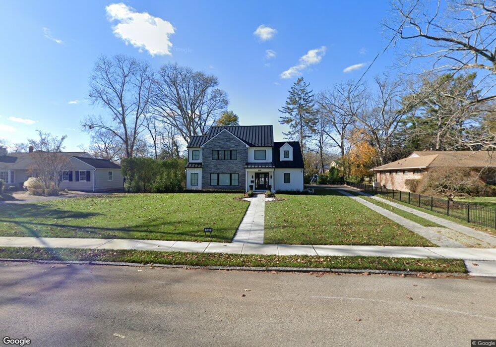
690 Woodgate Ave Long Branch, NJ 07740
Estimated Value: $1,421,000 - $2,260,000
4
Beds
5
Baths
3,711
Sq Ft
$538/Sq Ft
Est. Value
About This Home
This home is located at 690 Woodgate Ave, Long Branch, NJ 07740 and is currently estimated at $1,996,411, approximately $537 per square foot. 690 Woodgate Ave is a home located in Monmouth County with nearby schools including Long Branch High School, Bet Yaakov of the Jersey Shore, and Holy Trinity School.
Ownership History
Date
Name
Owned For
Owner Type
Purchase Details
Closed on
Nov 15, 2016
Sold by
Ellias Samuel J and Ellias Marsha
Bought by
Guindi Jack and Guindi Rochelle
Current Estimated Value
Purchase Details
Closed on
Sep 28, 1995
Sold by
Axelrod Julian
Bought by
Ellias Samuel and Ellias Marsha
Home Financials for this Owner
Home Financials are based on the most recent Mortgage that was taken out on this home.
Original Mortgage
$120,000
Interest Rate
7.86%
Create a Home Valuation Report for This Property
The Home Valuation Report is an in-depth analysis detailing your home's value as well as a comparison with similar homes in the area
Home Values in the Area
Average Home Value in this Area
Purchase History
| Date | Buyer | Sale Price | Title Company |
|---|---|---|---|
| Guindi Jack | $510,000 | -- | |
| Ellias Samuel | $219,000 | -- |
Source: Public Records
Mortgage History
| Date | Status | Borrower | Loan Amount |
|---|---|---|---|
| Previous Owner | Ellias Samuel | $120,000 |
Source: Public Records
Tax History
| Year | Tax Paid | Tax Assessment Tax Assessment Total Assessment is a certain percentage of the fair market value that is determined by local assessors to be the total taxable value of land and additions on the property. | Land | Improvement |
|---|---|---|---|---|
| 2025 | $21,669 | $1,672,900 | $819,600 | $853,300 |
| 2024 | $20,774 | $1,409,800 | $593,600 | $816,200 |
Source: Public Records
Map
Nearby Homes
- 324 Cedar Ave
- 266 Lenox Ave
- 211 Cedar Ave
- 280 Oakley Ave
- 316 Oakley Ave
- 497 Norwood Ave
- 448 Monmouth Place
- 294 Brighton Ave
- 9 Norwood Ct
- 3 Reid St
- 221 Brighton Ave Unit 203
- 19 Clarence Ave
- 552 Westwood Ave
- 20 Clarence Ave
- 65 Cedar Ave Unit D1
- 223 W End Ave
- 279 W End Ave
- 280 Cummings Ave
- 411 Brighton Ave
- 890 Woodgate Ave
- 686 Woodgate Ave
- 700 Woodgate Ave
- 275 Cedar Ave
- 682 Woodgate Ave
- 735 Westwood Ave
- 741 Westwood Ave
- 281 Cedar Ave
- 723 Westwood Ave
- 699 Woodgate Ave
- 685 Woodgate Ave
- 679 Woodgate Ave
- 279 Cedar Ave
- 747 Westwood Ave
- 721 Westwood Ave
- 707 Woodgate Ave
- 719 Westwood Ave
- 665 Woodgate Ave
- 288 Cedar Ave
- 274 Cedar Ave
- 286 Lenox Ave Unit 1
Your Personal Tour Guide
Ask me questions while you tour the home.