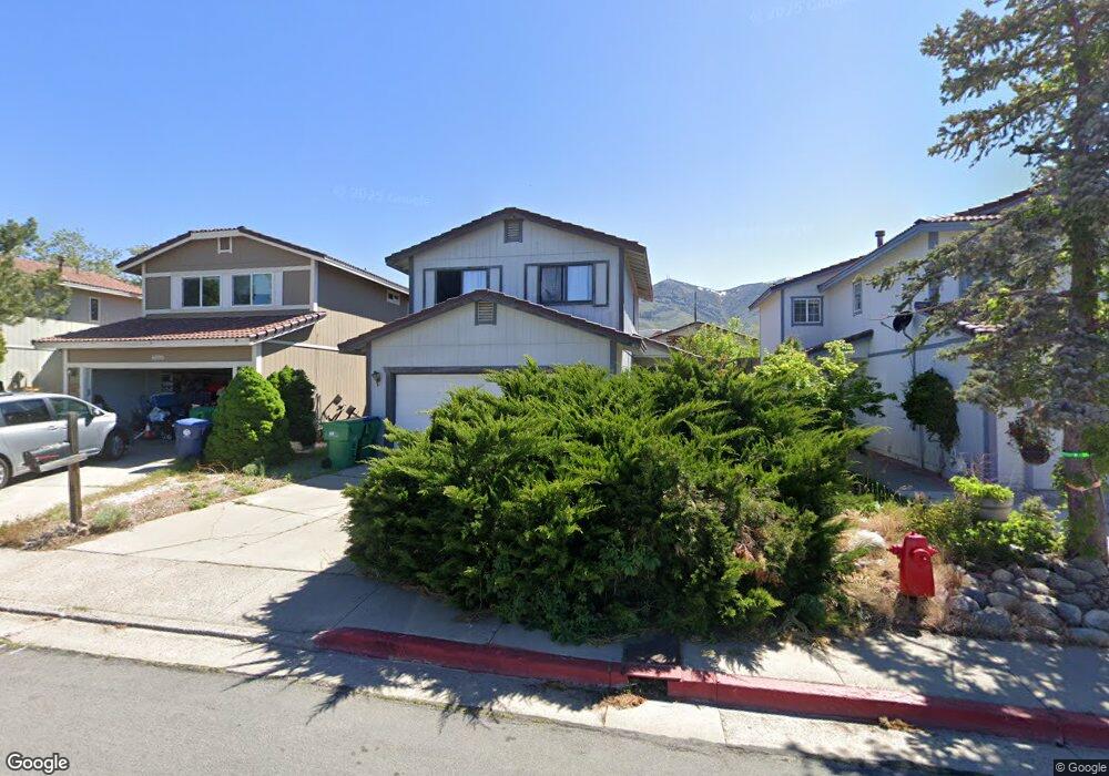
6900 Forsythia Way Reno, NV 89506
Stead NeighborhoodEstimated Value: $380,000 - $402,000
3
Beds
3
Baths
1,388
Sq Ft
$280/Sq Ft
Est. Value
About This Home
This home is located at 6900 Forsythia Way, Reno, NV 89506 and is currently estimated at $388,760, approximately $280 per square foot. 6900 Forsythia Way is a home located in Washoe County with nearby schools including Stead Elementary School, William O'Brien Middle School, and North Valleys High School.
Ownership History
Date
Name
Owned For
Owner Type
Purchase Details
Closed on
Jan 10, 2001
Sold by
Busselman Douglas D
Bought by
Busselman Kimerly A
Current Estimated Value
Home Financials for this Owner
Home Financials are based on the most recent Mortgage that was taken out on this home.
Original Mortgage
$91,000
Interest Rate
7.65%
Create a Home Valuation Report for This Property
The Home Valuation Report is an in-depth analysis detailing your home's value as well as a comparison with similar homes in the area
Home Values in the Area
Average Home Value in this Area
Purchase History
We collect this data history from publicly available records. To have your information removed, we recommend requesting removal directly through your county’s website.
| Date | Buyer | Sale Price | Title Company |
|---|---|---|---|
| Busselman Kimerly A | -- | First Centennial Title Co |
Source: Public Records
Mortgage History
We collect this data history from publicly available records. To have your information removed, we recommend requesting removal directly through your county’s website.
| Date | Status | Borrower | Loan Amount |
|---|---|---|---|
| Closed | Busselman Kimerly A | $91,000 | |
| Closed | Busselman Kimerly A | $16,000 |
Source: Public Records
Tax History
| Year | Tax Paid | Tax Assessment Tax Assessment Total Assessment is a certain percentage of the fair market value that is determined by local assessors to be the total taxable value of land and additions on the property. | Land | Improvement |
|---|---|---|---|---|
| 2026 | $921 | $68,896 | $29,260 | $39,636 |
| 2024 | $1,197 | $69,675 | $28,490 | $41,185 |
| 2023 | $1,163 | $66,779 | $27,475 | $39,304 |
| 2022 | $1,129 | $55,932 | $22,960 | $32,972 |
| 2021 | $1,096 | $51,475 | $18,410 | $33,065 |
| 2020 | $1,063 | $50,891 | $17,570 | $33,321 |
| 2019 | $1,032 | $48,383 | $16,030 | $32,353 |
| 2018 | $1,002 | $43,597 | $11,760 | $31,837 |
| 2017 | $973 | $42,569 | $10,535 | $32,034 |
| 2016 | $948 | $42,259 | $9,415 | $32,844 |
| 2015 | $947 | $40,467 | $7,490 | $32,977 |
| 2014 | $969 | $32,805 | $5,845 | $26,960 |
| 2013 | -- | $24,285 | $3,955 | $20,330 |
Source: Public Records
Map
Nearby Homes
- 6769 Peppermint Ct
- 6905 Peppermint Dr
- 6850 Peppermint Dr
- 6715 Peppermint Dr
- 3720 N Virginia St
- 9906 N Virginia St
- 8620 Winding Creek Dr
- 7497 Hebrides Ct
- 9819 Salty Dog Dr
- 7655 E Key Largo Ct
- 8614 Strutter Way
- 147 Gold Hill Ave
- 11272 Green Mountain St
- 11132 Rocky Mountain St
- 9040 Rising Moon Dr
- 9526 Nautical Mile Rd
- 9190 Brightridge Dr
- 7935 Key Largo Dr
- 7911 Sand Pebble Dr
- 7881 Anchor Point Ct
- 7055 Peppermint Dr
- 7065 Peppermint Dr
- 7045 Peppermint Dr
- 7075 Peppermint Dr
- 7035 Peppermint Dr
- 6934 Forsythia Way
- 6930 Forsythia Way
- 7085 Peppermint Dr
- 6940 Forsythia Way
- 6920 Forsythia Way
- 7025 Peppermint Dr
- 6910 Forsythia Way
- 6942 Forsythia Way
- 7095 Peppermint Dr
- 7015 Peppermint Dr
- 7050 Peppermint Dr
- 7060 Peppermint Dr
- 7040 Peppermint Dr
- 7070 Peppermint Dr
- 7030 Peppermint Dr
Your Personal Tour Guide
Ask me questions while you tour the home.