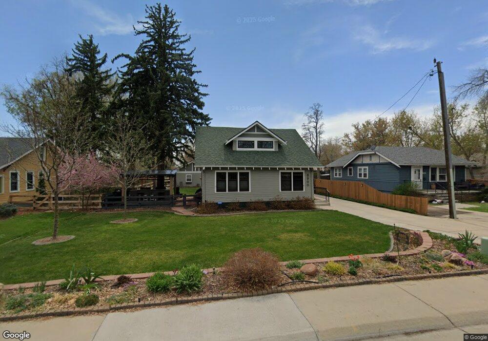
6900 Ralston Rd Arvada, CO 80002
Olde Town Arvada NeighborhoodEstimated Value: $643,981 - $853,000
3
Beds
1
Bath
1,091
Sq Ft
$690/Sq Ft
Est. Value
About This Home
This home is located at 6900 Ralston Rd, Arvada, CO 80002 and is currently estimated at $753,245, approximately $690 per square foot. 6900 Ralston Rd is a home located in Jefferson County with nearby schools including Secrest Elementary School, North Arvada Middle School, and Arvada High School.
Ownership History
Date
Name
Owned For
Owner Type
Purchase Details
Closed on
Jan 26, 2013
Sold by
Williams Neil A
Bought by
Williams Susan R and Williams Neil A
Current Estimated Value
Purchase Details
Closed on
Dec 8, 2010
Sold by
Williams Neil A
Bought by
Williams Susan R and Williams Neil A
Home Financials for this Owner
Home Financials are based on the most recent Mortgage that was taken out on this home.
Original Mortgage
$216,000
Interest Rate
4.18%
Mortgage Type
New Conventional
Purchase Details
Closed on
Aug 4, 1995
Sold by
William Glenda G
Bought by
Williams Neil A
Create a Home Valuation Report for This Property
The Home Valuation Report is an in-depth analysis detailing your home's value as well as a comparison with similar homes in the area
Home Values in the Area
Average Home Value in this Area
Purchase History
| Date | Buyer | Sale Price | Title Company |
|---|---|---|---|
| Williams Susan R | -- | Tiago Title Llc | |
| Williams Susan R | -- | Old Republic Title | |
| Williams Neil A | -- | -- |
Source: Public Records
Mortgage History
| Date | Status | Borrower | Loan Amount |
|---|---|---|---|
| Closed | Williams Susan R | $216,000 |
Source: Public Records
Tax History Compared to Growth
Tax History
| Year | Tax Paid | Tax Assessment Tax Assessment Total Assessment is a certain percentage of the fair market value that is determined by local assessors to be the total taxable value of land and additions on the property. | Land | Improvement |
|---|---|---|---|---|
| 2024 | $3,192 | $39,605 | $21,100 | $18,505 |
| 2023 | $3,192 | $39,605 | $21,100 | $18,505 |
| 2022 | $3,384 | $34,558 | $19,910 | $14,648 |
| 2021 | $3,440 | $35,553 | $20,483 | $15,070 |
| 2020 | $3,008 | $31,175 | $17,034 | $14,141 |
| 2019 | $2,968 | $31,175 | $17,034 | $14,141 |
| 2018 | $2,895 | $29,564 | $14,711 | $14,853 |
| 2017 | $2,650 | $29,564 | $14,711 | $14,853 |
| 2016 | $2,333 | $24,520 | $9,754 | $14,766 |
| 2015 | $2,361 | $24,520 | $9,754 | $14,766 |
| 2014 | $1,906 | $18,830 | $7,105 | $11,725 |
Source: Public Records
Map
Nearby Homes
- 6902 Ralston Rd
- 5815 Pierce St Unit A-H
- 7011 Grandview Ave
- 6855 Reno Dr
- 6780 W 60th Ave Unit H-1
- 6890 W 55th Place
- 5525 Pierce Ct
- 6480 W 60th Ave
- 6990 W 61st Ave
- 5513 Newland Way
- 5495 Saulsbury Ct
- 6700 W 55th Ave
- 5465 Saulsbury Ct
- 7700 Robinson Way
- 5465 Reed Ct
- 7365 W 61st Ave
- 7707 Ralston Rd
- 7801 Grandview Ave
- 6007 Yarrow St Unit D
- 6204 Vance St
- 6810 Ralston Rd
- 6904 Ralston Rd
- 5724 Reed St
- 5720 Reed St
- 6806 Ralston Rd
- 7000 Ralston Rd
- 5718 Reed St
- 7002 Ralston Rd
- 5721 Reed St
- 5716 Reed St
- 6802 Ralston Rd
- 7004 Ralston Rd
- 5815 Pierce St Unit H
- 5815 Pierce St Unit G
- 5815 Pierce St Unit F
- 5815 Pierce St Unit E
- 5815 Pierce St Unit D
- 5815 Pierce St Unit C
- 5815 Pierce St Unit B
- 5815 Pierce St Unit A