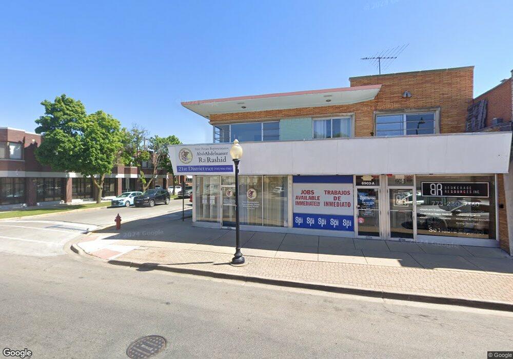
6901 Cermak Rd Berwyn, IL 60402
Estimated Value: $513,309 - $556,000
4
Beds
3
Baths
4,623
Sq Ft
$117/Sq Ft
Est. Value
About This Home
This home is located at 6901 Cermak Rd, Berwyn, IL 60402 and is currently estimated at $541,103, approximately $117 per square foot. 6901 Cermak Rd is a home located in Cook County with nearby schools including Charles E. Piper School, Freedom Middle School, and J Sterling Morton West High School.
Ownership History
Date
Name
Owned For
Owner Type
Purchase Details
Closed on
Jul 10, 2020
Sold by
Pristo Revier Victoria and Pristo Lillian
Bought by
Neil Healey Llc
Current Estimated Value
Home Financials for this Owner
Home Financials are based on the most recent Mortgage that was taken out on this home.
Original Mortgage
$300,000
Interest Rate
2.9%
Mortgage Type
Seller Take Back
Purchase Details
Closed on
Feb 7, 2018
Sold by
Suster Lorraine K
Bought by
Revier Victoria Pristo and Pristo Lillian
Purchase Details
Closed on
Jul 31, 2012
Sold by
Suster Lorraine K
Bought by
The Lorraine K Suster Trust
Purchase Details
Closed on
Apr 23, 2012
Sold by
Suster Lorraine K
Bought by
The Lorraine K Suster Trust
Purchase Details
Closed on
Aug 4, 1998
Sold by
American National Bk & Tr Co Of Chicago
Bought by
Lorraine K Suster Trust and Joseph C Suster Trust
Create a Home Valuation Report for This Property
The Home Valuation Report is an in-depth analysis detailing your home's value as well as a comparison with similar homes in the area
Home Values in the Area
Average Home Value in this Area
Purchase History
| Date | Buyer | Sale Price | Title Company |
|---|---|---|---|
| Neil Healey Llc | $375,000 | First American Title | |
| Revier Victoria Pristo | -- | Attorney | |
| The Lorraine K Suster Trust | -- | None Available | |
| The Lorraine K Suster Trust | -- | None Available | |
| Lorraine K Suster Trust | -- | -- |
Source: Public Records
Mortgage History
| Date | Status | Borrower | Loan Amount |
|---|---|---|---|
| Previous Owner | Neil Healey Llc | $300,000 |
Source: Public Records
Tax History Compared to Growth
Tax History
| Year | Tax Paid | Tax Assessment Tax Assessment Total Assessment is a certain percentage of the fair market value that is determined by local assessors to be the total taxable value of land and additions on the property. | Land | Improvement |
|---|---|---|---|---|
| 2024 | $14,399 | $40,278 | $6,077 | $34,201 |
| 2023 | $15,889 | $40,278 | $6,077 | $34,201 |
| 2022 | $15,889 | $34,966 | $5,333 | $29,633 |
| 2021 | $15,414 | $34,966 | $5,333 | $29,633 |
| 2020 | $8,005 | $19,215 | $5,333 | $13,882 |
| 2019 | $14,420 | $31,996 | $4,836 | $27,160 |
| 2018 | $13,574 | $31,996 | $4,836 | $27,160 |
| 2017 | $7,996 | $18,416 | $4,836 | $13,580 |
| 2016 | $9,762 | $22,510 | $3,968 | $18,542 |
| 2015 | $7,658 | $22,510 | $3,968 | $18,542 |
| 2014 | $7,424 | $22,510 | $3,968 | $18,542 |
| 2013 | $10,687 | $29,313 | $3,968 | $25,345 |
Source: Public Records
Map
Nearby Homes
- 2212 Grove Ave
- 2115 Kenilworth Ave
- 2221 Home Ave
- 1916 Kenilworth Ave
- 2125 Euclid Ave
- 2336 Oak Park Ave
- 2402 Clinton Ave
- 1835 Home Ave
- 2436 Grove Ave
- 1833 Oak Park Ave
- 1819 Kenilworth Ave
- 2418 Wesley Ave
- 2508 Kenilworth Ave
- 1648 Kenilworth Ave
- 1932 East Ave
- 2517 Clinton Ave
- 2107 East Ave
- 2302 Scoville Ave
- 2442 Clarence Ave
- 6921 26th St
- 6901 Cermak Rd Unit B
- 6901 Cermak Rd Unit CORNER
- 6903 Cermak Rd Unit B
- 6903A W Cermak Rd Unit A
- 6905 Cermak Rd
- 6905 Cermak Rd Unit A
- 6905 Cermak Rd Unit 2E
- 6847 Cermak Rd
- 2212 Kenilworth Ave
- 6843 Cermak Rd Unit 1
- 6843 Cermak Rd
- 2216 Kenilworth Ave
- 6841 Cermak Rd
- 6841 Cermak Rd Unit 6
- 6841 Cermak Rd Unit 3
- 6841 Cermak Rd Unit 12
- 6919 Cermak Rd Unit 2
- 6919 Cermak Rd
- 6915 Cermak Rd
- 2213 Kenilworth Ave