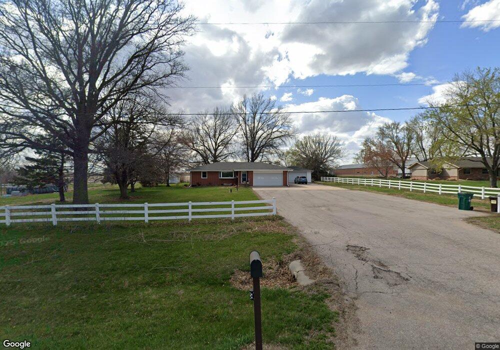
6901 SW 12th St Lincoln, NE 68523
Southwest Lincoln NeighborhoodEstimated Value: $556,980 - $651,000
3
Beds
2
Baths
2,494
Sq Ft
$246/Sq Ft
Est. Value
About This Home
This home is located at 6901 SW 12th St, Lincoln, NE 68523 and is currently estimated at $613,245, approximately $245 per square foot. 6901 SW 12th St is a home located in Lancaster County with nearby schools including Adams Elementary School, Scott Middle School, and Southwest High School.
Ownership History
Date
Name
Owned For
Owner Type
Purchase Details
Closed on
Jun 9, 2011
Sold by
Pester Donald L and Pester Esther L
Bought by
Bittle Charles H and Bittle Shandy E
Current Estimated Value
Home Financials for this Owner
Home Financials are based on the most recent Mortgage that was taken out on this home.
Original Mortgage
$238,789
Outstanding Balance
$161,993
Interest Rate
4.37%
Mortgage Type
FHA
Estimated Equity
$451,252
Purchase Details
Closed on
Mar 18, 2005
Sold by
Pester Donald L and Pester Esther L
Bought by
County Of Lancaster
Create a Home Valuation Report for This Property
The Home Valuation Report is an in-depth analysis detailing your home's value as well as a comparison with similar homes in the area
Home Values in the Area
Average Home Value in this Area
Purchase History
| Date | Buyer | Sale Price | Title Company |
|---|---|---|---|
| Bittle Charles H | $245,000 | Nltal | |
| County Of Lancaster | -- | -- |
Source: Public Records
Mortgage History
| Date | Status | Borrower | Loan Amount |
|---|---|---|---|
| Open | Bittle Charles H | $238,789 |
Source: Public Records
Tax History Compared to Growth
Tax History
| Year | Tax Paid | Tax Assessment Tax Assessment Total Assessment is a certain percentage of the fair market value that is determined by local assessors to be the total taxable value of land and additions on the property. | Land | Improvement |
|---|---|---|---|---|
| 2025 | $4,774 | $453,600 | $132,400 | $321,200 |
| 2024 | $4,774 | $432,200 | $132,400 | $299,800 |
| 2023 | $5,893 | $419,600 | $132,400 | $287,200 |
| 2022 | $5,463 | $318,600 | $100,000 | $218,600 |
| 2021 | $5,120 | $318,600 | $100,000 | $218,600 |
| 2020 | $4,461 | $271,500 | $90,000 | $181,500 |
| 2019 | $4,491 | $271,500 | $90,000 | $181,500 |
| 2018 | $4,465 | $268,200 | $85,000 | $183,200 |
| 2017 | $4,506 | $268,200 | $85,000 | $183,200 |
| 2016 | $3,657 | $218,000 | $60,000 | $158,000 |
| 2015 | $3,663 | $218,000 | $60,000 | $158,000 |
| 2014 | $4,078 | $239,600 | $55,000 | $184,600 |
| 2013 | -- | $239,600 | $55,000 | $184,600 |
Source: Public Records
Map
Nearby Homes
- 6700 SW 16th St
- 845 W Arezzo Ct
- 5800 SW Catalina St
- 6531 Via Sorrento Dr
- 1060 W Panorama Rd
- 1301 W Cademon Cir
- 1319 W Cademon Cir
- 6352 SW 8th St
- 945 W Santa Clara St
- 927 W Santa Clara St
- 955 W El Alameda St
- 1001 W El Alameda St
- Vail Plan at Southwest Village Heights
- Breckenridge Plan at Southwest Village Heights
- Ava Nicole 1625 Plan at Southwest Village Heights
- Nantucket II Plan at Southwest Village Heights
- Inca Plan at Southwest Village Heights
- Ava Nicole 1546 Plan at Southwest Village Heights
- Vista II Plan at Southwest Village Heights
- Kendrick Plan at Southwest Village Heights
- 0 SW 12th & W Denton Rd Unit 10113741
- 0 SW 12th & W Denton Rd Unit 10122106
- 0 SW 12th & W Denton Rd Unit 10122105
- 6905 SW 12th St
- 6821 SW 12th St
- 1100 Gailyn Cir
- 7101 SW 12th St
- 1033 Gailyn Cir
- 6900 SW 12th St
- 1030 Gailyn Cir
- 1400 W Denton Rd
- 955 Gailyn Cir
- 1401 Westridge Rd
- 950 Gailyn Cir
- 6501 SW 12th St
- 1501 Westridge Rd
- 6900 SW 16th St
- 6801 SW 9th St
- 1560 Westridge Rd
- 1600 W Denton Rd