Estimated Value: $277,000 - $318,000
2
Beds
2
Baths
1,975
Sq Ft
$148/Sq Ft
Est. Value
About This Home
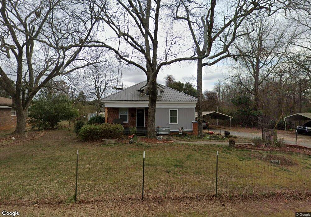
This home is located at 6902 Nowhere Rd, Hull, GA 30646 and is currently estimated at $293,040, approximately $148 per square foot. 6902 Nowhere Rd is a home located in Madison County with nearby schools including Madison County High School.
Ownership History
Date
Name
Owned For
Owner Type
Purchase Details
Closed on
Jul 31, 2003
Sold by
Spratlin Shirley Barber
Bought by
Dover Kenneth H and Dover Lisa J
Current Estimated Value
Purchase Details
Closed on
Mar 3, 2003
Sold by
Spratlin Shirley Bar
Bought by
Spratlin Shirley Barber
Purchase Details
Closed on
May 21, 1998
Sold by
Massey Katie B
Bought by
Spratlin Shirley Bar
Purchase Details
Closed on
Jan 1, 1973
Bought by
Massey Katie B
Create a Home Valuation Report for This Property
The Home Valuation Report is an in-depth analysis detailing your home's value as well as a comparison with similar homes in the area
Purchase History
| Date | Buyer | Sale Price | Title Company |
|---|---|---|---|
| Dover Kenneth H | $87,500 | -- | |
| Spratlin Shirley Barber | -- | -- | |
| Spratlin Shirley Bar | -- | -- | |
| Massey Katie B | -- | -- |
Source: Public Records
Tax History
| Year | Tax Paid | Tax Assessment Tax Assessment Total Assessment is a certain percentage of the fair market value that is determined by local assessors to be the total taxable value of land and additions on the property. | Land | Improvement |
|---|---|---|---|---|
| 2025 | $1,986 | $80,147 | $14,246 | $65,901 |
| 2024 | $19 | $78,110 | $14,246 | $63,864 |
| 2023 | $2,188 | $71,663 | $11,872 | $59,791 |
| 2022 | $1,630 | $61,092 | $8,162 | $52,930 |
| 2021 | $1,439 | $49,148 | $8,162 | $40,986 |
| 2020 | $1,413 | $47,961 | $6,975 | $40,986 |
| 2019 | $791 | $27,443 | $6,975 | $20,468 |
| 2018 | $746 | $25,932 | $6,381 | $19,551 |
| 2017 | $736 | $25,576 | $5,936 | $19,640 |
| 2016 | $568 | $21,796 | $5,400 | $16,396 |
| 2015 | $568 | $21,796 | $5,400 | $16,396 |
| 2014 | $585 | $22,230 | $5,616 | $16,614 |
| 2013 | -- | $22,230 | $5,616 | $16,614 |
Source: Public Records
Map
Nearby Homes
- 310 Sawdust Rd
- 0 Crabapple Hollow Rd Unit TRACT 2
- 357 Carither Rd
- 284 Snow Farm Rd
- 1246 Stone Stewart Rd
- 832 Stone Stewart Rd
- 0 Stone Stewart Rd Unit 7519457
- 0 Stone Stewart Rd Unit 10452697
- 0 Stone Stewart Rd Unit 1023553
- 25 Rose Hill Ln
- 1067 Garnett Ward Rd Unit 2
- 0 Nowhere Ln Unit 10544151
- 450 Candlestick Dr
- 9980 Nowhere Rd
- 140 Kimberly Way
- 103 Three Rivers Ct
- 9 Cooper Farm Rd
- 7 Cooper Farm Rd
- 975 Diamond Hill Neese Rd
- 65 Kimberly Way
- 6930 Nowhere Rd
- 3553 Seagraves Mill Rd
- 7016 Nowhere Rd
- 6770 Nowhere Rd
- 7015 Nowhere Rd
- 7041 Nowhere Rd
- 2831 Sanford Rd
- 7078 Nowhere Rd
- 7077 Nowhere Rd
- 6658 Nowhere Rd
- 161 Dillard Rd
- 6656 Nowhere Rd
- 190 Sawdust Rd
- 3433 Seagraves Mill Rd
- 7171 Nowhere Rd
- 1524 Martin Griffeth Rd
- 7191 Nowhere Rd
- 6655 Nowhere Rd
- 299 Sawdust Rd
- 2567 Sanford Rd
Your Personal Tour Guide
Ask me questions while you tour the home.