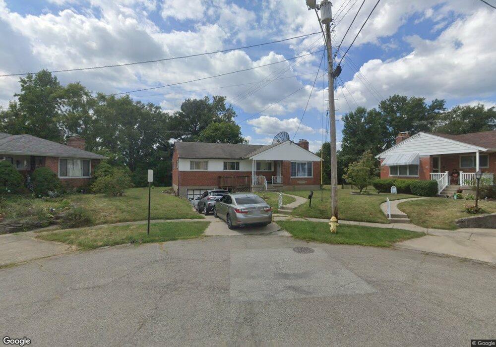
6902 Terrylynn Ln Cincinnati, OH 45239
Estimated Value: $203,000 - $224,751
4
Beds
2
Baths
1,849
Sq Ft
$114/Sq Ft
Est. Value
About This Home
This home is located at 6902 Terrylynn Ln, Cincinnati, OH 45239 and is currently estimated at $211,188, approximately $114 per square foot. 6902 Terrylynn Ln is a home located in Hamilton County with nearby schools including North College Hill Elementary School, North College Hill Middle School, and North College Hill High School.
Ownership History
Date
Name
Owned For
Owner Type
Purchase Details
Closed on
Mar 19, 2009
Sold by
Waiga Bakary
Bought by
Waiga Bakary and Waiga Aichetou
Current Estimated Value
Home Financials for this Owner
Home Financials are based on the most recent Mortgage that was taken out on this home.
Original Mortgage
$110,042
Outstanding Balance
$69,024
Interest Rate
5.2%
Mortgage Type
FHA
Estimated Equity
$142,164
Purchase Details
Closed on
Oct 22, 1997
Sold by
Peters Norbert N
Bought by
Peters Norbert N and Peters Agnes
Create a Home Valuation Report for This Property
The Home Valuation Report is an in-depth analysis detailing your home's value as well as a comparison with similar homes in the area
Home Values in the Area
Average Home Value in this Area
Purchase History
| Date | Buyer | Sale Price | Title Company |
|---|---|---|---|
| Waiga Bakary | -- | Attorney | |
| Peters Norbert N | -- | -- |
Source: Public Records
Mortgage History
| Date | Status | Borrower | Loan Amount |
|---|---|---|---|
| Open | Waiga Bakary | $110,042 |
Source: Public Records
Tax History
| Year | Tax Paid | Tax Assessment Tax Assessment Total Assessment is a certain percentage of the fair market value that is determined by local assessors to be the total taxable value of land and additions on the property. | Land | Improvement |
|---|---|---|---|---|
| 2025 | $3,249 | $57,950 | $10,815 | $47,135 |
| 2024 | $3,159 | $57,950 | $10,815 | $47,135 |
| 2023 | $2,992 | $57,950 | $10,815 | $47,135 |
| 2022 | $2,774 | $39,109 | $9,114 | $29,995 |
| 2021 | $2,704 | $39,109 | $9,114 | $29,995 |
| 2020 | $2,744 | $39,109 | $9,114 | $29,995 |
| 2019 | $2,458 | $33,146 | $7,725 | $25,421 |
| 2018 | $2,459 | $33,146 | $7,725 | $25,421 |
| 2017 | $2,320 | $33,146 | $7,725 | $25,421 |
| 2016 | $2,101 | $29,793 | $7,620 | $22,173 |
| 2015 | $2,113 | $29,793 | $7,620 | $22,173 |
| 2014 | $2,113 | $29,793 | $7,620 | $22,173 |
| 2013 | $2,336 | $34,244 | $8,757 | $25,487 |
Source: Public Records
Map
Nearby Homes
- 2391 Deblin Dr
- 2424 Banning Rd
- 2405 Amelia Ct
- 2342 Banning Rd
- 2268 Deblin Dr
- 2427 Crosley Meadow
- 2031 Emerson Ave
- 2125 Mckinley Ave
- 7170 Longwood Ct
- 2503 Flanigan Ct
- 2757 Banning Rd
- 2027 Sundale Ave
- 2048 4th Ave
- 1936 Cordova Ave
- 2806 Breezy Way
- 2820 Geraldine Dr
- 2836 Banning Rd
- 1938 Waltham Ave
- 2801 Byrneside Dr
- 2680 Royal Glen Dr
- 6909 Terrylynn Ln
- 6910 Terrylynn Ln
- 6952 Kellway Ct
- 6948 Kellway Ct
- 6956 Kellway Ct
- 6921 Terrylynn Ln
- 6916 Terrylynn Ln
- 6922 Terrylynn Ln
- 6807 Kenbyrne Ct
- 6929 Terrylynn Ln
- 2331 Deblin Dr
- 2293 Deblin Dr
- 2321 Deblin Dr
- 2295 Deblin Dr
- 6815 Kenbyrne Ct
- 6949 Kellway Ct
- 2311 Deblin Dr
- 2351 Deblin Dr
- 2289 Deblin Dr
- 6928 Terrylynn Ln
Your Personal Tour Guide
Ask me questions while you tour the home.