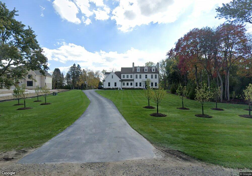
6903 Colby Ln Unit Bldg-Unit Bloomfield Hills, MI 48301
Estimated Value: $1,022,000 - $2,527,000
4
Beds
6
Baths
4,786
Sq Ft
$404/Sq Ft
Est. Value
About This Home
This home is located at 6903 Colby Ln Unit Bldg-Unit, Bloomfield Hills, MI 48301 and is currently estimated at $1,932,919, approximately $403 per square foot. 6903 Colby Ln Unit Bldg-Unit is a home located in Oakland County with nearby schools including Conant Elementary School, South Hills Middle School, and Bloomfield Hills High School.
Ownership History
Date
Name
Owned For
Owner Type
Purchase Details
Closed on
Nov 15, 2019
Sold by
Mcdonald Adam and Mcdonald Erin
Bought by
Matthews John David and Matthews Colleen Marie
Current Estimated Value
Purchase Details
Closed on
Dec 29, 2017
Sold by
Spruce Hill Associates Llc
Bought by
Mcdonald Adam and Mcdonald Erin
Create a Home Valuation Report for This Property
The Home Valuation Report is an in-depth analysis detailing your home's value as well as a comparison with similar homes in the area
Home Values in the Area
Average Home Value in this Area
Purchase History
| Date | Buyer | Sale Price | Title Company |
|---|---|---|---|
| Matthews John David | $1,735,000 | Title Express Llc | |
| Mcdonald Adam | -- | None Available |
Source: Public Records
Tax History Compared to Growth
Tax History
| Year | Tax Paid | Tax Assessment Tax Assessment Total Assessment is a certain percentage of the fair market value that is determined by local assessors to be the total taxable value of land and additions on the property. | Land | Improvement |
|---|---|---|---|---|
| 2024 | $15,409 | $872,620 | $0 | $0 |
| 2023 | $14,888 | $834,730 | $0 | $0 |
| 2022 | $27,977 | $812,220 | $0 | $0 |
| 2021 | $27,776 | $803,510 | $0 | $0 |
| 2020 | $15,942 | $648,840 | $0 | $0 |
| 2019 | $12,029 | $247,270 | $0 | $0 |
| 2018 | $6,233 | $127,620 | $0 | $0 |
| 2017 | $3,917 | $127,620 | $0 | $0 |
| 2016 | $3,905 | $127,620 | $0 | $0 |
| 2015 | -- | $122,690 | $0 | $0 |
| 2014 | -- | $109,070 | $0 | $0 |
| 2011 | -- | $76,400 | $0 | $0 |
Source: Public Records
Map
Nearby Homes
- 7100 Wing Lake Rd
- 6750 Wing Lake Rd
- 7005 Cathedral Dr
- 4428 Old Trinity Ct
- 7303 Brookside Village Ct
- 6572 Spruce Dr
- 6660 Woodbank Dr
- 6952 Sandalwood Dr
- 7200 Telegraph Rd
- 6701 Franklin Rd
- 4456 W Maple Rd
- 4200 Surrey Cross
- 32890 Whatley Rd
- 25690 W 14 Mile Rd
- 7310 Sandy Creek Ln
- 6720 Castle Dr
- 750 Trailwood Path Unit B
- 450 Billingsgate Ct Unit C
- 1760 Trailwood Path
- 4017 Hidden Woods Dr
- 6903 Colby Ln
- 6975 Wing Lake Rd
- 6873 Colby Ln
- 6962 Spruce Hill Ct
- 6961 Spruce Hill Ct
- 6905 Wing Lake Rd
- 6855 Colby Ln
- 6970 Wing Lake Rd
- 6980 Wing Lake Rd
- 6967 Spruce Hill Ct
- 6870 Colby Ln Unit Bldg-Unit
- 6870 Colby Ln
- 6867 Wing Lake Rd
- 4352 Spruce Hill Ln
- 4360 Spruce Hill Ln
- 4312 Spruce Hill Ln
- 6940 Wing Lake Rd
- 4381 Chisholm Trail
- 6914 Wing Lake Rd
- 4344 Spruce Hill Ln