Estimated Value: $251,000 - $466,000
Studio
2
Baths
2,981
Sq Ft
$126/Sq Ft
Est. Value
About This Home
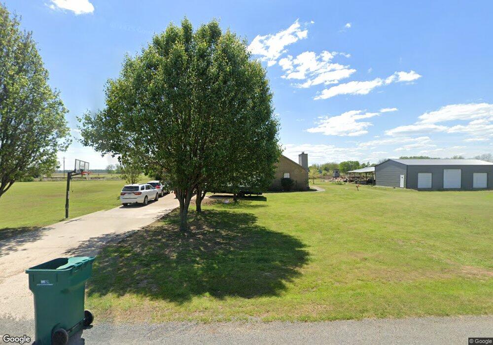
This home is located at 6903 Highway 161 S, Scott, AR 72142 and is currently estimated at $374,632, approximately $125 per square foot. 6903 Highway 161 S is a home located in Pulaski County with nearby schools including Harris Elementary School, Mills University Studies High School, and Scott Charter School.
Ownership History
Date
Name
Owned For
Owner Type
Purchase Details
Closed on
Nov 25, 2011
Sold by
Secretary Of Housing & Urban Development
Bought by
Martin Curtis and Martin Mindi
Current Estimated Value
Home Financials for this Owner
Home Financials are based on the most recent Mortgage that was taken out on this home.
Original Mortgage
$144,365
Outstanding Balance
$97,151
Interest Rate
3.75%
Mortgage Type
FHA
Estimated Equity
$277,481
Purchase Details
Closed on
Mar 29, 2011
Sold by
Gulley Grady R and Gulley Cynthia R
Bought by
Wells Fargo Bank Na
Purchase Details
Closed on
Feb 8, 2011
Sold by
Wells Fargo Bank Na
Bought by
The Secretary Of Housing & Urban Develop
Purchase Details
Closed on
Jan 13, 2005
Sold by
Birts Denia
Bought by
Gulley Grady R and Gulley Cynthia R
Home Financials for this Owner
Home Financials are based on the most recent Mortgage that was taken out on this home.
Original Mortgage
$172,632
Interest Rate
5.8%
Mortgage Type
FHA
Purchase Details
Closed on
Jan 14, 1998
Sold by
Cenark Homes Inc
Bought by
Birts Marion A
Home Financials for this Owner
Home Financials are based on the most recent Mortgage that was taken out on this home.
Original Mortgage
$160,875
Interest Rate
7.25%
Mortgage Type
VA
Purchase Details
Closed on
Jan 29, 1997
Sold by
Birts Marion Alvin and Birts Edna M
Bought by
Cenark Homes Inc
Create a Home Valuation Report for This Property
The Home Valuation Report is an in-depth analysis detailing your home's value as well as a comparison with similar homes in the area
Home Values in the Area
Average Home Value in this Area
Purchase History
| Date | Buyer | Sale Price | Title Company |
|---|---|---|---|
| Martin Curtis | -- | Professional Land Title Comp | |
| Wells Fargo Bank Na | $191,537 | None Available | |
| The Secretary Of Housing & Urban Develop | -- | None Available | |
| Gulley Grady R | $142,000 | American Abstract & Title Co | |
| Birts Marion A | $196,000 | American Abstract & Title Co | |
| Cenark Homes Inc | -- | American Abstract & Title Co | |
| Birts Marion Alvin | $25,000 | American Abstract & Title Co |
Source: Public Records
Mortgage History
| Date | Status | Borrower | Loan Amount |
|---|---|---|---|
| Open | Martin Curtis | $144,365 | |
| Previous Owner | Gulley Grady R | $172,632 | |
| Previous Owner | Birts Marion A | $160,875 |
Source: Public Records
Tax History
| Year | Tax Paid | Tax Assessment Tax Assessment Total Assessment is a certain percentage of the fair market value that is determined by local assessors to be the total taxable value of land and additions on the property. | Land | Improvement |
|---|---|---|---|---|
| 2025 | $2,945 | $70,937 | $11,256 | $59,681 |
| 2024 | $2,700 | $70,937 | $11,256 | $59,681 |
| 2023 | $2,700 | $70,937 | $11,256 | $59,681 |
| 2022 | $2,897 | $70,937 | $11,256 | $59,681 |
| 2021 | $2,674 | $48,300 | $6,570 | $41,730 |
| 2020 | $2,454 | $48,300 | $6,570 | $41,730 |
| 2019 | $2,289 | $48,300 | $6,570 | $41,730 |
| 2018 | $2,314 | $48,300 | $6,570 | $41,730 |
| 2017 | $2,314 | $48,300 | $6,570 | $41,730 |
| 2016 | $2,303 | $48,100 | $6,570 | $41,530 |
| 2015 | -- | $48,100 | $6,570 | $41,530 |
| 2014 | -- | $48,100 | $6,570 | $41,530 |
Source: Public Records
Map
Nearby Homes
- 00 Upper Steel Bend Rd
- 14420 Upper Steel Bend Rd
- 13423 Smarty Jones Dr
- 13129 Smarty Jones Dr
- 13319 Smarty Jones Dr
- 13203 Old River Dr
- 12904 Smarty Jones Dr
- 13118 Old River Dr
- 0 Colonel Maynard Rd Unit 26005250
- 0 Colonel Maynard Rd Unit 26005254
- 0 Colonel Maynard Rd Unit 26005249
- 0 Colonel Maynard Rd Unit 26005251
- 0 Colonel Maynard Rd Unit 26005253
- 0 Colonel Maynard Rd Unit 26005252
- 10642 Hwy 165 W
- 53 Planters Row
- 000 Planters Row
- 00 Planters Row
- XX Colonel Maynard Rd
- 0 Hwy 161 S Unit 26001033
- 3017 Highway 161 S
- 1303 Walkers Corner Rd S
- 15100 Upper Steel Bend Rd
- 7211 Highway 161 S
- 7201 Highway 161 S
- 6914 Pecan Rd
- 6902 Pecan Rd
- 7110 Pecan Rd
- 6901 Pecan Rd
- 7001 Pecan Rd
- 7101 Pecan Rd
- 7311 Highway 161 S
- 7225 Pecan Rd
- 0 Pecan Unit 16016225
- 0 Pecan Unit 17010702
- 14606 Upper Steel Bend Rd
- 7229 Pecan Rd
- 14909 Old River Dr
- 14815 Old River Dr
- 14921 Old River Dr
Your Personal Tour Guide
Ask me questions while you tour the home.