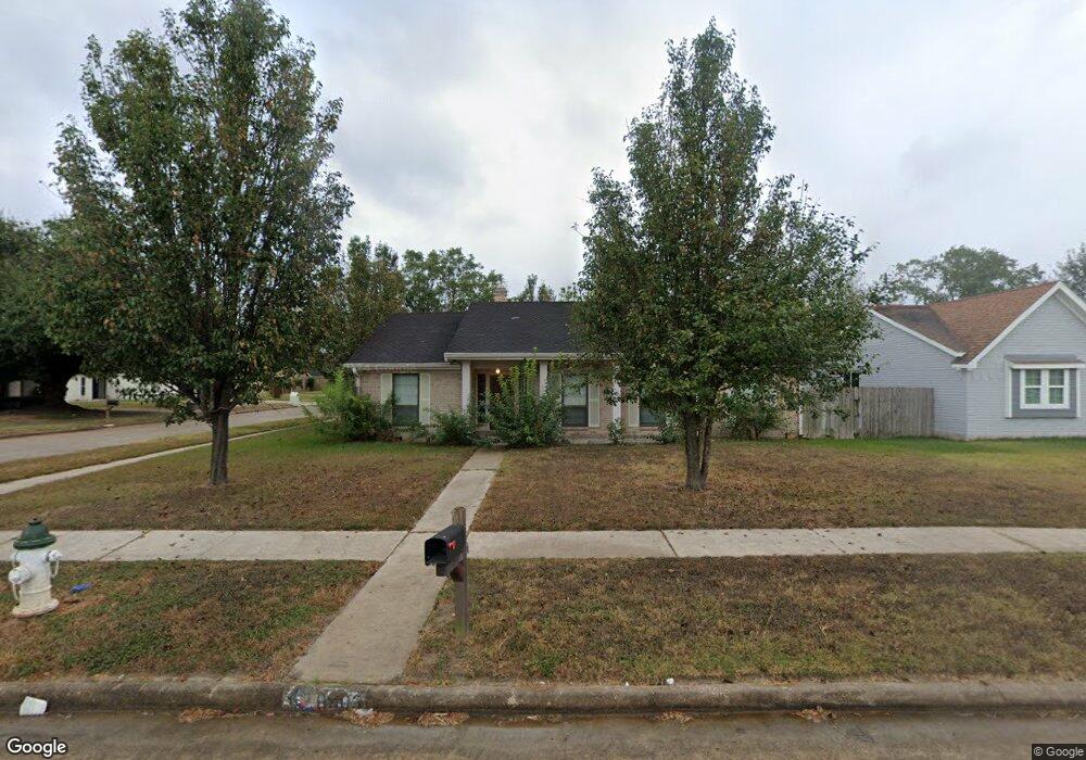
6903 Northleaf Dr Houston, TX 77086
North Houston NeighborhoodEstimated Value: $226,943 - $250,000
3
Beds
2
Baths
1,862
Sq Ft
$129/Sq Ft
Est. Value
About This Home
This home is located at 6903 Northleaf Dr, Houston, TX 77086 and is currently estimated at $240,986, approximately $129 per square foot. 6903 Northleaf Dr is a home located in Harris County with nearby schools including Kujawa EC/Pre-K/K School, Carmichael Elementary School, and Shotwell Middle School.
Ownership History
Date
Name
Owned For
Owner Type
Purchase Details
Closed on
Aug 11, 2021
Sold by
Snell Robert Lee and Jackson Patricia D
Bought by
Rivera Ann
Current Estimated Value
Purchase Details
Closed on
Dec 9, 2013
Sold by
Coquyt Francis Joseph
Bought by
Snell Robert Lee and Jackson Patricia D
Home Financials for this Owner
Home Financials are based on the most recent Mortgage that was taken out on this home.
Original Mortgage
$103,098
Interest Rate
4.25%
Mortgage Type
FHA
Create a Home Valuation Report for This Property
The Home Valuation Report is an in-depth analysis detailing your home's value as well as a comparison with similar homes in the area
Home Values in the Area
Average Home Value in this Area
Purchase History
| Date | Buyer | Sale Price | Title Company |
|---|---|---|---|
| Rivera Ann | $158,000 | Alaw Texas Title Documents | |
| Snell Robert Lee | -- | None Available |
Source: Public Records
Mortgage History
| Date | Status | Borrower | Loan Amount |
|---|---|---|---|
| Previous Owner | Snell Robert Lee | $103,098 |
Source: Public Records
Tax History Compared to Growth
Tax History
| Year | Tax Paid | Tax Assessment Tax Assessment Total Assessment is a certain percentage of the fair market value that is determined by local assessors to be the total taxable value of land and additions on the property. | Land | Improvement |
|---|---|---|---|---|
| 2025 | $5,597 | $270,000 | $40,209 | $229,791 |
| 2024 | $5,597 | $242,000 | $40,209 | $201,791 |
| 2023 | $5,597 | $325,947 | $40,209 | $285,738 |
| 2022 | $6,058 | $248,871 | $34,075 | $214,796 |
| 2021 | $5,421 | $223,220 | $34,075 | $189,145 |
| 2020 | $5,598 | $207,345 | $34,075 | $173,270 |
| 2019 | $5,827 | $207,584 | $17,358 | $190,226 |
| 2018 | $2,803 | $195,191 | $17,358 | $177,833 |
| 2017 | $4,938 | $182,445 | $15,587 | $166,858 |
| 2016 | $3,710 | $163,934 | $15,587 | $148,347 |
| 2015 | $3,070 | $153,469 | $15,587 | $137,882 |
| 2014 | $3,070 | $113,285 | $15,587 | $97,698 |
Source: Public Records
Map
Nearby Homes
- 6654 Brownie Campbell Rd
- 6722 Winding Trace Dr
- 11007 Tobasa Ct
- 11006 Crinkleawn Dr
- 6630 Brownie Campbell Rd
- 7002 Sandswept Ln
- 6610 Northleaf Dr
- 11021 Crenchrus Ct
- 11009 Panicum Ct
- 7023 Sandswept Ln
- 7218 Winding Trace Dr
- 6615 Winding Trace Dr
- 7222 Northleaf Dr
- 10522 Northview Dr
- 6911 Silver Star Dr
- 7227 Greenyard Dr
- 10614 Mackenzie Dr
- 6502 Trail Valley Way
- 10711 Heather Hill Dr
- 10307 Bammel North Houston Rd
- 6907 Northleaf Dr
- 6911 Northleaf Dr
- 10806 Misty Summit Dr
- 10810 Misty Summit Dr
- 10802 Misty Summit Dr
- 10711 Misty Summit Dr
- 6902 Northleaf Dr
- 6915 Northleaf Dr
- 6906 Northleaf Dr
- 10902 Misty Summit Dr
- 6910 Canyon Way Dr
- 10714 Misty Summit Dr
- 6914 Canyon Way Dr
- 6910 Northleaf Dr
- 10906 Misty Summit Dr
- 6919 Northleaf Dr
- 10707 Misty Summit Dr
- 10811 Coralstone Rd
- 10710 Misty Summit Dr
- 6914 Northleaf Dr