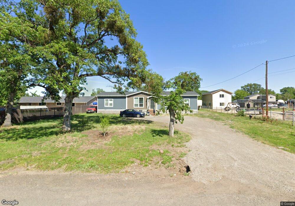
6904 Pinehurst St Central Point, OR 97502
Estimated Value: $257,416
2
Beds
1
Bath
1,276
Sq Ft
$202/Sq Ft
Est. Value
About This Home
This home is located at 6904 Pinehurst St, Central Point, OR 97502 and is currently priced at $257,416, approximately $201 per square foot. 6904 Pinehurst St is a home located in Jackson County with nearby schools including Sams Valley Elementary School, Scenic Middle School, and Crater High School.
Ownership History
Date
Name
Owned For
Owner Type
Purchase Details
Closed on
Jan 14, 2022
Sold by
Corbett Denise C
Bought by
Mitchell Travis J and Hall Erin L
Current Estimated Value
Purchase Details
Closed on
Mar 25, 2005
Sold by
Buchwald Matthew J and Buchwald Denise C
Bought by
Buchwald Denise C
Home Financials for this Owner
Home Financials are based on the most recent Mortgage that was taken out on this home.
Original Mortgage
$115,000
Interest Rate
5.6%
Mortgage Type
New Conventional
Create a Home Valuation Report for This Property
The Home Valuation Report is an in-depth analysis detailing your home's value as well as a comparison with similar homes in the area
Purchase History
| Date | Buyer | Sale Price | Title Company |
|---|---|---|---|
| Mitchell Travis J | $107,000 | Accommodation/Courtesy Recordi | |
| Buchwald Denise C | -- | Lawyers Title Ins |
Source: Public Records
Mortgage History
| Date | Status | Borrower | Loan Amount |
|---|---|---|---|
| Previous Owner | Buchwald Denise C | $115,000 |
Source: Public Records
Tax History
| Year | Tax Paid | Tax Assessment Tax Assessment Total Assessment is a certain percentage of the fair market value that is determined by local assessors to be the total taxable value of land and additions on the property. | Land | Improvement |
|---|---|---|---|---|
| 2026 | $2,239 | $138,510 | -- | -- |
| 2025 | $1,533 | $134,480 | $134,480 | -- |
| 2024 | $1,533 | $123,860 | $123,860 | -- |
| 2023 | $1,604 | $121,980 | $121,980 | $0 |
| 2022 | $1,606 | $129,310 | $129,310 | $0 |
| 2021 | $1,783 | $134,480 | $67,510 | $66,970 |
| 2020 | $1,927 | $130,570 | $65,540 | $65,030 |
| 2019 | $1,903 | $123,080 | $61,770 | $61,310 |
| 2018 | $1,785 | $111,000 | $73,050 | $37,950 |
| 2017 | $1,507 | $111,000 | $73,050 | $37,950 |
| 2016 | $1,489 | $116,020 | $58,220 | $57,800 |
| 2015 | $1,420 | $116,020 | $58,220 | $57,800 |
| 2014 | $1,386 | $109,370 | $54,880 | $54,490 |
Source: Public Records
Map
Nearby Homes
- 380 W Gregory Rd Unit 1
- 594 W Gregory Rd
- 6850 Downing Rd Unit 11
- 6850 Downing Rd Unit SPC 31
- 6850 Downing Rd Unit 7
- 6850 Downing Rd Unit 25
- 6850 Downing Rd Unit 65
- 1729 E Gregory Rd
- 225 Wilson Rd
- 1917 Bobcat Way
- 549 Wilson Rd
- 1921 Bobcat Way
- 10068 SE Pavati Dr Unit 37
- 9674 SE Pavati Dr Unit 41
- 10098 SE Pavati Dr Unit 36
- 9697 SE Pavati Dr Unit 27
- 9868 SE Pavati Dr Unit 40
- 2460 Jeremy St
- 7414 Denman Ct
- 7418 Denman Ct
- 6922 Pinehurst St
- 6903 Pinehurst St
- 6883 Pinehurst St
- 6942 Pinehurst St
- 6883 Oakhurst St
- 6921 Pinehurst St
- 6856 Pinehurst St
- 6941 Pinehurst St
- 6960 Pinehurst St
- 6865 Pinehurst St
- 6959 Pinehurst St
- 6832 Pinehurst St
- 6865 Oakhurst St
- 6845 Pinehurst St
- 170 Elmhurst St
- 6915 Oakhurst St
- 6845 Oakhurst St
- 6831 Pinehurst St
- 6828 Pinehurst St
Your Personal Tour Guide
Ask me questions while you tour the home.