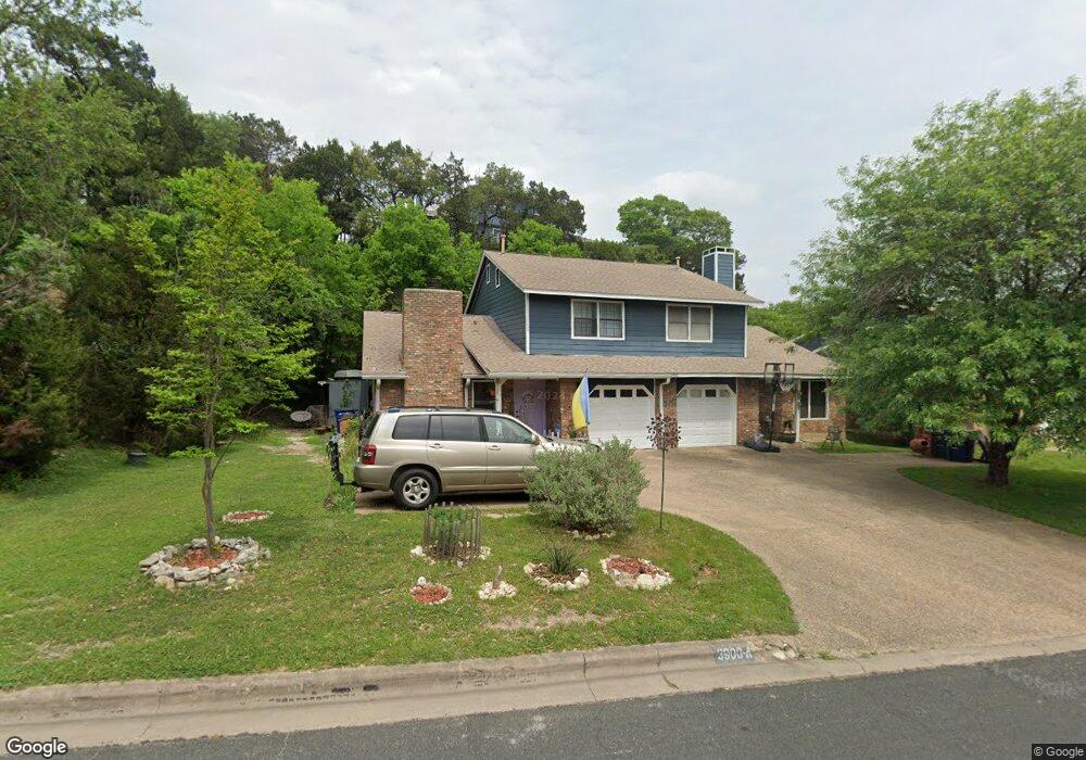
6904 Thorncliffe Dr Unit 1 Austin, TX 78731
Northwest Hills NeighborhoodEstimated Value: $375,000 - $464,000
3
Beds
2
Baths
1,450
Sq Ft
$288/Sq Ft
Est. Value
About This Home
This home is located at 6904 Thorncliffe Dr Unit 1, Austin, TX 78731 and is currently estimated at $417,294, approximately $287 per square foot. 6904 Thorncliffe Dr Unit 1 is a home located in Travis County with nearby schools including Doss Elementary School, Murchison Middle School, and Anderson High School.
Ownership History
Date
Name
Owned For
Owner Type
Purchase Details
Closed on
Aug 24, 2001
Sold by
Mayes David Glenn
Bought by
Morson Eric S
Current Estimated Value
Home Financials for this Owner
Home Financials are based on the most recent Mortgage that was taken out on this home.
Original Mortgage
$136,400
Outstanding Balance
$53,246
Interest Rate
7.16%
Estimated Equity
$364,048
Purchase Details
Closed on
Feb 29, 2000
Sold by
Peevey Jill E and Swift Thomas Grover
Bought by
Morson Eric S
Home Financials for this Owner
Home Financials are based on the most recent Mortgage that was taken out on this home.
Original Mortgage
$92,000
Interest Rate
8.31%
Create a Home Valuation Report for This Property
The Home Valuation Report is an in-depth analysis detailing your home's value as well as a comparison with similar homes in the area
Home Values in the Area
Average Home Value in this Area
Purchase History
| Date | Buyer | Sale Price | Title Company |
|---|---|---|---|
| Morson Eric S | -- | -- | |
| Morson Eric S | -- | Austin Title Company |
Source: Public Records
Mortgage History
| Date | Status | Borrower | Loan Amount |
|---|---|---|---|
| Open | Morson Eric S | $136,400 | |
| Previous Owner | Morson Eric S | $92,000 |
Source: Public Records
Tax History Compared to Growth
Tax History
| Year | Tax Paid | Tax Assessment Tax Assessment Total Assessment is a certain percentage of the fair market value that is determined by local assessors to be the total taxable value of land and additions on the property. | Land | Improvement |
|---|---|---|---|---|
| 2025 | $6,722 | $417,829 | $50,000 | $367,829 |
| 2023 | $5,506 | $388,671 | $0 | $0 |
| 2022 | $6,978 | $353,337 | $0 | $0 |
| 2021 | $6,992 | $321,215 | $84,732 | $236,483 |
| 2020 | $4,892 | $228,061 | $84,732 | $143,329 |
| 2018 | $4,786 | $216,190 | $84,732 | $141,076 |
| 2017 | $4,383 | $196,536 | $84,732 | $140,036 |
| 2016 | $3,985 | $178,669 | $67,786 | $148,038 |
| 2015 | $3,494 | $162,426 | $67,786 | $94,640 |
| 2014 | $3,494 | $162,689 | $67,786 | $94,903 |
Source: Public Records
Map
Nearby Homes
- 6910 Hart Ln Unit 110
- 6910 Hart Ln Unit 403
- 6910 Hart Ln Unit 312
- 6910 Hart Ln Unit 805
- 6910 Hart Ln Unit 807
- 3908 Knollwood Dr
- 6303 Shadow Valley Dr
- 6210 Shadow Valley Dr
- 6814 Old Quarry Ln
- 6727 Old Quarry Ln
- 6108 Shadow Valley Dr Unit A
- 6108 Shadow Valley Dr Unit A & B
- 3840 Far West Blvd Unit 113
- 6004 Shadow Valley Cove Unit B
- 3510 Wendel Cove Unit 5
- 7122 Wood Hollow Dr Unit 52
- 6631 Valleyside Rd
- 5902 Tumbling Cir
- 6507 Mesa Dr
- 4100 Firstview Dr
- 6904 Thorncliffe Dr Unit B
- 6904 Thorncliffe Dr Unit A
- 6906 Thorncliffe Dr Unit 1
- 6906 Thorncliffe Dr Unit A
- 6906 Thorncliffe Dr Unit 2
- 3900 Knollwood Dr Unit 2
- 3900 Knollwood Dr Unit 1
- 3900 Knollwood Dr
- 3900 Knollwood Dr Unit B
- 3900 Knollwood Dr Unit A
- 3802 Knollwood Dr Unit 2
- 3802 Knollwood Dr Unit 1
- 3902B Knollwood Dr
- 3902 Knollwood Dr
- 3902 Knollwood Dr Unit B
- 3902 Knollwood Dr Unit A
- 3902 Knollwood Dr
- 3800 Knollwood Dr Unit 1 B
- 3800 Knollwood Dr Unit 2
- 3800 Knollwood Dr Unit 1