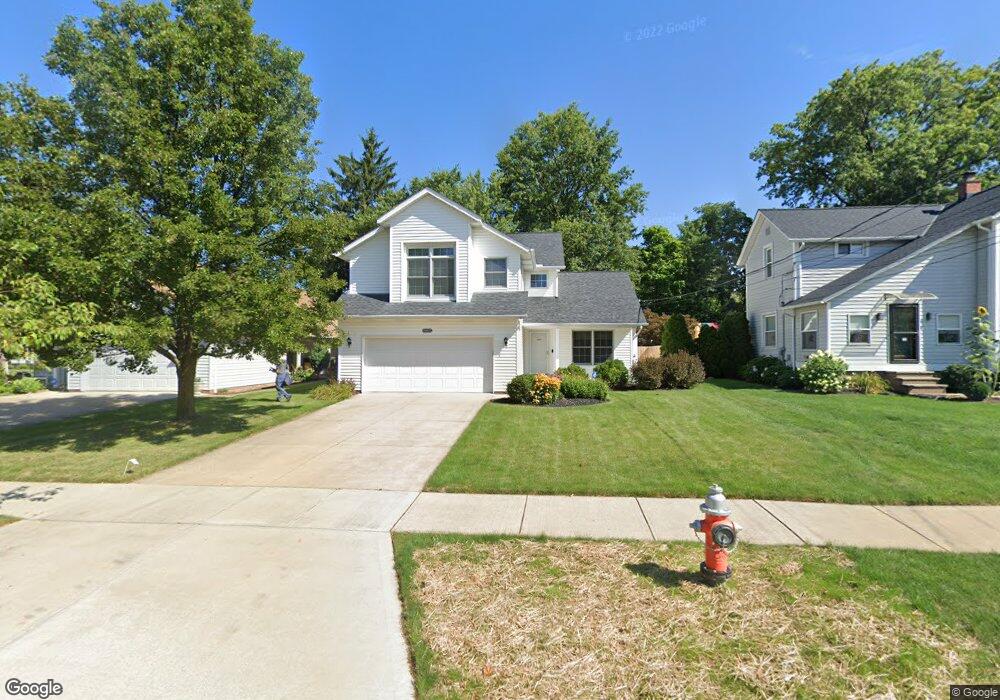
6905 Chestnut Rd Independence, OH 44131
Estimated Value: $337,000 - $406,000
3
Beds
3
Baths
1,882
Sq Ft
$192/Sq Ft
Est. Value
About This Home
This home is located at 6905 Chestnut Rd, Independence, OH 44131 and is currently estimated at $360,576, approximately $191 per square foot. 6905 Chestnut Rd is a home located in Cuyahoga County with nearby schools including Independence Primary School, Independence Middle School, and Independence High School.
Ownership History
Date
Name
Owned For
Owner Type
Purchase Details
Closed on
Nov 22, 1998
Sold by
F J J Ltd Liability
Bought by
Metz James F and Metz Donna M
Current Estimated Value
Home Financials for this Owner
Home Financials are based on the most recent Mortgage that was taken out on this home.
Original Mortgage
$160,000
Interest Rate
6.96%
Mortgage Type
Construction
Purchase Details
Closed on
Nov 18, 1994
Sold by
Kendall Jean B
Bought by
F J J Ltd Liability Co
Create a Home Valuation Report for This Property
The Home Valuation Report is an in-depth analysis detailing your home's value as well as a comparison with similar homes in the area
Home Values in the Area
Average Home Value in this Area
Purchase History
| Date | Buyer | Sale Price | Title Company |
|---|---|---|---|
| Metz James F | $75,000 | Midland Title Security Inc | |
| F J J Ltd Liability Co | $200,000 | -- |
Source: Public Records
Mortgage History
| Date | Status | Borrower | Loan Amount |
|---|---|---|---|
| Previous Owner | Metz James F | $160,000 |
Source: Public Records
Tax History
| Year | Tax Paid | Tax Assessment Tax Assessment Total Assessment is a certain percentage of the fair market value that is determined by local assessors to be the total taxable value of land and additions on the property. | Land | Improvement |
|---|---|---|---|---|
| 2024 | $5,593 | $116,935 | $13,125 | $103,810 |
| 2023 | $5,676 | $107,840 | $12,390 | $95,450 |
| 2022 | $5,645 | $107,840 | $12,390 | $95,450 |
| 2021 | $5,563 | $107,840 | $12,390 | $95,450 |
| 2020 | $5,440 | $98,950 | $11,380 | $87,570 |
| 2019 | $5,251 | $282,700 | $32,500 | $250,200 |
| 2018 | $5,298 | $98,950 | $11,380 | $87,570 |
| 2017 | $4,726 | $85,060 | $8,510 | $76,550 |
| 2016 | $4,678 | $85,060 | $8,510 | $76,550 |
| 2015 | $4,674 | $85,060 | $8,510 | $76,550 |
| 2014 | $4,674 | $85,060 | $8,510 | $76,550 |
Source: Public Records
Map
Nearby Homes
- 0 Brecksville Rd
- 0 Daisy Blvd
- 5108 Great Oaks Pkwy
- 8420 Stone Rd
- 0 Acorn Dr Unit 5023848
- 6990 S Great Oaks Pkwy
- 6606 Crossview Rd
- 6352 Crossview Rd
- VL Laura Lee Ln
- 6387 Bonroi Dr
- VL TBB Laura Lee Ln
- 6473 Tanglewood Ln
- 5706 Heinton Rd
- 6399 Tanglewood Ln
- 7003 Brecksville Rd
- 1691 E Parkhaven Dr
- 9152 Fosdick Rd
- 5024 Dorset Dr
- 6258 Carlyle Dr
- 874 E Meadowlawn Blvd
- 6903 Chestnut Rd
- 6907 Chestnut Rd
- 6511 Anderson Ave
- 6911 Chestnut Rd
- 6507 Anderson Ave
- 6915 Chestnut Rd
- 6520 Anderson Ave
- 6501 Anderson Ave
- 6516 Anderson Ave
- 6508 Anderson Ave
- 6710 Chestnut Rd
- 6500 Anderson Ave
- 6816 Daisy Ave
- V/L Daisy Ave
- 6615 Chestnut Rd
- 6812 Daisy Ave
- 6908 Daisy Ave
- 6706 Chestnut Rd
- 6914 Daisy Ave