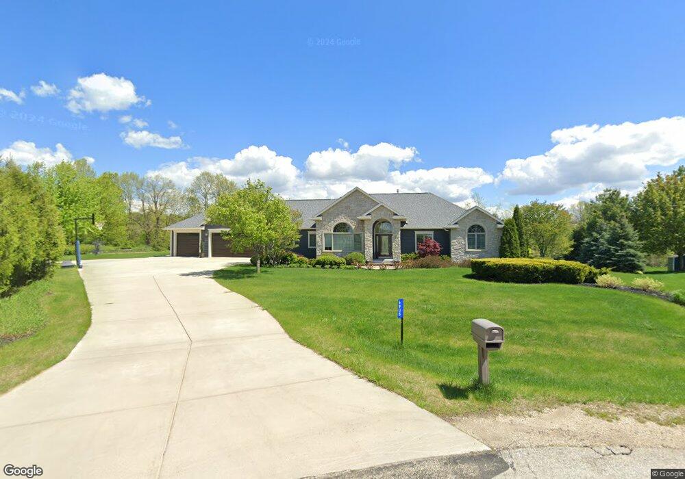
6905 Mount Pleasant Dr West Bend, WI 53090
Estimated Value: $546,267 - $765,000
--
Bed
--
Bath
--
Sq Ft
1.04
Acres
About This Home
This home is located at 6905 Mount Pleasant Dr, West Bend, WI 53090 and is currently estimated at $650,067. 6905 Mount Pleasant Dr is a home located in Washington County with nearby schools including McLane Elementary School, Silverbrook Intermediate School, and East High School.
Ownership History
Date
Name
Owned For
Owner Type
Purchase Details
Closed on
Jul 24, 2006
Sold by
L & R Development Llc
Bought by
Grube Timothy M and Kuhlow Koreen M
Current Estimated Value
Home Financials for this Owner
Home Financials are based on the most recent Mortgage that was taken out on this home.
Original Mortgage
$73,800
Outstanding Balance
$44,223
Interest Rate
6.82%
Mortgage Type
Purchase Money Mortgage
Estimated Equity
$605,844
Create a Home Valuation Report for This Property
The Home Valuation Report is an in-depth analysis detailing your home's value as well as a comparison with similar homes in the area
Home Values in the Area
Average Home Value in this Area
Purchase History
| Date | Buyer | Sale Price | Title Company |
|---|---|---|---|
| Grube Timothy M | $82,000 | Abstract & Title Company |
Source: Public Records
Mortgage History
| Date | Status | Borrower | Loan Amount |
|---|---|---|---|
| Open | Grube Timothy M | $73,800 |
Source: Public Records
Tax History Compared to Growth
Tax History
| Year | Tax Paid | Tax Assessment Tax Assessment Total Assessment is a certain percentage of the fair market value that is determined by local assessors to be the total taxable value of land and additions on the property. | Land | Improvement |
|---|---|---|---|---|
| 2024 | $4,329 | $364,400 | $75,000 | $289,400 |
| 2023 | $3,894 | $364,400 | $75,000 | $289,400 |
| 2022 | $4,102 | $364,400 | $75,000 | $289,400 |
| 2021 | $4,382 | $364,400 | $75,000 | $289,400 |
| 2020 | $4,435 | $364,400 | $75,000 | $289,400 |
| 2019 | $4,243 | $364,400 | $75,000 | $289,400 |
| 2018 | $4,222 | $364,400 | $75,000 | $289,400 |
| 2017 | $4,129 | $364,400 | $75,000 | $289,400 |
| 2016 | $4,298 | $364,400 | $75,000 | $289,400 |
| 2015 | $4,152 | $364,400 | $75,000 | $289,400 |
| 2014 | $4,152 | $364,400 | $75,000 | $289,400 |
| 2013 | $4,712 | $364,400 | $75,000 | $289,400 |
Source: Public Records
Map
Nearby Homes
- 7165 Town Line Rd
- 4538 Church Dr
- 6837 Reuter Ln
- 4262 N Woodcrest Ridge Dr
- Lt3-5 Schuster Dr
- Lt3 Schuster Dr
- Lt5 Schuster Dr
- Lt4 Schuster Dr
- 6386 Alpine Dr
- 6215 Riesch Rd
- 3315 Windsor Place
- 3316 Mediterranean Ave
- 6043 State Highway 144
- Lt2 Beaver Dam Rd
- 5036 County Highway D
- 2606 Park Forest Dr
- 2820 Valley Ave
- 805 Canterberry Ct Unit C
- 7721 Aurora Rd
- 2346 W Washington St
- 6907 Mount Pleasant Dr
- 6901 Mount Pleasant Dr
- 6805 Old Apple Ln
- 6909 Mount Pleasant Dr
- 6809 Old Apple Ln
- 6603 Canyon Ln
- 6911 Mount Pleasant Dr
- 4685 Hawk Ridge Rd
- 6816 Old Apple Ln
- 6806 Old Apple Ln
- 6607 Canyon Ln
- 6915 Mount Pleasant Dr
- 4597 Schuster Dr
- 6810 Old Apple Ln
- 6600 Canyon Ln
- 6615 Canyon Ln
- 6783 Stonefield Ct
- 6606 Canyon Ln
- 6784 Stonefield Ct
- 4575 Schuster Dr