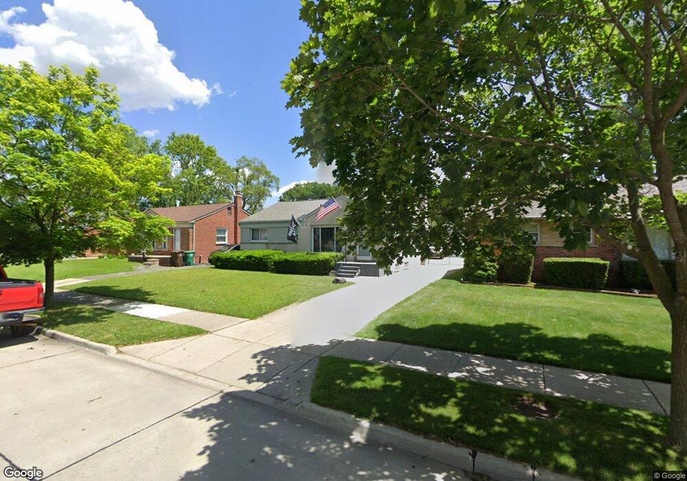
6908 Burnly St Unit Bldg-Unit Garden City, MI 48135
Estimated Value: $239,263 - $257,000
--
Bed
1
Bath
1,038
Sq Ft
$239/Sq Ft
Est. Value
About This Home
This home is located at 6908 Burnly St Unit Bldg-Unit, Garden City, MI 48135 and is currently estimated at $248,566, approximately $239 per square foot. 6908 Burnly St Unit Bldg-Unit is a home located in Wayne County with nearby schools including Douglas Elementary 3-4 Campus, Memorial Elementary 1-2 Campus, and Garden City Middle School.
Ownership History
Date
Name
Owned For
Owner Type
Purchase Details
Closed on
Jul 2, 2025
Sold by
Warra Brothers Llc
Bought by
Hankins Stephanie
Current Estimated Value
Purchase Details
Closed on
Sep 28, 2020
Sold by
Warra John and Warra Ronny
Bought by
Warra Brothers Llc
Purchase Details
Closed on
Jul 25, 2008
Sold by
Warra Brother Llc
Bought by
Warra John
Purchase Details
Closed on
Sep 21, 2006
Sold by
Sobkowiak Judith
Bought by
Novastar Mortgage Inc
Purchase Details
Closed on
Mar 4, 1998
Sold by
Sh Charles E Oxendine Pr
Bought by
Lapeer Credit Cooperative
Create a Home Valuation Report for This Property
The Home Valuation Report is an in-depth analysis detailing your home's value as well as a comparison with similar homes in the area
Home Values in the Area
Average Home Value in this Area
Purchase History
| Date | Buyer | Sale Price | Title Company |
|---|---|---|---|
| Hankins Stephanie | $252,900 | None Listed On Document | |
| Warra Brothers Llc | -- | None Available | |
| Warra John | -- | None Available | |
| Novastar Mortgage Inc | $81,930 | None Available | |
| Lapeer Credit Cooperative | $49,000 | -- |
Source: Public Records
Tax History Compared to Growth
Tax History
| Year | Tax Paid | Tax Assessment Tax Assessment Total Assessment is a certain percentage of the fair market value that is determined by local assessors to be the total taxable value of land and additions on the property. | Land | Improvement |
|---|---|---|---|---|
| 2025 | $2,985 | $106,600 | $0 | $0 |
| 2024 | $2,985 | $99,500 | $0 | $0 |
| 2023 | $2,835 | $86,400 | $0 | $0 |
| 2022 | $3,507 | $73,300 | $0 | $0 |
| 2021 | $3,423 | $69,500 | $0 | $0 |
| 2020 | $3,421 | $64,800 | $0 | $0 |
| 2019 | $2,559 | $59,400 | $0 | $0 |
| 2018 | $2,310 | $51,600 | $0 | $0 |
| 2017 | $1,346 | $49,500 | $0 | $0 |
| 2016 | $2,919 | $48,300 | $0 | $0 |
| 2015 | $3,912 | $44,100 | $0 | $0 |
| 2013 | $3,790 | $38,600 | $0 | $0 |
| 2012 | $2,770 | $40,000 | $12,700 | $27,300 |
Source: Public Records
Map
Nearby Homes
- 6747 Burnly St
- 29801 Bridge St
- 6705 Whitby St
- 6649 Burnly St
- 29498 Bridge St
- 29878 Malvern St
- 6727 Hawthorne St
- 7505 Donna St
- 7637 Melvin Ave
- 28912 Cambridge St
- 6557 Huntleigh St
- 29825 Dawson Ave
- 29825 Dawson St
- 28627 Bridge St
- 6439 Huntleigh St
- 28843 Balmoral St
- 31208 Windsor St
- 29256 Brody Ave
- 30436 Beechwood St
- 0000 N Middlebelt Rd
- 6860 Burnly St
- 6918 Burnly St
- 6850 Burnly St
- 6928 Burnly St
- 6840 Burnly St
- 6938 Burnly St
- 29896 Bridge St
- 29895 Bridge St
- 6909 Burnly St
- 6861 Burnly St
- 6919 Burnly St
- 6948 Burnly St
- 6830 Burnly St
- 6851 Burnly St
- 6929 Burnly St
- 29880 Bridge St
- 29879 Bridge St
- 6841 Burnly St
- 6939 Burnly St
- 29833 James St