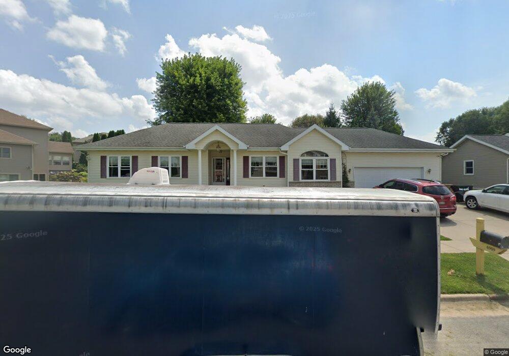
6909 Stockbridge Dr Madison, WI 53718
East Madison NeighborhoodEstimated Value: $473,000 - $484,000
3
Beds
3
Baths
1,617
Sq Ft
$296/Sq Ft
Est. Value
About This Home
This home is located at 6909 Stockbridge Dr, Madison, WI 53718 and is currently estimated at $479,059, approximately $296 per square foot. 6909 Stockbridge Dr is a home located in Dane County with nearby schools including Kennedy Elementary School, Whitehorse Middle School, and La Follette High School.
Ownership History
Date
Name
Owned For
Owner Type
Purchase Details
Closed on
Oct 16, 2025
Sold by
Debra A Ring Living Trust
Bought by
Ring Gina J
Current Estimated Value
Purchase Details
Closed on
Oct 11, 2016
Sold by
Ring Debra A
Bought by
Ring Debra A and Debra A Ring Living Trust
Purchase Details
Closed on
Mar 8, 2010
Sold by
Ring Rodney W
Bought by
Ring Debra A
Purchase Details
Closed on
Jan 29, 2009
Sold by
Ring Debra A
Bought by
Ring Rodney W
Home Financials for this Owner
Home Financials are based on the most recent Mortgage that was taken out on this home.
Original Mortgage
$30,000
Interest Rate
5.08%
Mortgage Type
Purchase Money Mortgage
Purchase Details
Closed on
Oct 21, 2005
Sold by
Associated Bank Na
Bought by
Ring Debra A and Ring Rodney W
Home Financials for this Owner
Home Financials are based on the most recent Mortgage that was taken out on this home.
Original Mortgage
$150,000
Interest Rate
5.8%
Mortgage Type
New Conventional
Purchase Details
Closed on
Jun 20, 2005
Sold by
Best Construction Inc
Bought by
Associated Bank Na
Create a Home Valuation Report for This Property
The Home Valuation Report is an in-depth analysis detailing your home's value as well as a comparison with similar homes in the area
Home Values in the Area
Average Home Value in this Area
Purchase History
| Date | Buyer | Sale Price | Title Company |
|---|---|---|---|
| Ring Gina J | -- | None Listed On Document | |
| Ring Debra A | -- | Attorney | |
| Ring Debra A | -- | None Available | |
| Ring Rodney W | $30,000 | None Available | |
| Ring Debra A | $240,000 | None Available | |
| Associated Bank Na | -- | None Available |
Source: Public Records
Mortgage History
| Date | Status | Borrower | Loan Amount |
|---|---|---|---|
| Previous Owner | Ring Rodney W | $30,000 | |
| Previous Owner | Ring Debra A | $150,000 |
Source: Public Records
Tax History Compared to Growth
Tax History
| Year | Tax Paid | Tax Assessment Tax Assessment Total Assessment is a certain percentage of the fair market value that is determined by local assessors to be the total taxable value of land and additions on the property. | Land | Improvement |
|---|---|---|---|---|
| 2024 | $14,647 | $433,600 | $111,300 | $322,300 |
| 2023 | $7,061 | $409,100 | $105,000 | $304,100 |
| 2021 | $6,379 | $314,800 | $95,200 | $219,600 |
| 2020 | $6,463 | $299,800 | $90,700 | $209,100 |
| 2019 | $6,269 | $291,100 | $88,100 | $203,000 |
| 2018 | $5,977 | $277,200 | $88,100 | $189,100 |
| 2017 | $5,883 | $261,500 | $88,100 | $173,400 |
| 2016 | $5,739 | $249,000 | $88,100 | $160,900 |
| 2015 | $5,255 | $225,500 | $83,900 | $141,600 |
| 2014 | $5,254 | $225,500 | $83,900 | $141,600 |
| 2013 | $5,180 | $225,500 | $86,100 | $139,400 |
Source: Public Records
Map
Nearby Homes
- 425 E Hill Pkwy
- 302 E Hill Pkwy
- 409 Wyalusing Dr
- Lot 4 Wyalusing Dr
- Lot 2 Wyalusing Dr
- Lot 3 Wyalusing Dr
- Lot 5 Wyalusing Dr
- Lot 1 Wyalusing Dr
- 212 E Hill Pkwy
- 239 Shady Leaf Rd
- 6725 Reston Heights Dr Unit 1
- 7114 Littlemore Dr
- 7120 Field Flower Way
- 7032 Havenswood Dr
- 704 Herndon Dr Unit 201
- 402 Jubilee Ln
- 620 Malvern Hill Dr
- 502 Traveler Ln
- 101 Metro Terrace Unit 204
- 121 Metro Terrace Unit 101
- 6905 Stockbridge Dr
- 6913 Stockbridge Dr
- 7006 Bluff Point Dr
- 7018 Bluff Point Dr
- 7002 Bluff Point Dr
- 6901 Stockbridge Dr
- 6918 Bluff Point Dr
- 405 Bailey Dr
- 7025 Bluff Point Dr
- 7001 Bluff Point Dr
- 7009 Bluff Point Dr
- 7021 Bluff Point Dr
- 7013 Bluff Point Dr
- 7017 Bluff Point Dr
- 6914 Bluff Point Dr
- 6917 Bluff Point Dr
- 409 Bailey Dr
- 402 Bailey Dr
- 319-327 E Hill Pkwy
- 6913 Bluff Point Dr