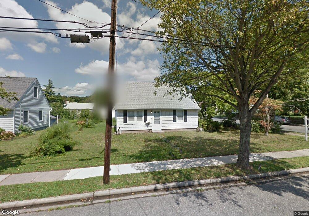
691 Barnes Ave Baldwin, NY 11510
Estimated Value: $574,000 - $655,484
4
Beds
1
Bath
1,008
Sq Ft
$610/Sq Ft
Est. Value
About This Home
This home is located at 691 Barnes Ave, Baldwin, NY 11510 and is currently estimated at $614,742, approximately $609 per square foot. 691 Barnes Ave is a home located in Nassau County with nearby schools including Baldwin Senior High School.
Ownership History
Date
Name
Owned For
Owner Type
Purchase Details
Closed on
Jul 11, 2019
Sold by
Funaro John and Funaro Barbara
Bought by
Clausnitzer Christian and Clausnitzer Monika
Current Estimated Value
Home Financials for this Owner
Home Financials are based on the most recent Mortgage that was taken out on this home.
Original Mortgage
$351,500
Outstanding Balance
$307,945
Interest Rate
3.82%
Mortgage Type
New Conventional
Estimated Equity
$306,797
Purchase Details
Closed on
Dec 17, 2007
Sold by
Kopf Lynne A
Create a Home Valuation Report for This Property
The Home Valuation Report is an in-depth analysis detailing your home's value as well as a comparison with similar homes in the area
Home Values in the Area
Average Home Value in this Area
Purchase History
| Date | Buyer | Sale Price | Title Company |
|---|---|---|---|
| Clausnitzer Christian | $370,000 | Stewart Title | |
| -- | -- | -- |
Source: Public Records
Mortgage History
| Date | Status | Borrower | Loan Amount |
|---|---|---|---|
| Open | Clausnitzer Christian | $351,500 |
Source: Public Records
Tax History
| Year | Tax Paid | Tax Assessment Tax Assessment Total Assessment is a certain percentage of the fair market value that is determined by local assessors to be the total taxable value of land and additions on the property. | Land | Improvement |
|---|---|---|---|---|
| 2025 | $12,706 | $412 | $201 | $211 |
| 2024 | $3,226 | $412 | $201 | $211 |
Source: Public Records
Map
Nearby Homes
- 704 Barnes Ave
- 2847 Grand Ave
- 689 Arlington Ave
- 2910 Yale Place
- 2899 Grand Ave Unit 5
- 2929 Yale Place
- 817 Southard St
- 25 Sunnybrook Dr E
- 2962 Grand Ave
- 2684 Park Ave
- 890 Clay St
- 719 Lincoln St
- 647 Lincoln St
- 2970 Grand Blvd
- 3004 Harbor St
- 2941 Moreland Ave
- 2730 Remsen St
- 2758 Harvard Place
- 702 Fishermans Rd
- 613 Smith Place
Your Personal Tour Guide
Ask me questions while you tour the home.