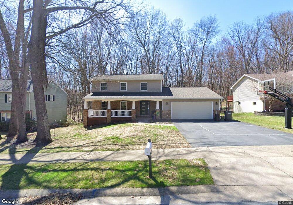
691 Berkshire Dr State College, PA 16803
Estimated Value: $494,012 - $554,000
4
Beds
3
Baths
2,724
Sq Ft
$192/Sq Ft
Est. Value
About This Home
This home is located at 691 Berkshire Dr, State College, PA 16803 and is currently estimated at $523,503, approximately $192 per square foot. 691 Berkshire Dr is a home located in Centre County with nearby schools including Radio Park Elementary School, Park Forest Middle School, and State College Area High School.
Ownership History
Date
Name
Owned For
Owner Type
Purchase Details
Closed on
Jun 11, 2007
Sold by
Denegar Craig R and Denegar Susan E
Bought by
Foster Terry L and Foster Dawn M
Current Estimated Value
Home Financials for this Owner
Home Financials are based on the most recent Mortgage that was taken out on this home.
Original Mortgage
$177,000
Interest Rate
6.19%
Mortgage Type
Purchase Money Mortgage
Create a Home Valuation Report for This Property
The Home Valuation Report is an in-depth analysis detailing your home's value as well as a comparison with similar homes in the area
Home Values in the Area
Average Home Value in this Area
Purchase History
| Date | Buyer | Sale Price | Title Company |
|---|---|---|---|
| Foster Terry L | $257,000 | None Available |
Source: Public Records
Mortgage History
| Date | Status | Borrower | Loan Amount |
|---|---|---|---|
| Closed | Foster Terry L | $177,000 |
Source: Public Records
Tax History Compared to Growth
Tax History
| Year | Tax Paid | Tax Assessment Tax Assessment Total Assessment is a certain percentage of the fair market value that is determined by local assessors to be the total taxable value of land and additions on the property. | Land | Improvement |
|---|---|---|---|---|
| 2025 | $5,377 | $86,825 | $11,495 | $75,330 |
| 2024 | $4,340 | $74,950 | $11,495 | $63,455 |
| 2023 | $4,340 | $74,950 | $11,495 | $63,455 |
| 2022 | $4,223 | $74,950 | $11,495 | $63,455 |
| 2021 | $4,223 | $74,950 | $11,495 | $63,455 |
| 2020 | $4,223 | $74,950 | $11,495 | $63,455 |
| 2019 | $3,534 | $74,950 | $11,495 | $63,455 |
| 2018 | $4,078 | $74,950 | $11,495 | $63,455 |
| 2017 | $4,027 | $74,950 | $11,495 | $63,455 |
| 2016 | -- | $74,950 | $11,495 | $63,455 |
| 2015 | -- | $74,950 | $11,495 | $63,455 |
| 2014 | -- | $74,950 | $11,495 | $63,455 |
Source: Public Records
Map
Nearby Homes
- 2251 Red Oak Ln
- 2292 Oak Leaf Dr
- 1765 Cambridge Dr
- 169 Sandy Ridge Rd
- 291 Oakley Dr
- 1635 Princeton Dr
- 479 Westgate Dr
- 1111-C W Aaron Dr
- 835 Galen Dr Unit 835
- 833 Galen Dr
- 1832 Waddle Rd
- 1836 Waddle Rd
- 253 Bolton Ave
- 1383 N Allen St
- 3182 Carnegie Dr
- 505 Hillcrest Ave
- 465 Hillcrest Ave
- 1457 Curtin St
- 936 Taylor St
- 861 Willard St
- 689 Berkshire Dr
- 693 Berkshire Dr
- 687 Berkshire Dr
- 695 Berkshire Dr
- 106 Ridgewood Cir
- 100 Cherry Ridge Rd
- 101 Cherry Ridge Rd
- 674 Berkshire Dr
- 610 Devonshire Dr
- 107 Ridgewood Cir
- 104 Ridgewood Cir
- 102 Cherry Ridge Rd
- 614 Devonshire Dr
- 103 Cherry Ridge Rd
- 672 Berkshire Dr
- 606 Devonshire Dr
- 683 Berkshire Dr
- 104 Cherry Ridge Rd
- 105 Ridgewood Cir
- 670 Berkshire Dr