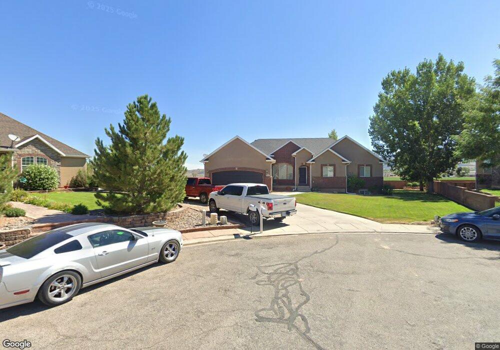
691 E 5020 N Cedar City, UT 84721
Estimated Value: $449,129 - $605,000
--
Bed
1
Bath
1,909
Sq Ft
$281/Sq Ft
Est. Value
About This Home
This home is located at 691 E 5020 N, Cedar City, UT 84721 and is currently estimated at $537,282, approximately $281 per square foot. 691 E 5020 N is a home located in Iron County with nearby schools including Three Peaks School, Cedar Middle School, and Cedar City High School.
Ownership History
Date
Name
Owned For
Owner Type
Purchase Details
Closed on
Aug 8, 2019
Sold by
Barton Matthew H
Bought by
Barton Matthew H and Barton Carlynn W
Current Estimated Value
Home Financials for this Owner
Home Financials are based on the most recent Mortgage that was taken out on this home.
Original Mortgage
$262,500
Outstanding Balance
$173,300
Interest Rate
3.73%
Mortgage Type
New Conventional
Estimated Equity
$363,982
Purchase Details
Closed on
Nov 5, 2005
Sold by
A & G Llc
Bought by
Barton Matthew H and Barton Carlynn W
Home Financials for this Owner
Home Financials are based on the most recent Mortgage that was taken out on this home.
Original Mortgage
$248,000
Interest Rate
5.97%
Mortgage Type
New Conventional
Create a Home Valuation Report for This Property
The Home Valuation Report is an in-depth analysis detailing your home's value as well as a comparison with similar homes in the area
Home Values in the Area
Average Home Value in this Area
Purchase History
| Date | Buyer | Sale Price | Title Company |
|---|---|---|---|
| Barton Matthew H | -- | Security Escrow & Ttl Ins Ag | |
| Barton Matthew H | -- | Security Escrow & Ttl Ins Ag | |
| Barton Matthew H | -- | -- |
Source: Public Records
Mortgage History
| Date | Status | Borrower | Loan Amount |
|---|---|---|---|
| Open | Barton Matthew H | $262,500 | |
| Closed | Barton Matthew H | $248,000 |
Source: Public Records
Tax History Compared to Growth
Tax History
| Year | Tax Paid | Tax Assessment Tax Assessment Total Assessment is a certain percentage of the fair market value that is determined by local assessors to be the total taxable value of land and additions on the property. | Land | Improvement |
|---|---|---|---|---|
| 2025 | $2,020 | $276,686 | $45,650 | $231,036 |
| 2023 | $2,040 | $274,395 | $43,770 | $230,625 |
| 2022 | $2,150 | $251,345 | $41,685 | $209,660 |
| 2021 | $1,704 | $199,235 | $24,520 | $174,715 |
| 2020 | $1,702 | $174,840 | $16,300 | $158,540 |
| 2019 | $1,629 | $158,855 | $14,730 | $144,125 |
| 2018 | $1,629 | $154,415 | $14,730 | $139,685 |
| 2017 | $1,370 | $136,195 | $14,730 | $121,465 |
| 2016 | $1,309 | $121,160 | $12,555 | $108,605 |
| 2015 | $1,300 | $113,735 | $0 | $0 |
| 2014 | $1,299 | $106,890 | $0 | $0 |
Source: Public Records
Map
Nearby Homes
- 582 E 5020 N
- 4953 N Winchester Dr
- 0 1 Acre Ft of Water Rights Unit North of Hwy 56
- 4937 N Winchester Dr
- 4973 N Remington Rd
- 800 E 5200 N
- 4973 N 900 E
- 4954 N Remington Rd
- 0 Lot 86 Phase 2 Unit 113690
- 0 Lot 86 Phase 2 Unit 25-266407
- 4960 N Minersville Hwy Approx
- 0 Lot 50 Phase 2
- 965 E Winchester Dr
- 0 Lot 51 Phase 2 Unit 25-259576
- 0 Lot 49 Phase 2 Unit 110503
- 0 Lot 49 Phase 2 Unit 25-259544
- 985 E Winchester Dr
- 2522 W 5190 N
- 2318 W 5190 N
- 5165 N 2570 W
- 679 E 5020 N
- 692 E 5020 N
- 678 E 5080 N
- 690 E 5080 N
- 667 E 5020 N
- 680 E 5020 N
- 670 E 5080 N
- 651 E 5020 N
- 4958 N Winchester Dr Unit lot 33
- 4958 N Winchester Dr Unit Phase 1
- 652 E 5020 N
- 689 E 5080 N
- 867 E Winchester Dr Unit lot 40
- 867 E Winchester Dr
- 867 E Winchester Dr Unit Phase 1
- 4982 N Winchester Dr
- 4982 N Winchester Dr Unit Phase 1
- 650 E 5080 N
- 650 E 5080 N Unit 15
- 635 E 5020 N