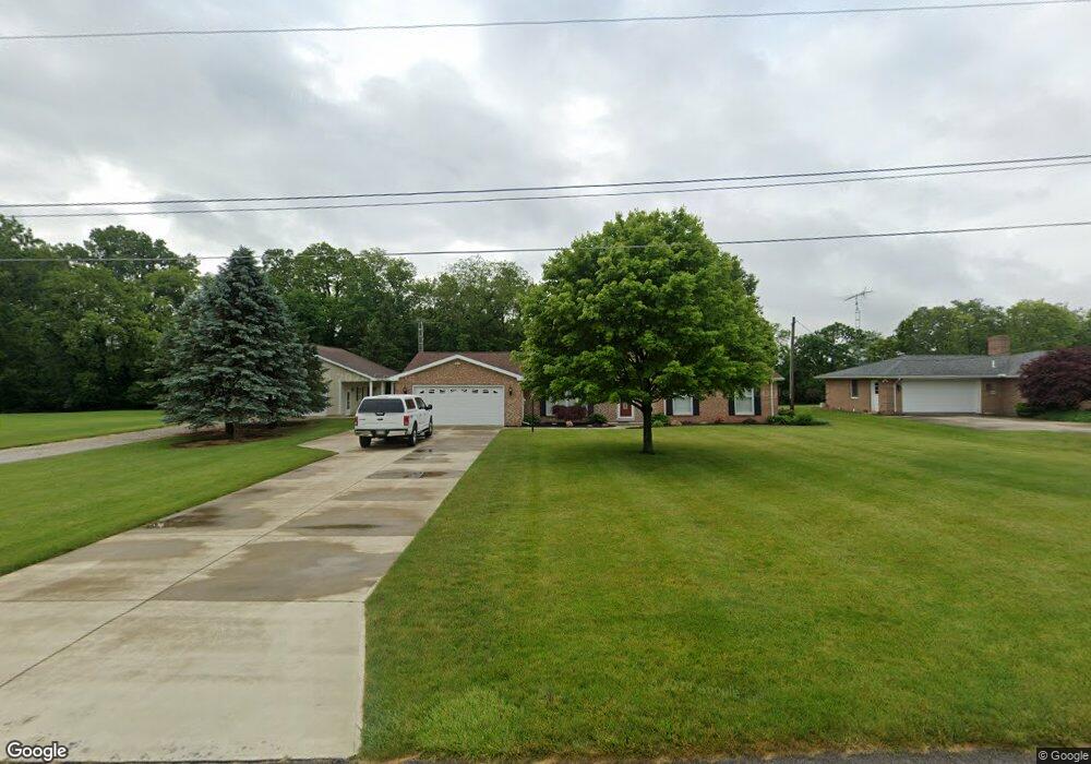
691 Rambo Ln Fremont, OH 43420
Estimated Value: $292,954 - $372,000
3
Beds
3
Baths
1,950
Sq Ft
$170/Sq Ft
Est. Value
About This Home
This home is located at 691 Rambo Ln, Fremont, OH 43420 and is currently estimated at $331,489, approximately $169 per square foot. 691 Rambo Ln is a home located in Sandusky County with nearby schools including Fremont Ross High School and St. Joseph School.
Ownership History
Date
Name
Owned For
Owner Type
Purchase Details
Closed on
Sep 17, 2019
Sold by
Keiser Thomas M and Keiser Kari A
Bought by
Keiser Thomas M and Keiser Kari A
Current Estimated Value
Purchase Details
Closed on
Nov 30, 2006
Sold by
Keiser Thomas M and Keiser Kari A
Bought by
Keiser Thomas M and Keiser Kari A
Purchase Details
Closed on
Jul 1, 1993
Sold by
Keiser Thomas M
Bought by
Keiser Thomas M and Keiser Kari A
Purchase Details
Closed on
May 1, 1990
Sold by
Keiser Thomas M
Bought by
Keiser Thomas M and Keiser Kari A
Purchase Details
Closed on
Dec 1, 1984
Bought by
Keiser Thomas M and Keiser Kari A
Create a Home Valuation Report for This Property
The Home Valuation Report is an in-depth analysis detailing your home's value as well as a comparison with similar homes in the area
Home Values in the Area
Average Home Value in this Area
Purchase History
| Date | Buyer | Sale Price | Title Company |
|---|---|---|---|
| Keiser Thomas M | -- | None Available | |
| Keiser Thomas M | -- | None Available | |
| Keiser Thomas M | -- | -- | |
| Keiser Thomas M | $88,500 | -- | |
| Keiser Thomas M | $47,000 | -- |
Source: Public Records
Tax History Compared to Growth
Tax History
| Year | Tax Paid | Tax Assessment Tax Assessment Total Assessment is a certain percentage of the fair market value that is determined by local assessors to be the total taxable value of land and additions on the property. | Land | Improvement |
|---|---|---|---|---|
| 2024 | $3,090 | $79,460 | $13,270 | $66,190 |
| 2023 | $3,090 | $64,580 | $10,780 | $53,800 |
| 2022 | $2,682 | $64,580 | $10,780 | $53,800 |
| 2021 | $2,763 | $64,580 | $10,780 | $53,800 |
| 2020 | $2,721 | $62,340 | $10,780 | $51,560 |
| 2019 | $2,718 | $62,340 | $10,780 | $51,560 |
| 2018 | $2,580 | $62,340 | $10,780 | $51,560 |
| 2017 | $2,515 | $58,980 | $10,780 | $48,200 |
| 2016 | $2,205 | $58,980 | $10,780 | $48,200 |
| 2015 | $2,169 | $58,980 | $10,780 | $48,200 |
| 2014 | $2,334 | $60,800 | $14,630 | $46,170 |
| 2013 | $2,285 | $60,800 | $14,630 | $46,170 |
Source: Public Records
Map
Nearby Homes
- 855 Rambo Ln
- 43 Sun Valley Dr Unit 43
- 2484 Buckland Ave
- 350 Conner Dr
- 1970 Morrison Rd
- 1818 Finley Dr
- 41 Brookview Dr
- 10 Meadowbrook Dr
- 10 Meadowbrook Ln
- 2020 Elm Dr
- 64 River Run Dr Unit J
- 64 River Run Dr
- 822 Upton Rd
- 1832 Myrtle St
- 135 Briarwood Cir
- 1719 Buckland Ave
- 1826 Morrison Rd
- 1485 Autumn Woods Dr
- 880 Cleveland Ave
- 18 Katlyn Dr