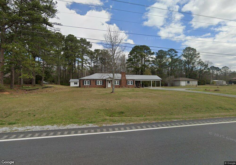
691 Rock Mills Rd Roanoke, AL 36274
Estimated Value: $172,805 - $216,000
--
Bed
--
Bath
2,153
Sq Ft
$91/Sq Ft
Est. Value
About This Home
This home is located at 691 Rock Mills Rd, Roanoke, AL 36274 and is currently estimated at $195,201, approximately $90 per square foot. 691 Rock Mills Rd is a home located in Randolph County with nearby schools including Knight Enloe Elementary School, Handley Middle School, and Handley High School.
Ownership History
Date
Name
Owned For
Owner Type
Purchase Details
Closed on
Sep 4, 2025
Sold by
Pike Linda S and Pierce Linda Sue
Bought by
Slay Whaley Michael and Strain Whaley Shalyn
Current Estimated Value
Home Financials for this Owner
Home Financials are based on the most recent Mortgage that was taken out on this home.
Original Mortgage
$223,232
Outstanding Balance
$223,232
Interest Rate
6.74%
Mortgage Type
New Conventional
Estimated Equity
-$28,031
Create a Home Valuation Report for This Property
The Home Valuation Report is an in-depth analysis detailing your home's value as well as a comparison with similar homes in the area
Home Values in the Area
Average Home Value in this Area
Purchase History
| Date | Buyer | Sale Price | Title Company |
|---|---|---|---|
| Slay Whaley Michael | $221,000 | None Listed On Document | |
| Slay Whaley Michael | $221,000 | None Listed On Document |
Source: Public Records
Mortgage History
| Date | Status | Borrower | Loan Amount |
|---|---|---|---|
| Open | Slay Whaley Michael | $223,232 | |
| Closed | Slay Whaley Michael | $223,232 |
Source: Public Records
Tax History Compared to Growth
Tax History
| Year | Tax Paid | Tax Assessment Tax Assessment Total Assessment is a certain percentage of the fair market value that is determined by local assessors to be the total taxable value of land and additions on the property. | Land | Improvement |
|---|---|---|---|---|
| 2024 | $557 | $14,620 | $1,180 | $13,440 |
| 2023 | $557 | $12,640 | $960 | $11,680 |
| 2022 | $451 | $12,640 | $960 | $11,680 |
| 2021 | $451 | $12,640 | $960 | $11,680 |
| 2020 | $451 | $12,640 | $960 | $11,680 |
| 2018 | $365 | $10,600 | $960 | $9,640 |
| 2017 | $0 | $11,540 | $960 | $10,580 |
| 2016 | $0 | $10,640 | $980 | $9,660 |
| 2015 | -- | $106,342 | $0 | $0 |
| 2014 | $400 | $106,342 | $0 | $0 |
| 2013 | -- | $112,086 | $0 | $0 |
Source: Public Records
Map
Nearby Homes
- 0 Cauthen Cir Unit Lot 12 21404430
- 206 Gilham Rd
- 507 Cherry Ave
- 161 Lakeview Dr
- 306 Stewart Dr
- 220 Centerway Dr
- 470 Gilham Rd
- 0 County Road 87 Unit 23688959
- 2950 Highway 431 Unit 7.5 Ac
- 0 Fincher Rd
- 192 Cody Rd
- 0 Longshore St
- 269 Longshore St
- 435 South St
- 0 Hwy 431 Unit 10582424
- 0 Field St
- 63445 Alabama 22 Unit 70 Ac
- 0 Cody Rd Unit 15.66 acres 21410436
- 646 Mickle Dr
- 534 Knight Ave
- 0 Rock Mills Rd Unit 3284387
- 688 Rock Mills Rd
- 681 Rock Mills Rd
- 715 Rock Mills Rd
- 715 Rock Mills Rd
- 533 Rock Mills Rd
- 651 Rock Mills Rd
- 658 Rock Mills Rd
- 708 Rock Mills Rd Unit 1.63 ac
- 367 Cauthen Cir
- 380 Cauthen Cir
- 392 Cauthen Cir
- 763 Rock Mills Rd
- 763 Rock Mills Rd
- 357 Cauthen Cir
- 349 Cauthen Cir
- 358 Cauthen Cir
- LOT 12 Cauthen Cir Unit 12
- LOT 12 Cauthen Cir
- 39 Cauthen Cir Unit lot 39