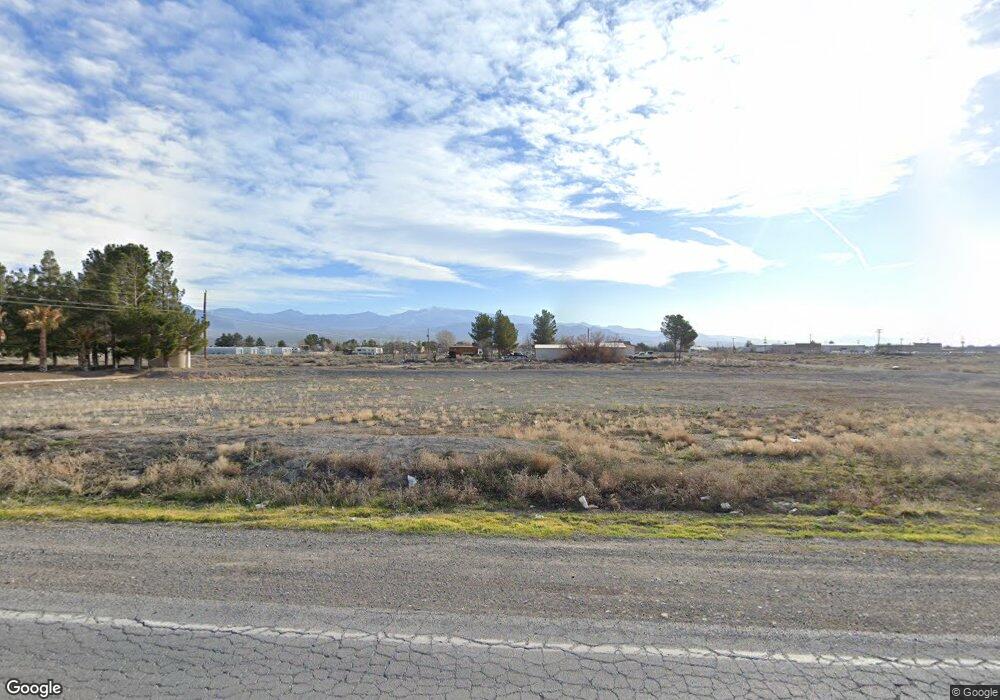
691 S Linda St Pahrump, NV 89048
Estimated Value: $39,973
--
Bed
--
Bath
--
Sq Ft
0.83
Acres
About This Home
This home is located at 691 S Linda St, Pahrump, NV 89048 and is currently estimated at $39,973. 691 S Linda St is a home located in Nye County with nearby schools including J.G. Johnson Elementary School, Rosemary Clarke Middle School, and Pahrump Valley High School.
Ownership History
Date
Name
Owned For
Owner Type
Purchase Details
Closed on
Jun 27, 2013
Sold by
Benson William B and Benson Shirley C
Bought by
Tassler Barry Eli
Current Estimated Value
Purchase Details
Closed on
Jan 29, 2010
Sold by
American General Financial Services Inc
Bought by
Benson William B and Benson Shirley C
Purchase Details
Closed on
Mar 16, 2009
Sold by
Sugar Kiyoshi
Bought by
American General Financial Services Inc
Purchase Details
Closed on
Feb 20, 2007
Sold by
Sugai Jason
Bought by
Sugai Jane K
Purchase Details
Closed on
Jan 25, 2006
Sold by
Sugai Jane and Sugai Kiyoshi
Bought by
Sugai Kiyoshi
Home Financials for this Owner
Home Financials are based on the most recent Mortgage that was taken out on this home.
Original Mortgage
$42,659
Interest Rate
6.16%
Mortgage Type
Purchase Money Mortgage
Create a Home Valuation Report for This Property
The Home Valuation Report is an in-depth analysis detailing your home's value as well as a comparison with similar homes in the area
Home Values in the Area
Average Home Value in this Area
Purchase History
| Date | Buyer | Sale Price | Title Company |
|---|---|---|---|
| Tassler Barry Eli | $15,000 | First American Title | |
| Benson William B | $43,500 | North American Title Company | |
| American General Financial Services Inc | $43,578 | Cow County Title Co | |
| Sugai Jane K | -- | None Available | |
| Sugai Jason | -- | None Available | |
| Sugai Kiyoshi | -- | Lawyers Title Of Nv | |
| Sugai Kiyoshi | $42,659 | Lawyers Title Of Nv |
Source: Public Records
Mortgage History
| Date | Status | Borrower | Loan Amount |
|---|---|---|---|
| Previous Owner | Sugai Kiyoshi | $42,659 |
Source: Public Records
Tax History Compared to Growth
Tax History
| Year | Tax Paid | Tax Assessment Tax Assessment Total Assessment is a certain percentage of the fair market value that is determined by local assessors to be the total taxable value of land and additions on the property. | Land | Improvement |
|---|---|---|---|---|
| 2025 | $171 | $4,135 | $4,135 | -- |
| 2024 | $171 | $4,135 | $4,135 | $0 |
| 2023 | $171 | $4,135 | $4,135 | $0 |
| 2022 | $149 | $4,135 | $4,135 | $0 |
| 2021 | $143 | $3,308 | $3,308 | $0 |
| 2020 | $138 | $3,308 | $3,308 | $0 |
| 2019 | $131 | $3,308 | $3,308 | $0 |
| 2018 | $126 | $2,646 | $2,646 | $0 |
| 2017 | $127 | $2,646 | $2,646 | $0 |
| 2016 | $128 | $2,646 | $2,646 | $0 |
| 2015 | $128 | $2,646 | $2,646 | $0 |
| 2014 | $127 | $2,646 | $2,646 | $0 |
Source: Public Records
Map
Nearby Homes
- 867 S Linda St
- 1860 W Irons St
- 1240 W Irons St
- 1081 Vondell Dr
- 1421 W Irons St
- 1141 Turquoise Ave
- 601 W Nevada Highway 372
- 561 W Nevada Highway 372
- 581 Montecito Dr
- 540 Brady Ln
- 541 W Nevada Highway 372
- 410 Candle Stick Ave
- 1141 W Chipmunk Rd
- 801 S Ford Loop
- 360 Inverness Ave
- 831 S Ford Loop
- 356 Saint Andrew St
- 311 Inverness Ave
- 1371 W Basin Ave
- 1660 W Charleston Park Ave
- 1021 W Irons St
- 1051 W Irons St
- 920 Vondell Dr
- 1021 Vondell Dr
- 580 S Linda St
- 1080 Vondell Dr
- 1081 W Irons St
- 1051 Vondell Dr
- 890 Vondell Dr
- 1110 Vondell Dr
- 1111 W Irons St
- 1020 Gold Dust Ln
- 1050 Gold Dust Ln
- 981 W Wilson Rd
- 1051 W Wilson Rd
- 1081 W Wilson Rd
- 1110 W Irons St
- 1080 Gold Dust Ln
- 1141 W Irons St
- 1141 Irons
