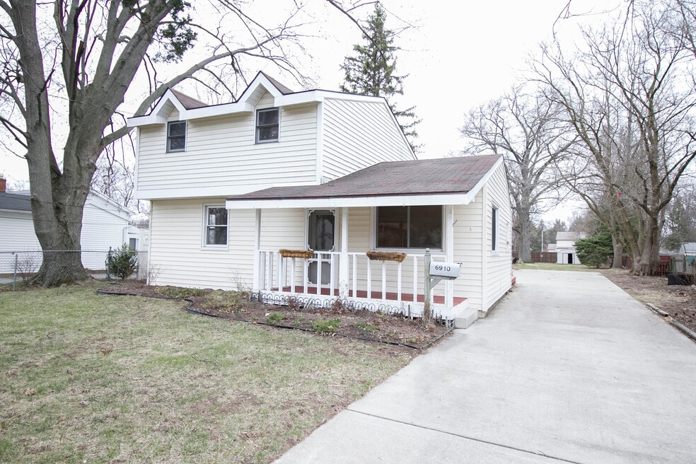
6910 Brint Rd Sylvania, OH 43560
About This Home
Text or call Lisa to schedule your showing.
To view all of our places, or to apply online, check out our website.
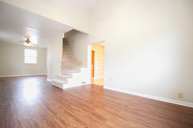
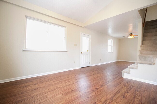
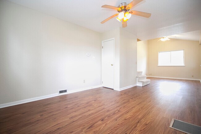
Located in the Sylvania School District , 6910 Brint Rd. has undergone a lovely transformation! Hardwood floors, updated kitchen and bath, washer dryer hookups, master bedroom with en-suite . This is a must see!
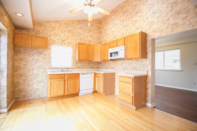
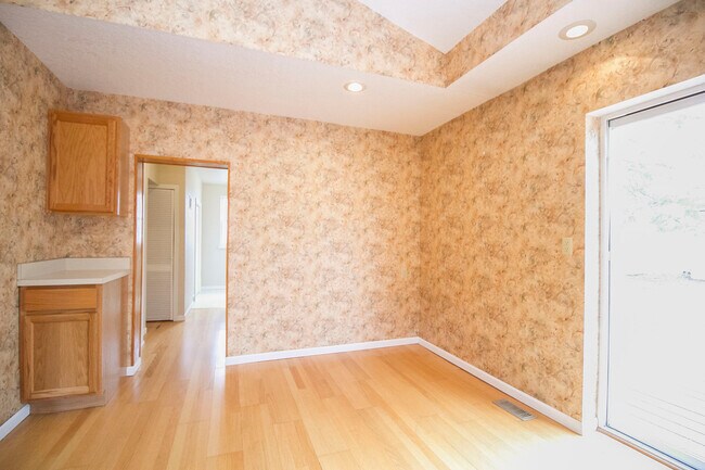
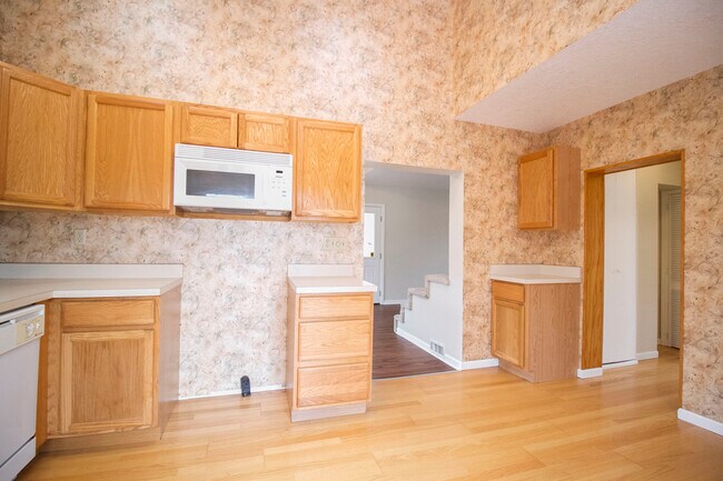
6910 Brint has undergone a lovely transformation! Step onto the welcoming covered front porch and enter the airy open-concept living space. New wood flooring adds a contemporary touch while being easy to maintain. The expansive eat-in kitchen boasts light oak cabinets, sleek solid surface countertops, and updated flooring. Throughout the home, fresh paint highlights the vaulted ceilings, lending a modern feel. The pristine main bathroom features a full tub/shower combo and all-new fixtures. The utility room, located at the rear, includes washer and dryer hookups. Upstairs, the luxurious master bedroom offers plush carpeting, skylights, and a spacious en-suite bathroom. Two additional bedrooms upstairs provide ample closet space and plush carpeting. Outside, entertain on the deck or concrete patio, with a detached 1.5 car garage and vast yard for year-round relaxation. Situated on a charming residential street in the Sylvania School District, this home exudes character and convenience. Don't miss out on this opportunity!
Rent is $1695 Deposit is $1695
Application fee: $30 per adult.
Rent-to-own options also available.
Pets accepted: Dogs and cats are an extra $30 each per month.
Text or call Lisa to schedule your showing.
Qualifications: Total household income that is 3 times the rent, no evictions or housing related collections, minimum FICO credit score of 625, not any more than 5 tradelines that are 30+ days late, and a clean criminal background.

Map
- 6924 Brintwood Rd
- 4814 Sylvan Ct
- 6807 Gettysburg Dr
- 6846 Fredericksburg Dr
- 6708 Gettysburg Dr
- 6584 Brint Rd
- 9152 Mill St
- 6641 Convent Blvd
- 6732 Gaines Mill Dr
- 4610 Woodland Ln
- 4533 Gettysburg Dr
- 6517 Cornwall Ct
- 6409 Madison Cove Ct Unit 3
- 20 Main Street Cir
- 7345 Country Commons Ln
- 7030 Hickory Ridge Rd
- 6400 Longfellow Rd
- 5109 Shadywood Ct
- 4902 Marble Cliff Blvd
- 6732 5th Ave
- 4215 N Mccord Rd
- 4615 N Holland Sylvania Rd
- 4120 King Rd
- 4430 N Holland Sylvania Rd
- 4045 Langston Place
- 7629 Sylvan Towne Dr
- 3233 Percentum Rd
- 4828 Whiteford Rd
- 2759 Pin Oak Dr
- 5610 Hogan Ave Unit 19
- 6300-6318 W Bancroft St
- 2411 N Holland Sylvania Rd
- 2704 Westmar Ct
- 2241 Vaness Dr
- 6951 W Bancroft St
- 3017 Coffeetree Ln
- 6705 W Bancroft St
- 2143 Fieldbrook Dr
- 2161 Orchard Lakes Place
- 2015 N Mccord Rd