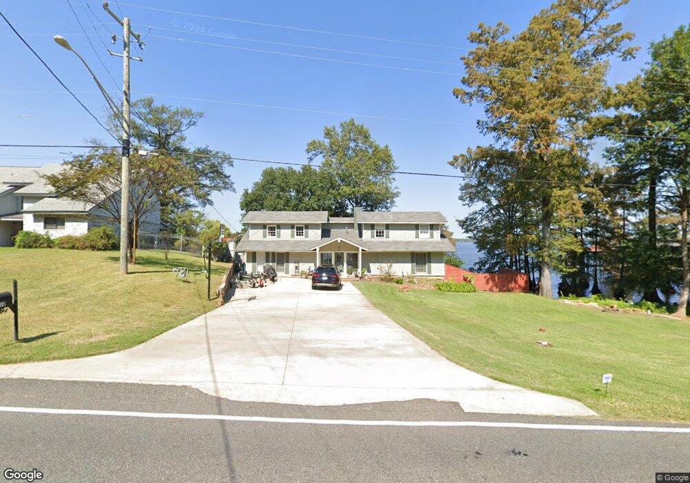
6910 S Lakeshore Dr Shreveport, LA 71119
Western Hills-Yarborough NeighborhoodEstimated Value: $482,000 - $521,098
4
Beds
4
Baths
3,654
Sq Ft
$136/Sq Ft
Est. Value
About This Home
This home is located at 6910 S Lakeshore Dr, Shreveport, LA 71119 and is currently estimated at $498,525, approximately $136 per square foot. 6910 S Lakeshore Dr is a home located in Caddo Parish with nearby schools including Judson Fundamental Elementary School, Fairfield Magnet School, and South Highlands Elementary.
Ownership History
Date
Name
Owned For
Owner Type
Purchase Details
Closed on
Oct 4, 2019
Sold by
Lasama Lp
Bought by
Fouts William Lance and Fouts Molly Johnson
Current Estimated Value
Home Financials for this Owner
Home Financials are based on the most recent Mortgage that was taken out on this home.
Original Mortgage
$1,000,000
Outstanding Balance
$874,248
Interest Rate
3.4%
Mortgage Type
New Conventional
Estimated Equity
-$375,723
Create a Home Valuation Report for This Property
The Home Valuation Report is an in-depth analysis detailing your home's value as well as a comparison with similar homes in the area
Home Values in the Area
Average Home Value in this Area
Purchase History
| Date | Buyer | Sale Price | Title Company |
|---|---|---|---|
| Fouts William Lance | $367,000 | None Available |
Source: Public Records
Mortgage History
| Date | Status | Borrower | Loan Amount |
|---|---|---|---|
| Open | Fouts William Lance | $1,000,000 | |
| Closed | Fouts William Lance | $192,000 |
Source: Public Records
Tax History Compared to Growth
Tax History
| Year | Tax Paid | Tax Assessment Tax Assessment Total Assessment is a certain percentage of the fair market value that is determined by local assessors to be the total taxable value of land and additions on the property. | Land | Improvement |
|---|---|---|---|---|
| 2024 | $6,008 | $38,541 | $9,760 | $28,781 |
| 2023 | $5,768 | $36,189 | $9,295 | $26,894 |
| 2022 | $5,768 | $36,189 | $9,295 | $26,894 |
| 2021 | $5,680 | $36,189 | $9,295 | $26,894 |
| 2020 | $5,681 | $36,189 | $9,295 | $26,894 |
| 2019 | $5,834 | $36,076 | $9,295 | $26,781 |
| 2018 | $3,262 | $25,332 | $9,295 | $16,037 |
| 2017 | $4,162 | $25,332 | $9,295 | $16,037 |
| 2015 | $3,048 | $23,520 | $9,300 | $14,220 |
| 2014 | $3,071 | $23,520 | $9,300 | $14,220 |
| 2013 | -- | $23,520 | $9,300 | $14,220 |
Source: Public Records
Map
Nearby Homes
- TBD Shorewood Dr
- 0 Bonnieview Rd Unit 25791588
- 0 Bonnieview Rd Unit 25737120
- 6701 Long Timbers Dr
- 7780 S Lakeshore Dr
- 2912 Brookline Dr
- 7206 S Lakeshore Dr
- 7334 Saybrook Cir
- 2918 Bonnieview Rd
- 3020 Pines Rd
- 0 Kingfish Dr
- 3053 Pines Rd
- 3073 Risinger Dr
- 6259 S Lakeshore Dr
- 3045 Risinger Dr
- 3030 Duncan Dr
- 6144 S Lakeshore Dr
- 414 Cross Ridge Ct
- 0 Duncan Dr
- 0 Bird Island Ln Unit 2512911
- 6914 S Lakeshore Dr
- 6918 S Lakeshore Dr
- 6926 S Lakeshore Dr
- 6824 S Lakeshore Dr
- 6930 S Lakeshore Dr
- 6822 S Lakeshore Dr
- 6915 S Lakeshore Dr
- 6934 S Lakeshore Dr
- 6923 S Lakeshore Dr
- 6909 S Lakeshore Dr
- 6938 S Lakeshore Dr
- 6820 S Lakeshore Dr
- 6969 S Lakeshore Dr
- 6969 S Lakeshore Dr
- 6808 S Lakeshore Dr
- 2805 Shorewood Dr
- 7016 S Lakeshore Dr
- 7020 S Lakeshore Dr
- 7020 S Lakeshore Dr
- 2948 Moss Point Dr