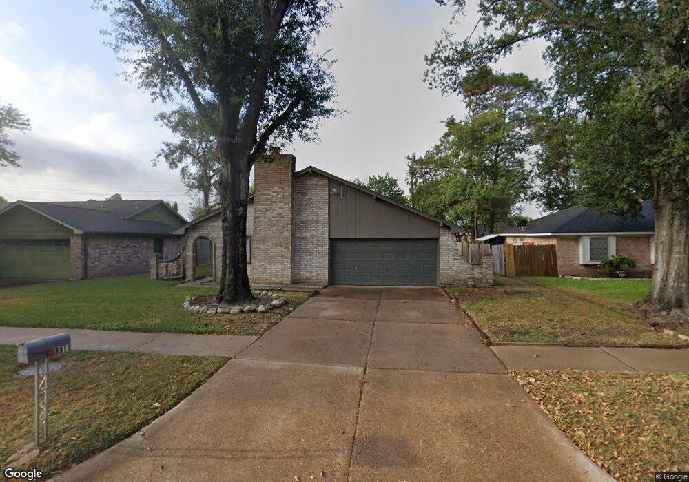
6911 Desert Rose Ln Houston, TX 77086
North Houston NeighborhoodEstimated Value: $222,492 - $246,000
3
Beds
2
Baths
1,817
Sq Ft
$128/Sq Ft
Est. Value
About This Home
This home is located at 6911 Desert Rose Ln, Houston, TX 77086 and is currently estimated at $232,123, approximately $127 per square foot. 6911 Desert Rose Ln is a home located in Harris County with nearby schools including Kujawa EC/Pre-K/K School, Carmichael Elementary School, and Shotwell Middle School.
Ownership History
Date
Name
Owned For
Owner Type
Purchase Details
Closed on
Aug 18, 1995
Sold by
Millar Cindy A
Bought by
Millar Michael J
Current Estimated Value
Home Financials for this Owner
Home Financials are based on the most recent Mortgage that was taken out on this home.
Original Mortgage
$50,300
Interest Rate
7.6%
Mortgage Type
Assumption
Create a Home Valuation Report for This Property
The Home Valuation Report is an in-depth analysis detailing your home's value as well as a comparison with similar homes in the area
Home Values in the Area
Average Home Value in this Area
Purchase History
| Date | Buyer | Sale Price | Title Company |
|---|---|---|---|
| Millar Michael J | -- | -- |
Source: Public Records
Mortgage History
| Date | Status | Borrower | Loan Amount |
|---|---|---|---|
| Closed | Millar Michael J | $50,300 |
Source: Public Records
Tax History Compared to Growth
Tax History
| Year | Tax Paid | Tax Assessment Tax Assessment Total Assessment is a certain percentage of the fair market value that is determined by local assessors to be the total taxable value of land and additions on the property. | Land | Improvement |
|---|---|---|---|---|
| 2025 | $1,175 | $208,195 | $39,648 | $168,547 |
| 2024 | $1,175 | $208,195 | $39,648 | $168,547 |
| 2023 | $1,175 | $215,368 | $39,648 | $175,720 |
| 2022 | $3,594 | $181,461 | $33,600 | $147,861 |
| 2021 | $3,260 | $149,408 | $33,600 | $115,808 |
| 2020 | $3,294 | $141,735 | $33,600 | $108,135 |
| 2019 | $3,114 | $136,530 | $17,126 | $119,404 |
| 2018 | $1,089 | $127,478 | $17,126 | $110,352 |
| 2017 | $2,481 | $119,515 | $15,378 | $104,137 |
| 2016 | $2,256 | $108,476 | $15,378 | $93,098 |
| 2015 | $1,581 | $102,380 | $15,378 | $87,002 |
| 2014 | $1,581 | $76,348 | $15,378 | $60,970 |
Source: Public Records
Map
Nearby Homes
- 6830 Desert Rose Ln
- 6822 Dusty Dawn Dr
- 6911 Silver Star Dr
- 9815 Lonsford Dr
- 6703 Deer Ridge Ln
- 7011 Lower Arrow Dr
- 10306 Jillana Kaye Dr
- 6706 Redding Springs Ln
- 6606 Dusty Dawn Dr
- 10307 Bammel North Houston Rd
- 10214 Trade Winds Dr
- 7307 Silver Star Dr
- 7023 Sandswept Ln
- 7302 Seton Lake Dr
- 7002 Sandswept Ln
- 6722 Winding Trace Dr
- 10614 Mackenzie Dr
- 6622 Sutton Meadows Dr
- 6615 Winding Trace Dr
- 0 Tomball Pkwy
- 6915 Desert Rose Ln
- 6907 Desert Rose Ln
- 6918 Vickie Springs Ln
- 6914 Vickie Springs Ln
- 6903 Desert Rose Ln
- 6919 Desert Rose Ln
- 6922 Vickie Springs Ln
- 6910 Vickie Springs Ln
- 6910 Desert Rose Ln
- 6914 Desert Rose Ln
- 6906 Desert Rose Ln
- 6926 Vickie Springs Ln
- 6923 Desert Rose Ln
- 6906 Vickie Springs Ln
- 6839 Desert Rose Ln
- 6918 Desert Rose Ln
- 6930 Vickie Springs Ln
- 6902 Vickie Springs Ln
- 6927 Desert Rose Ln
- 6835 Desert Rose Ln