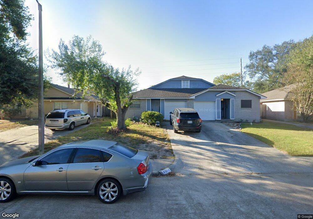
6911 Greenyard Dr Houston, TX 77086
North Houston NeighborhoodEstimated Value: $169,350 - $184,000
3
Beds
2
Baths
1,260
Sq Ft
$138/Sq Ft
Est. Value
About This Home
This home is located at 6911 Greenyard Dr, Houston, TX 77086 and is currently estimated at $173,838, approximately $137 per square foot. 6911 Greenyard Dr is a home located in Harris County with nearby schools including Kujawa EC/Pre-K/K School, Carmichael Elementary School, and Shotwell Middle School.
Ownership History
Date
Name
Owned For
Owner Type
Purchase Details
Closed on
Dec 21, 2001
Sold by
Carroll Richard B and Carroll Cindy D
Bought by
Quintanilla Raul E and Quintanilla Claudia
Current Estimated Value
Home Financials for this Owner
Home Financials are based on the most recent Mortgage that was taken out on this home.
Original Mortgage
$59,575
Outstanding Balance
$23,555
Interest Rate
6.73%
Mortgage Type
FHA
Estimated Equity
$150,283
Create a Home Valuation Report for This Property
The Home Valuation Report is an in-depth analysis detailing your home's value as well as a comparison with similar homes in the area
Home Values in the Area
Average Home Value in this Area
Purchase History
| Date | Buyer | Sale Price | Title Company |
|---|---|---|---|
| Quintanilla Raul E | -- | Stewart Title |
Source: Public Records
Mortgage History
| Date | Status | Borrower | Loan Amount |
|---|---|---|---|
| Open | Quintanilla Raul E | $59,575 |
Source: Public Records
Tax History Compared to Growth
Tax History
| Year | Tax Paid | Tax Assessment Tax Assessment Total Assessment is a certain percentage of the fair market value that is determined by local assessors to be the total taxable value of land and additions on the property. | Land | Improvement |
|---|---|---|---|---|
| 2025 | $927 | $150,000 | $29,249 | $120,751 |
| 2024 | $927 | $162,398 | $24,487 | $137,911 |
| 2023 | $927 | $166,900 | $24,516 | $142,384 |
| 2022 | $1,857 | $142,220 | $18,387 | $123,833 |
| 2021 | $1,774 | $122,660 | $18,387 | $104,273 |
| 2020 | $1,716 | $120,037 | $18,387 | $101,650 |
| 2019 | $1,661 | $112,395 | $18,387 | $94,008 |
| 2018 | $482 | $87,615 | $18,387 | $69,228 |
| 2017 | $1,457 | $87,615 | $18,387 | $69,228 |
| 2016 | $1,324 | $63,131 | $18,387 | $44,744 |
| 2015 | $923 | $65,087 | $10,215 | $54,872 |
| 2014 | $923 | $40,000 | $10,215 | $29,785 |
Source: Public Records
Map
Nearby Homes
- 11007 Tobasa Ct
- 11006 Crinkleawn Dr
- 11021 Crenchrus Ct
- 11009 Panicum Ct
- 6654 Brownie Campbell Rd
- 6610 Northleaf Dr
- 6630 Brownie Campbell Rd
- 6722 Winding Trace Dr
- 7002 Sandswept Ln
- 7218 Winding Trace Dr
- 7222 Northleaf Dr
- 7023 Sandswept Ln
- 7227 Greenyard Dr
- 6615 Winding Trace Dr
- 10522 Northview Dr
- 5010 Kale Ct
- 10711 Heather Hill Dr
- 10614 Mackenzie Dr
- 5103 Dartmoor Ridge Trail
- 6911 Silver Star Dr
- 6913 Greenyard Dr
- 6909 Greenyard Dr
- 6915 Greenyard Dr
- 6907 Greenyard Dr
- 6917 Greenyard Dr
- 6905 Greenyard Dr
- 6919 Greenyard Dr
- 6903 Greenyard Dr
- 11002 Tobasa Ct
- 6921 Greenyard Dr
- 11003 Misty Summit Dr
- 11004 Tobasa Ct
- 6923 Greenyard Dr
- 11005 Misty Summit Dr
- 11006 Tobasa Ct
- 6925 Greenyard Dr
- 11003 Tobasa Ct
- 11007 Misty Summit Dr
- 6813 Greenyard Dr
- 11008 Tobasa Ct