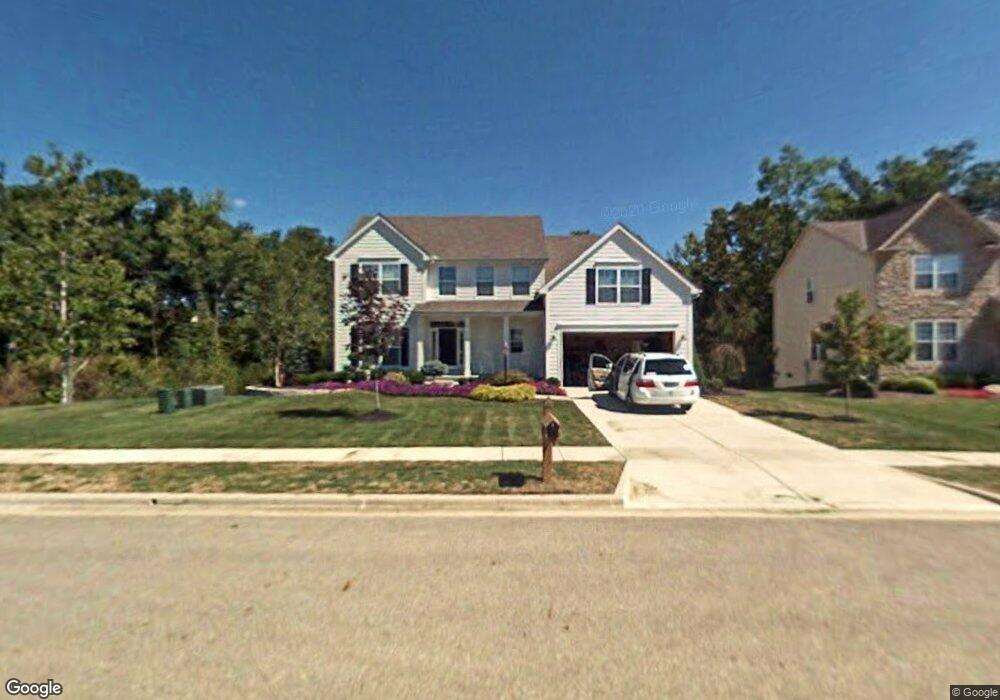
6911 Roespark Blvd Lewis Center, OH 43035
Orange NeighborhoodEstimated Value: $580,000 - $639,000
4
Beds
3
Baths
3,021
Sq Ft
$198/Sq Ft
Est. Value
About This Home
This home is located at 6911 Roespark Blvd, Lewis Center, OH 43035 and is currently estimated at $598,663, approximately $198 per square foot. 6911 Roespark Blvd is a home located in Delaware County with nearby schools including Freedom Trail Elementary School, Olentangy Orange Middle School, and Orange High School.
Ownership History
Date
Name
Owned For
Owner Type
Purchase Details
Closed on
Jan 30, 2004
Sold by
Homewood Corp
Bought by
Ailshire George K and Ailshire Susan C
Current Estimated Value
Home Financials for this Owner
Home Financials are based on the most recent Mortgage that was taken out on this home.
Original Mortgage
$252,200
Outstanding Balance
$117,541
Interest Rate
5.74%
Mortgage Type
Purchase Money Mortgage
Estimated Equity
$481,122
Create a Home Valuation Report for This Property
The Home Valuation Report is an in-depth analysis detailing your home's value as well as a comparison with similar homes in the area
Home Values in the Area
Average Home Value in this Area
Purchase History
| Date | Buyer | Sale Price | Title Company |
|---|---|---|---|
| Ailshire George K | $296,900 | Preferred Title Agency Inc |
Source: Public Records
Mortgage History
| Date | Status | Borrower | Loan Amount |
|---|---|---|---|
| Open | Ailshire George K | $252,200 |
Source: Public Records
Tax History Compared to Growth
Tax History
| Year | Tax Paid | Tax Assessment Tax Assessment Total Assessment is a certain percentage of the fair market value that is determined by local assessors to be the total taxable value of land and additions on the property. | Land | Improvement |
|---|---|---|---|---|
| 2024 | $9,759 | $176,400 | $40,810 | $135,590 |
| 2023 | $9,795 | $176,400 | $40,810 | $135,590 |
| 2022 | $8,285 | $121,350 | $25,730 | $95,620 |
| 2021 | $8,332 | $121,350 | $25,730 | $95,620 |
| 2020 | $8,367 | $121,350 | $25,730 | $95,620 |
| 2019 | $7,490 | $112,670 | $25,730 | $86,940 |
| 2018 | $7,521 | $112,670 | $25,730 | $86,940 |
| 2017 | $6,942 | $99,400 | $19,600 | $79,800 |
| 2016 | $7,063 | $99,400 | $19,600 | $79,800 |
| 2015 | $6,445 | $99,400 | $19,600 | $79,800 |
| 2014 | $6,537 | $99,400 | $19,600 | $79,800 |
| 2013 | $6,543 | $97,090 | $19,600 | $77,490 |
Source: Public Records
Map
Nearby Homes
- 2771 Abbey Knoll Dr
- 3144 Abbey Knoll Dr
- 2515 Coltsbridge Dr
- 0 E Orange Rd
- 2840 Waukeegan Ave
- 1915 Myrtle St
- 7698 Gladshire Blvd
- 7631 Pleasant Colony Ct
- 3177 Shoreline Dr
- 7959 S Old State Rd
- 1955 Royal Oak Dr
- 1811 Ivy St
- 7715 Windy Hill Ct Unit 7715
- 3902 Rivers Run Dr
- 1923 Myrtle St
- 2567 Carmel Dr
- 6566 Morningside Dr
- 1929 Rocklake Ct
- 7787 Holderman St
- 1654 Sunflower St
- 6925 Roespark Blvd
- 2773 Jeanne Ct
- 2747 Roe Dr
- 6934 Roespark Blvd
- 2799 Jeanne Ct
- 2729 Roe Dr
- 2864 Tweed Ct
- 6831 Roespark Blvd
- 6956 Roespark Blvd
- 2815 Jeanne Ct
- 2768 Jeanne Ct
- 2861 Tweed Ct
- 2711 Roe Dr
- 2696 Roe Dr
- 2790 Jeanne Ct
- 2876 Tweed Ct
- 6974 Roespark Blvd
- 2825 Jeanne Ct
- 2865 Tweed Ct
- 6977 Roespark Blvd